Arrondissement of Les Sables-d'Olonne
Located in Vendée, Pays de la Loire Region Coordinates: 46°39′32″ N 1°46′22″ W
- Population
- 259,243
- 259.2K
- Elevation
- 17 m
- above sea level
- Local time
- UTC+01:00
- Europe/Paris · UTC+01:00
- Places inside
- 71
- listed under Arrondissement of Les Sables-d'Olonne
- Airports
- NTE Nantes Atlantique Airport56 km
- LRH La Rochelle Île de Ré Airport69 km
About Arrondissement of Les Sables-d'Olonne
Arrondissement of Les Sables-d'Olonne is a municipality. Location: Vendée, Pays de la Loire Region. Population: 259,243. Elevation: 17 m. The best months to visit are June–September. The nearest airport is Nantes Atlantique Airport (56 km). Nearby sights include Auzance and Ruisseau le Guy-Gorand.
Climate of Arrondissement of Les Sables-d'Olonne
Best months for sightseeingBest months for sightseeing: June–September.
This month · November
Outside the best season
Day 13° · Night 7° · Rain 89 mm
- Hottest month
- August (day 24°)
- Coldest month
- January (night 4°)
- Wettest month
- November (89 mm)
- Driest month
- August (35 mm)
Bars: average monthly low and high temperature. Below: precipitation. Monthly averages for 1970–2000 at about 18 km resolution, adjusted for elevation. Highlighted months are mild and relatively dry. Source: WorldClim 2.1 (CC BY 4.0).
Show values as a table
| Month | Jan | Feb | Mar | Apr | May | Jun | Jul | Aug | Sep | Oct | Nov | Dec |
|---|---|---|---|---|---|---|---|---|---|---|---|---|
| Average high (°C) | 9° | 10° | 13° | 15° | 19° | 22° | 24° | 24° | 22° | 18° | 13° | 10° |
| Average low (°C) | 4° | 4° | 5° | 7° | 10° | 13° | 15° | 15° | 13° | 10° | 7° | 4° |
| Precipitation (mm) | 84 | 72 | 55 | 55 | 56 | 39 | 37 | 35 | 62 | 82 | 89 | 88 |
Other places to visit in this season: June July August September
How to get to Arrondissement of Les Sables-d'Olonne
The nearest airport is Nantes Atlantique Airport (NTE), 56 km to the north as the crow flies. The nearest large city is Nantes, 64 km to the north.
Airports
- Nantes Atlantique Airport (NTE) Nantes 56 kmnorth
- La Rochelle Île de Ré Airport (LRH) La Rochelle 69 kmsoutheast
- Rennes-Saint-Jacques Airport (RNS) Saint-Jacques-de-la-Lande, Ille-et-Vilaine 157 kmnorth
Nearby large cities
- Nantes Population: 325.1K 64 kmnorth
- Angers Population: 168.3K 129 kmnortheast
- Rennes Population: 227.8K 162 kmnorth
- Tours Population: 141.6K 205 kmnortheast
- Le Mans Population: 144.5K 211 kmnortheast
Straight-line distances; road distances are longer. Airport data: OurAirports.
Day trips from Arrondissement of Les Sables-d'Olonne
Within 100 km: 146 historic and cultural sites, 69 natural sites, 114 lakes, rivers and coasts.
0–25 km27 places
- Plage de Sauveterre Beach 13 kmS
- Forêt d'Olonne Natural site 13 kmS
- Baie de Cayola Natural site 23 kmS
- Vie River 14 kmW
25–60 km96 places
- Île de Ré Island 58 kmSE
- Noirmoutier Island 52 kmNW
- Île d'Yeu Island 45 kmW
- Plage du Rocher Beach 35 kmSE
60–100 km206 places
- Oléron Island 89 kmSE
- Plage Nord Beach 68 kmSE
- Plage Sud Beach 68 kmSE
- La Plage d'Aytré Beach 78 kmSE
Straight-line distances.
Arrondissement of Les Sables-d'Olonne and similar cities
Side by side with cities of similar size in the same country: population, elevation and climate.
| Measure | Arrondissement of Les Sables-d'Olonne | Bordeaux | Montpellier | Strasbourg |
|---|---|---|---|---|
| Population | 259.2K | 265.3K | 248.3K | 274.8K |
| Elevation | 17 m | 20 m | 55 m | 147 m |
| Summer day (hottest month) | 24° | 26° | 29° | 25° |
| Winter night (coldest month) | 4° | 2° | 3° | -1° |
| Annual rainfall | 754 mm | 921 mm | 645 mm | 735 mm |
| Best months | Jun–Sep | May–Sep | May–Oct | May–Sep |
| Distance | — | 222 km | 559 km | 746 km |
Climate values are 1970–2000 monthly averages; straight-line distance.
Places in Arrondissement of Les Sables-d'Olonne
71 places- 1 Les Sables-d'Olonne 43.2K
- 2 Challans 20.3K
- 3 Saint-Hilaire-de-Riez 11K
- 4 Saint-Jean-de-Monts 8.6K
- 5 Saint-Gilles-Croix-de-Vie 7.6K
- 6 Talmont-Saint-Hilaire 7.5K
- 7 Les Achards 5K
- 8 La Garnache 5K
- 9 L'Île-d'Yeu 4.8K
- 10 Noirmoutier-en-l'Île 4.7K
- 11 Le Fenouiller 4.7K
- 12 Bretignolles-sur-Mer 4.5K
- 13 Soullans 4.2K
- 14 Beauvoir-sur-Mer 3.9K
- 15 Commequiers 3.4K
- 16 Coëx 3.1K
- 17 Sallertaine 3.1K
- 18 La Tranche-sur-Mer 2.9K
- 19 Angles 2.8K
- 20 L'Île-d'Olonne 2.7K
- 21 Brem-sur-Mer 2.7K
- 22 Jard-sur-Mer 2.6K
- 23 Saint-Gervais 2.6K
- 24 Saint-Christophe-du-Ligneron 2.5K
- 25 Longeville-sur-Mer 2.5K
- 26 Nieul-le-Dolent 2.5K
- 27 Sainte-Flaive-des-Loups 2.4K
- 28 Saint-Mathurin 2.2K
- 29 Beaulieu-sous-la-Roche 2.2K
- 30 La Barre-de-Monts 2.2K
- 31 Bouin 2.2K
- 32 Grosbreuil 2.2K
- 33 Givrand 2.1K
- 34 Moutiers-les-Mauxfaits 2.1K
- 35 Sainte-Foy 2.1K
- 36 L'Aiguillon-la-Presqu'île 2.1K
- 37 Notre-Dame-de-Riez 2.1K
- 38 Notre-Dame-de-Monts 2.1K
- 39 Bois-de-Céné 2K
- 40 Le Perrier 2K
- 41 L'Aiguillon-sur-Vie 1.9K
- 42 Le Champ-Saint-Père 1.8K
- 43 Froidfond 1.8K
- 44 Saint-Urbain 1.8K
- 45 Barbâtre 1.8K
- 46 Saint-Julien-des-Landes 1.7K
- 47 Vairé 1.7K
- 48 Saint-Georges-de-Pointindoux 1.7K
- 49 L'Épine 1.6K
- 50 Saint-Vincent-sur-Graon 1.5K
- 51 Saint-Révérend 1.4K
- 52 Avrillé 1.4K
- 53 La Boissière-des-Landes 1.4K
- 54 Landevieille 1.4K
- 55 La Guérinière 1.4K
- 56 Saint-Vincent-sur-Jard 1.3K
- 57 Le Bernard 1.2K
- 58 Martinet 1.1K
- 59 Poiroux 1.1K
- 60 La Chaize-Giraud 1.1K
Bar: population relative to the most populous place in this list.
Nearby attractions & nature
Everything nearby-
Auzance River, Vendée8 km S
-
Ruisseau le Guy-Gorand River, Vendée8.8 km W
-
Ciboule River, Vendée9.6 km S
-
Forêt d'Olonne Natural site, Vendée13 km S
-
Ligneron River, Vendée13 km NW
-
Vie River, Vendée14 km W
-
Petite Boulogne River, Vendée15 km NE
-
Jaunay River, Pays de la Loire Region13 km W
Other cities and towns in Vendée
-
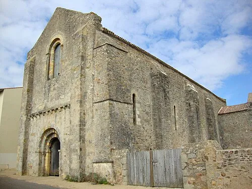 Château-d'Olonne Town, Les Sables-d'Olonne17 km S
-
Olonne-sur-Mer Town, Les Sables-d'Olonne14 km S
-
Saint-Gilles-Croix-de-Vie Town, Saint-Gilles-Croix-de-Vie14 km W
-
Saint-Hilaire-de-Riez Town, Saint-Hilaire-de-Riez15 km NW
-
Les Sables-d'Olonne Town, Les Sables-d'Olonne18 km S
-
Challans Town, Challans22 km N
Sources & licences
Data last updated: