Avance
Located in Hautes-Alpes, Provence-Alpes-Côte d'Azur Region Coordinates: 44°28′37″ N 6°06′21″ E
- Elevation
- 622 m
- above sea level
- Local time
- UTC+01:00
- Europe/Paris · UTC+01:00
- Airports
- AVN Avignon Caumont airport115 km
- GNB Grenoble Alpes Isère Airport116 km
About Avance
Avance is a river. Location: Hautes-Alpes, Provence-Alpes-Côte d'Azur Region. The best months to visit are May–June, September. The nearest airport is Avignon Caumont airport (115 km). Nearby sights include Luye and Montagne Saint-Maurice.
Photos of Avance
-
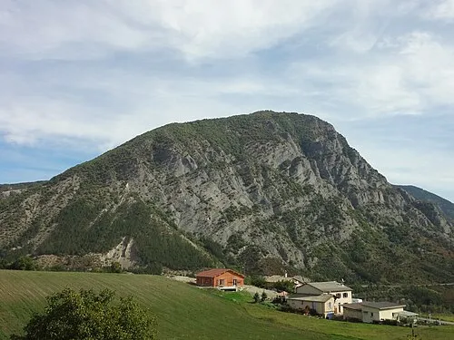
Montagne Saint-Maurice Sébastien Thébault · CC BY-SA 3.0 -
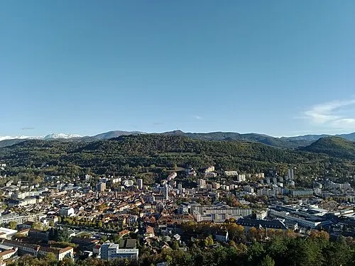
Puy Maurel Rémih · CC BY-SA 4.0


Climate of Avance
Best months for sightseeingBest months for sightseeing: May–June, September.
This month · November
A wet month
Day 12° · Night 3° · Rain 109 mm
- Hottest month
- July (day 28°)
- Coldest month
- January (night 0°)
- Wettest month
- November (109 mm)
- Driest month
- July (46 mm)
Bars: average monthly low and high temperature. Below: precipitation. Monthly averages for 1970–2000 at about 18 km resolution, adjusted for elevation. Highlighted months are mild and relatively dry. Source: WorldClim 2.1 (CC BY 4.0).
Show values as a table
| Month | Jan | Feb | Mar | Apr | May | Jun | Jul | Aug | Sep | Oct | Nov | Dec |
|---|---|---|---|---|---|---|---|---|---|---|---|---|
| Average high (°C) | 8° | 10° | 13° | 15° | 20° | 24° | 28° | 28° | 23° | 18° | 12° | 9° |
| Average low (°C) | 0° | 0° | 2° | 5° | 9° | 12° | 15° | 15° | 12° | 8° | 3° | 1° |
| Precipitation (mm) | 78 | 68 | 68 | 75 | 80 | 76 | 46 | 68 | 83 | 105 | 109 | 87 |
How to get to Avance
The nearest airport is Avignon Caumont airport (AVN), 115 km to the southwest as the crow flies. The nearest large city is Grenoble, 84 km to the north.
Airports
- Avignon Caumont airport (AVN) Avignon 115 kmsouthwest
- Grenoble Alpes Isère Airport (GNB) Grenoble 116 kmnorthwest
- Cuneo International Airport (CUF) Levaldigi (CN) 121 kmeast
Nearby large cities
- Grenoble Population: 158.6K 84 kmnorth
- Aix-en-Provence Population: 146.8K 118 kmsouthwest
- Nice Population: 342.7K 127 kmsoutheast
- Marseille Population: 877.2K 143 kmsouthwest
- Toulon Population: 168.7K 151 kmsouth
Straight-line distances; road distances are longer. Airport data: OurAirports.
Day trips from Avance
Within 100 km: 108 historic and cultural sites, 1,453 natural sites, 263 lakes, rivers and coasts.
0–25 km108 places
- Clapes River 22 kmSE
- Lac de Serre-Ponçon Lake 15 kmE
- Grande Autane Mountain 24 kmNE
- Montagne de Seymuil Mountain 12 kmSE
25–60 km622 places
- Lac Premier Lake 58 kmE
- Lac Vert Lake 55 kmE
- Lac du Vallon Lake 56 kmN
- Lac du Saulet Lake 40 kmN
60–100 km1,094 places
- Lac Mort Lake 66 kmN
- Lakes of Vens Lake 68 kmE
- Lacs de Ténibres Lake 72 kmE
- Lacs de Roure Lake 64 kmE
Straight-line distances.
Nearest towns and villages
Nearby attractions & nature
Everything nearby-
Luye River, Hautes-Alpes1.5 km W
-
Montagne Saint-Maurice Mountain, Valserres3.4 km E
-
Puy Cervier Mountain, Jarjayes4 km NE
-
Bois du Pic Cervier Natural site, Hautes-Alpes4.1 km NE
-
Puy Maurel Mountain, Jarjayes5.6 km NE
-
Sommet de la Cita Mountain, Piégut4.6 km SE
-
Le Grand Bois Natural site, Alpes-de-Haute-Provence4.9 km S
-
Sommet de Monserieux Mountain, Gigors5.1 km S
Sources & licences
Data last updated: