Dévoluy
Located in Hautes-Alpes, Provence-Alpes-Côte d'Azur Region Coordinates: 44°39′00″ N 5°53′00″ E
- Elevation
- 2,106 m
- above sea level
- Local time
- UTC+01:00
- Europe/Paris · UTC+01:00
- Airports
- GNB Grenoble Alpes Isère Airport90 km
- CMF Chambéry Aix les Bains airport110 km
About Dévoluy
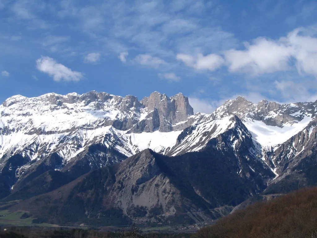
Dévoluy is a mountain. Location: Hautes-Alpes, Provence-Alpes-Côte d'Azur Region. Elevation: 2,106 m.
The Dévoluy Mountains (French: massif du Dévoluy, pronounced [masif dy devɔlɥi]) is a limestone massif located in Hautes-Alpes, France. It is part of the Dauphiné Prealps and is bordered by the Drac River to the north and the Buëch River to the south and west and is a popular destination for hiking, mountaineering and skiing. Its most notable peaks are the Grande Tête de l'Obiou (2,789 m) and Pic de Bure at 2,709 m.
Source: Wikipedia · CC BY-SA 4.0
Photos of Dévoluy
-

Giorgio Galeotti · CC BY-SA 4.0 -

Officier communication du 4e RCh · CC BY-SA 4.0 -

Armel · CC BY-SA 2.0 -

Rémih · CC BY-SA 4.0 -

Julien Peytard · CC BY 4.0


Climate of Dévoluy
Best months for sightseeingBest months for sightseeing: July–August.
This month · November
A wet month
Day 2° · Night -6° · Rain 137 mm
- Hottest month
- July (day 18°)
- Coldest month
- January (night -9°)
- Wettest month
- November (137 mm)
- Driest month
- July (56 mm)
Bars: average monthly low and high temperature. Below: precipitation. Monthly averages for 1970–2000 at about 18 km resolution, adjusted for elevation. Highlighted months are mild and relatively dry. Source: WorldClim 2.1 (CC BY 4.0).
Show values as a table
| Month | Jan | Feb | Mar | Apr | May | Jun | Jul | Aug | Sep | Oct | Nov | Dec |
|---|---|---|---|---|---|---|---|---|---|---|---|---|
| Average high (°C) | -2° | -1° | 2° | 5° | 10° | 14° | 18° | 18° | 13° | 8° | 2° | -1° |
| Average low (°C) | -9° | -9° | -7° | -5° | 0° | 3° | 6° | 6° | 3° | -1° | -6° | -8° |
| Precipitation (mm) | 103 | 86 | 90 | 94 | 107 | 91 | 56 | 80 | 100 | 120 | 137 | 113 |
How to get to Dévoluy
The nearest airport is Grenoble Alpes Isère Airport (GNB), 90 km to the northwest as the crow flies. The nearest large city is Grenoble, 60 km to the north.
Airports
- Grenoble Alpes Isère Airport (GNB) Grenoble 90 kmnorthwest
- Chambéry Aix les Bains airport (CMF) Chambéry 110 kmnorth
- Avignon Caumont airport (AVN) Avignon 114 kmsouthwest
Nearby large cities
- Grenoble Population: 158.6K 60 kmnorth
- Aix-en-Provence Population: 146.8K 129 kmsouth
- Saint-Etienne Population: 176.3K 146 kmnorthwest
- Lyon Population: 520.8K 147 kmnorthwest
- Villeurbanne Population: 131.4K 147 kmnorthwest
Straight-line distances; road distances are longer. Airport data: OurAirports.
Day trips from Dévoluy
Within 100 km: 130 historic and cultural sites, 1,377 natural sites, 283 lakes, rivers and coasts.
0–25 km99 places
- Lac du Saulet Lake 18 kmN
- Quigouret Mountain 19 kmW
- Sommet de Queyron Mountain 22 kmE
- Montagne de Pinchinet Mountain 23 kmW
25–60 km660 places
- Lac Mort Lake 43 kmN
- Clapes River 48 kmSE
- Lac du Vallon Lake 38 kmN
- Lake Pierre-Châtel Lake 37 kmN
60–100 km1,031 places
- Îles Margeries Island 99 kmW
- Grande Île Island 100 kmN
- Petite Île Island 100 kmN
- Lac Premier Lake 77 kmE
Straight-line distances.
Nearest towns and villages
-
La Cluse Village, Dévoluy3.1 km SW
-
Les Garcins Village, Dévoluy2.5 km NW
-
Agnières-en-Dévoluy Village, Dévoluy4.9 km N
-
Dévoluy Village, Arrondissement of Gap6.6 km NE
-
Arrondissement of Gap Municipality, Hautes-Alpes12 km SE
-
Le Dévoluy Village, Dévoluy6.6 km NE
Nearby attractions & nature
Everything nearby-
Montagne d'Aurouze Mountain, Dévoluy1.8 km SE
-
Roc d'Aurouze Mountain, Dévoluy3.1 km NE
-
Crête de Chauvet Mountain, Dévoluy4 km W
-
Pic de Bure Mountain, Montmaur4.7 km SE
-
Montagne de la Plane Mountain, La Roche-des-Arnauds5.6 km E
-
Tête d'Ere Mountain, Dévoluy6 km SW
-
Trèsaubenq Mountain, Montmaur6.1 km S
-
Tête des Ormans Mountain, Dévoluy6.5 km W
More nature in France
-
 Grand Ferrand Mountain, Dévoluy9.6 km NW
-
Chergaie Mountain, Veynes9 km SW
-
Crête des Aiguilles Mountain, Dévoluy6.9 km W
-
Roc de la Garnesier Mountain, Dévoluy7.4 km W
-
Montagne de Feraud Mountain, Le Glaizil11 km NE
-
Montagne Durbonas Mountain, La Faurie11 km SW
Sources & licences
Data last updated: · 2 independent sources