Vallouise
Located in Hautes-Alpes, Provence-Alpes-Côte d'Azur Region Coordinates: 44°52′00″ N 6°30′00″ E
- Elevation
- 1,529 m
- above sea level
- Local time
- UTC+01:00
- Europe/Paris · UTC+01:00
- Airports
- CUF Cuneo International Airport96 km
- TRN Turin Airport98 km
About Vallouise
Vallouise is a natural site. Location: Hautes-Alpes, Provence-Alpes-Côte d'Azur Region. The best months to visit are July–August. The nearest airport is Cuneo International Airport (96 km). Nearby sights include Torrent de l'Eychauda and Torrent de l'Ailefroide.
Photos of Vallouise
-
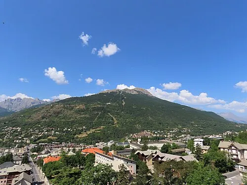
Sommet du Prorel Rémih · CC BY-SA 4.0 -
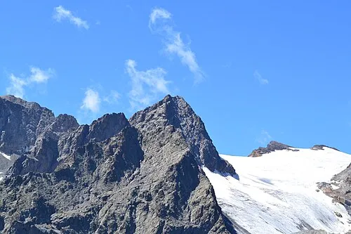
Pic Gardiner Bastenbas · CC BY-SA 4.0 -
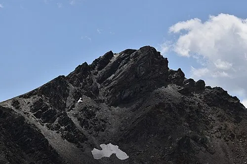
Rocher de l'Yret Bastenbas · CC BY-SA 4.0 -
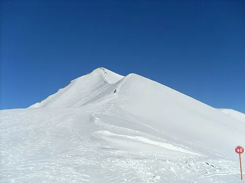
La Cucumelle This Photo was taken by FredrikLähnn All my photos are public domain , but if you use them outside Wikimedia I will appr · Public domain


Climate of Vallouise
Best months for sightseeingBest months for sightseeing: July–August.
This month · November
A wet month
Day 6° · Night -1° · Rain 139 mm
- Hottest month
- August (day 21°)
- Coldest month
- January (night -4°)
- Wettest month
- November (139 mm)
- Driest month
- July (66 mm)
Bars: average monthly low and high temperature. Below: precipitation. Monthly averages for 1970–2000 at about 18 km resolution, adjusted for elevation. Highlighted months are mild and relatively dry. Source: WorldClim 2.1 (CC BY 4.0).
Show values as a table
| Month | Jan | Feb | Mar | Apr | May | Jun | Jul | Aug | Sep | Oct | Nov | Dec |
|---|---|---|---|---|---|---|---|---|---|---|---|---|
| Average high (°C) | 2° | 3° | 5° | 7° | 13° | 17° | 21° | 21° | 17° | 12° | 6° | 3° |
| Average low (°C) | -4° | -4° | -3° | 0° | 4° | 7° | 10° | 11° | 8° | 4° | -1° | -3° |
| Precipitation (mm) | 121 | 107 | 102 | 108 | 111 | 91 | 66 | 81 | 94 | 129 | 139 | 128 |
How to get to Vallouise
The nearest airport is Cuneo International Airport (CUF), 96 km to the east as the crow flies. For international flights: Turin Airport (TRN) (98 km). The nearest large city is Grenoble, 71 km to the northwest.
Airports
- Cuneo International Airport (CUF) Levaldigi (CN) 96 kmeast
- Turin Airport (TRN) Caselle Torinese (TO) 98 kmnortheast
- Chambéry Aix les Bains airport (CMF) Chambéry 99 kmnorthwest
Nearby large cities
- Grenoble Population: 158.6K 71 kmnorthwest
- Nice Population: 342.7K 143 kmsoutheast
- Geneva Population: 201.7K 151 kmnorth
- Villeurbanne Population: 131.4K 162 kmnorthwest
- Lyon Population: 520.8K 162 kmnorthwest
Straight-line distances; road distances are longer. Airport data: OurAirports.
Day trips from Vallouise
Within 100 km: 96 historic and cultural sites, 1,531 natural sites, 280 lakes, rivers and coasts.
0–25 km190 places
- Lac Faravel Lake 18 kmS
- Lac Palluel Lake 17 kmSW
- Lac de Néal Lake 16 kmSE
- Grand Lac des Estaris Lake 19 kmSW
25–60 km702 places
- Lac Mort Lake 59 kmW
- Clapes River 57 kmS
- Lac Premier Lake 45 kmSE
- Lac Vert Lake 38 kmSE
60–100 km1,015 places
- St Alban Plage Beach 95 kmNW
- Grande Île Island 94 kmNW
- Petite Île Island 94 kmNW
- Lakes of Vens Lake 70 kmSE
Straight-line distances.
Nearest towns and villages
-
Vallouise-Pelvoux Village, Arrondissement of Briançon1.1 km W
-
Vallouise Village, Vallouise-Pelvoux2.4 km S
-
Saint-Antoine Village, Vallouise-Pelvoux1.1 km W
-
Le Poët Village, Vallouise-Pelvoux1.1 km SW
-
Le Sarret Village, Vallouise-Pelvoux1.3 km W
-
Puy-Saint-Vincent Village, Arrondissement of Briançon4.2 km S
Nearby attractions & nature
Everything nearby-
Torrent de l'Eychauda River, Hautes-Alpes1.3 km W
-
Torrent de l'Ailefroide River, Hautes-Alpes1.3 km W
-
Pic de Montbrison Mountain, Saint-Martin-de-Queyrières2.8 km E
-
Torrent Onde River, Hautes-Alpes2.3 km SW
-
Cime de la Condamine Mountain, Puy-Saint-André3.4 km NE
-
Tête d'Amont Mountain, Saint-Martin-de-Queyrières3.2 km SE
-
Rocher de l'Yret Mountain, Vallouise-Pelvoux7.5 km N
-
Sommet du Prorel Mountain, Puy-Saint-Pierre7.7 km NE
More nature in France
-
La Cucumelle Mountain, Le Monêtier-les-Bains8 km N
-
Pic Gardiner Mountain, Vallouise-Pelvoux7.3 km NW
-
Pic de Clouzis Mountain, Vallouise-Pelvoux6.7 km NW
-
Pointe du Rascrouset Mountain, Vallouise-Pelvoux7.3 km W
-
Pointe de Celse Nière Mountain, Vallouise-Pelvoux8.3 km W
-
Pointe Durand Mountain, Vallouise-Pelvoux8.6 km NW
Sources & licences
Data last updated: