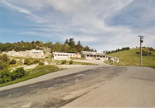
Plateau d'Albion
Located in Provence-Alpes-Côte d'Azur Region, France Coordinates: 44°06′43″ N 5°35′11″ E
- Elevation
- 1,105 m
- above sea level
- Local time
- UTC+01:00
- Europe/Paris · UTC+01:00
- Airports
- AVN Avignon Caumont airport59 km
- MRS Marseille Provence Airport81 km
About Plateau d'Albion
Plateau d'Albion is a natural site. Location: Provence-Alpes-Côte d'Azur Region, France. The best months to visit are June–September. The nearest airport is Avignon Caumont airport (59 km). Nearby sights include Le Grand Terme and Le Jambard.
Climate of Plateau d'Albion
Best months for sightseeingBest months for sightseeing: June–September.
This month · November
A wet month
Day 9° · Night 0° · Rain 107 mm
- Hottest month
- July (day 25°)
- Coldest month
- January (night -3°)
- Wettest month
- October (118 mm)
- Driest month
- July (41 mm)
Bars: average monthly low and high temperature. Below: precipitation. Monthly averages for 1970–2000 at about 18 km resolution, adjusted for elevation. Highlighted months are mild and relatively dry. Source: WorldClim 2.1 (CC BY 4.0).
Show values as a table
| Month | Jan | Feb | Mar | Apr | May | Jun | Jul | Aug | Sep | Oct | Nov | Dec |
|---|---|---|---|---|---|---|---|---|---|---|---|---|
| Average high (°C) | 5° | 7° | 10° | 12° | 17° | 21° | 25° | 24° | 20° | 15° | 9° | 6° |
| Average low (°C) | -3° | -3° | -1° | 2° | 6° | 9° | 12° | 12° | 9° | 5° | 0° | -2° |
| Precipitation (mm) | 87 | 68 | 72 | 86 | 91 | 69 | 41 | 68 | 91 | 118 | 107 | 91 |
Other places to visit in this season: June July August September
How to get to Plateau d'Albion
The nearest airport is Avignon Caumont airport (AVN), 59 km to the west as the crow flies. For international flights: Marseille Provence Airport (MRS) (81 km). The nearest large city is Aix-en-Provence, 66 km to the south.
Airports
- Avignon Caumont airport (AVN) Avignon 59 kmwest
- Marseille Provence Airport (MRS) Marignane, Bouches-du-Rhône 81 kmsouth
- Nîmes-Arles-Camargue Airport (FNI) Nîmes/Garons 102 kmwest
Nearby large cities
- Aix-en-Provence Population: 146.8K 66 kmsouth
- Marseille Population: 877.2K 92 kmsouth
- Nîmes Population: 148.2K 103 kmwest
- Toulon Population: 168.7K 113 kmsouth
- Grenoble Population: 158.6K 119 kmnorth
Straight-line distances; road distances are longer. Airport data: OurAirports.
Day trips from Plateau d'Albion
Within 100 km: 147 historic and cultural sites, 977 natural sites, 237 lakes, rivers and coasts.
0–25 km62 places
- Monts de Vaucluse Mountain 22 kmSW
- Montagne de Lure Mountain 15 kmE
- Grou de Bane Mountain 8 kmSE
- Roc de l'Aigle Mountain 23 kmNE
25–60 km392 places
- L'ile aux castors Island 46 kmSW
- Mont Ventoux Mountain 26 kmW
- Vaucluse Mountain 57 kmNW
- Chaîne de la Trévaresse Mountain 57 kmS
60–100 km907 places
- Alba-la-Romaine (Ardèche, France) -- Théâtre gallo-romain Historic site 93 kmNW
- Clapes River 66 kmNE
- Plages du Prado Beach 96 kmS
- Plage du Bestouan Beach 100 kmS
Straight-line distances.
Nearest towns and villages
-
Redortiers Village, Arrondissement of Forcalquier2.7 km E
-
Revest-du-Bion Village, Arrondissement of Forcalquier4.4 km SW
-
Revest-du-Bion Village, Revest-du-Bion4.4 km SW
-
Saint-André-de-Villesèche Village, Les Omergues2.2 km N
-
Le Contadour Village, Redortiers2.7 km E
-
Les Omergues Village, Arrondissement of Forcalquier6.9 km N
Nearby attractions & nature
Everything nearby-
Le Grand Terme Mountain, Les Omergues4.9 km NW
-
Le Jambard Mountain, Barret-de-Lioure6.2 km N
-
Bois du Cracq Natural site, Alpes-de-Haute-Provence5.8 km E
-
Le Tay Mountain, Barret-de-Lioure7.4 km NW
-
Plateau de Saint-Christol Natural site, Alpes-de-Haute-Provence7.6 km SW
-
Le Négron Mountain, Les Omergues6.7 km N
-
Le Treboux Mountain, Châteauneuf-Miravail8.3 km NE
-
Montagne d'Albion Natural site, Barret-de-Lioure6.8 km NW
More nature in France
-
Pic Bouine Mountain, Lardiers9.1 km SE
-
Grou de Bane Mountain, Banon7.5 km SE
-
Combe Saint Barthelemy Mountain, Lardiers11 km E
-
 Signal De Lure Mountain, Noyers-sur-Jabron17 km E
-
Crête des Blaches de Paillar Mountain, Châteauneuf-Miravail10 km NE
-
Combe de Saint-Guilhem Natural site, Vaucluse15 km W
Sources & licences
Data last updated: