- Elevation
- 273 m
- above sea level
- Local time
- UTC+01:00
- Europe/Berlin · UTC+01:00
- Airports
- SXB Strasbourg Airport33 km
- FKB Karlsruhe Baden-Baden Airport50 km
About Weiler
Weiler is a village. Location: Seelbach, Ortenaukreis. Elevation: 273 m. The best months to visit are June–September. The nearest airport is Strasbourg Airport (33 km). Nearby sights include Geroldseck and Eichberg.
Photos of Weiler
-
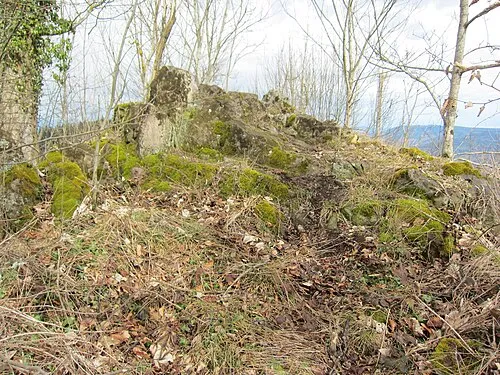
Geroldseck Lutz H · CC BY 2.0 de

Climate of Weiler
Best months for sightseeingBest months for sightseeing: June–September.
This month · November
A cold month
Day 8° · Night 2° · Rain 81 mm
- Hottest month
- July (day 24°)
- Coldest month
- January (night -2°)
- Wettest month
- June (108 mm)
- Driest month
- January (62 mm)
Bars: average monthly low and high temperature. Below: precipitation. Monthly averages for 1970–2000 at about 18 km resolution, adjusted for elevation. Highlighted months are mild and relatively dry. Source: WorldClim 2.1 (CC BY 4.0).
Show values as a table
| Month | Jan | Feb | Mar | Apr | May | Jun | Jul | Aug | Sep | Oct | Nov | Dec |
|---|---|---|---|---|---|---|---|---|---|---|---|---|
| Average high (°C) | 4° | 6° | 10° | 14° | 19° | 21° | 24° | 24° | 19° | 14° | 8° | 5° |
| Average low (°C) | -2° | -1° | 2° | 4° | 8° | 12° | 13° | 13° | 10° | 6° | 2° | 0° |
| Precipitation (mm) | 62 | 63 | 65 | 73 | 103 | 108 | 95 | 78 | 80 | 81 | 81 | 80 |
Other places to visit in this season: June July August September
How to get to Weiler
The nearest airport is Strasbourg Airport (SXB), 33 km to the northwest as the crow flies. The nearest large city is Strasbourg, 32 km to the northwest.
Airports
- Strasbourg Airport (SXB) Strasbourg 33 kmnorthwest
- Karlsruhe Baden-Baden Airport (FKB) Rheinmünster 50 kmnorth
- EuroAirport Basel–Mulhouse–Freiburg (BSL) Bâle / Mulhouse 88 kmsouth
Nearby large cities
- Strasbourg Population: 274.8K 32 kmnorthwest
- Freiburg im Breisgau Population: 237.5K 39 kmsouth
- Mulhouse Population: 111.4K 80 kmsouthwest
- Karlsruhe Population: 283.8K 82 kmnortheast
- Pforzheim Population: 119.3K 82 kmnortheast
Straight-line distances; road distances are longer. Airport data: OurAirports.
Day trips from Weiler
Within 100 km: 603 historic and cultural sites, 3,021 natural sites, 650 lakes, rivers and coasts.
0–25 km300 places
- Unditz River 14 kmNW
- Glaswaldsee Lake 24 kmNE
- Matschelsee Lake 13 kmNW
- Vögelestein Mountain 24 kmS
25–60 km1,105 places
- Rench River 38 kmN
- Titisee Lake 51 kmS
- Schluchsee Lake 60 kmS
- Mummelsee Lake 34 kmNE
60–100 km2,869 places
- Chernensee Lake 99 kmSE
- Stadlersee Lake 99 kmSE
- Rheinhafen Kleinhüningen Lake 88 kmS
- Paradiesweiher Lake 91 kmSE
Straight-line distances.
Nearby attractions & nature
Everything nearby-
Geroldseck Historic site, Seelbach0.7 km SE
-
Eichberg Mountain, Lahr/Schwarzwald0.7 km SW
-
Langeck Mountain, Lahr/Schwarzwald1.5 km NW
-
Hohengeroldseck Historic site, Seelbach1.6 km E
-
Hohengeroldseck Castle Historic site, Seelbach1.6 km E
-
Rauhkasten Mountain, Friesenheim2.5 km NE
Sources & licences
Data last updated: