Neckar-Odenwald-Kreis
Located in Karlsruhe Region, Baden-Wurttemberg Coordinates: 49°29′09″ N 9°16′33″ E
- Population
- 145,263
- 145.3K
- Elevation
- 416 m
- above sea level
- Local time
- UTC+01:00
- Europe/Berlin · UTC+01:00
- Places inside
- 28
- listed under Neckar-Odenwald-Kreis
- Airports
- MHG Mannheim-City Airport55 km
- FRA Frankfurt Main Airport79 km
About Neckar-Odenwald-Kreis
Neckar-Odenwald-Kreis is a municipality. Location: Karlsruhe Region, Baden-Wurttemberg. Population: 145,263. Elevation: 416 m. The best months to visit are June–August. The nearest airport is Mannheim-City Airport (55 km). Nearby sights include Grauer Forst and Großer Wald.
Photos of Neckar-Odenwald-Kreis
-
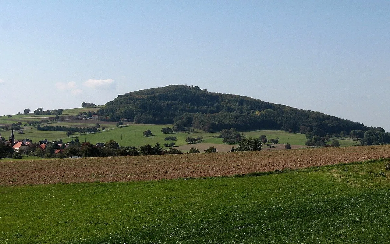
Katzenbuckel Dirk Schmidt · CC BY-SA 3.0 -
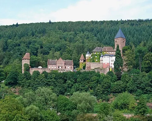
Schloß Zwingenberg Felix König · CC BY 3.0 -
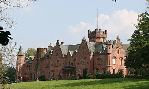
Schloß Waldleiningen UrLunkwill · CC BY-SA 3.0 de -
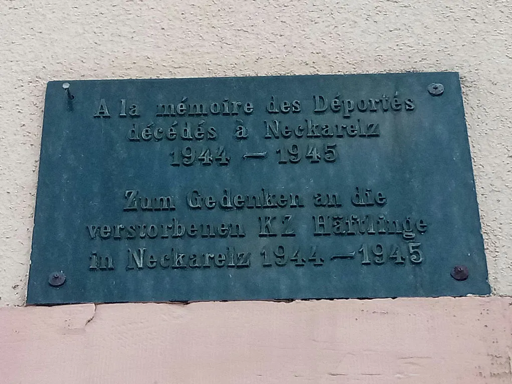
Neckarelz I Concentration Camp Granpar · CC BY 3.0 -
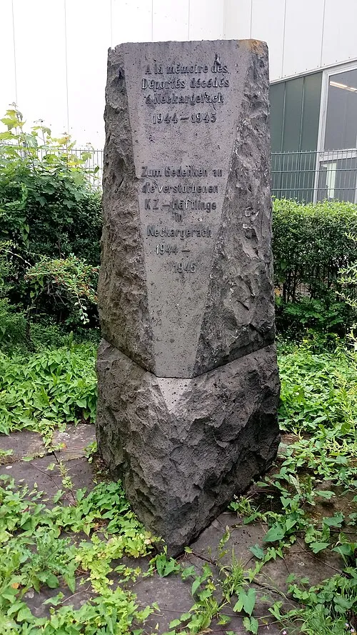
Neckargerach Concentration Camp Granpar · CC BY 3.0


Climate of Neckar-Odenwald-Kreis
Best months for sightseeingBest months for sightseeing: June–August.
This month · November
A cold month
Day 6° · Night 1° · Rain 75 mm
- Hottest month
- July (day 23°)
- Coldest month
- January (night -3°)
- Wettest month
- December (93 mm)
- Driest month
- April (56 mm)
Bars: average monthly low and high temperature. Below: precipitation. Monthly averages for 1970–2000 at about 18 km resolution, adjusted for elevation. Highlighted months are mild and relatively dry. Source: WorldClim 2.1 (CC BY 4.0).
Show values as a table
| Month | Jan | Feb | Mar | Apr | May | Jun | Jul | Aug | Sep | Oct | Nov | Dec |
|---|---|---|---|---|---|---|---|---|---|---|---|---|
| Average high (°C) | 2° | 4° | 8° | 12° | 18° | 20° | 23° | 23° | 18° | 12° | 6° | 3° |
| Average low (°C) | -3° | -3° | 0° | 3° | 7° | 10° | 12° | 12° | 8° | 4° | 1° | -2° |
| Precipitation (mm) | 79 | 69 | 70 | 56 | 69 | 78 | 75 | 58 | 62 | 78 | 75 | 93 |
How to get to Neckar-Odenwald-Kreis
The nearest airport is Mannheim-City Airport (MHG), 55 km to the west as the crow flies. For international flights: Frankfurt Main Airport (FRA) (79 km). The nearest large city is Heilbronn, 39 km to the south.
Airports
- Mannheim-City Airport (MHG) Mannheim 55 kmwest
- Frankfurt Main Airport (FRA) Frankfurt am Main 79 kmnorthwest
- Stuttgart Airport (STR) Stuttgart 89 kmsouth
Nearby large cities
- Heilbronn Population: 120.7K 39 kmsouth
- Heidelberg Population: 143.3K 43 kmwest
- Mannheim Population: 308K 59 kmwest
- Würzburg Population: 133.7K 60 kmnortheast
- Ludwigshafen am Rhein Population: 163.2K 60 kmwest
Straight-line distances; road distances are longer. Airport data: OurAirports.
Day trips from Neckar-Odenwald-Kreis
Within 100 km: 1,402 historic and cultural sites, 3,673 natural sites, 915 lakes, rivers and coasts.
0–25 km326 places
- Hollersee Lake 4 kmN
- Mülbener See Lake 12 kmW
- Roberner See Lake 10 kmSW
- Dauntalweiher Lake 6 kmNE
25–60 km1,696 places
- Hessental Concentration Camp Historic site 56 kmSE
- Umpfer River 33 kmE
- Elsenz River 36 kmW
- Friesenheimer Insel Island 60 kmW
60–100 km3,968 places
- Uzbach River 65 kmE
- Modau River 69 kmNW
- Lauter River 90 kmS
- Petersaue Island 95 kmNW
Straight-line distances.
Neckar-Odenwald-Kreis and similar cities
Side by side with cities of similar size in the same country: population, elevation and climate.
| Measure | Neckar-Odenwald-Kreis | Heidelberg | Paderborn | Regensburg |
|---|---|---|---|---|
| Population | 145.3K | 143.3K | 142.2K | 151.4K |
| Elevation | 416 m | 115 m | 118 m | 341 m |
| Summer day (hottest month) | 23° | 24° | 23° | 24° |
| Winter night (coldest month) | -3° | 0° | -1° | -4° |
| Annual rainfall | 862 mm | 953 mm | 934 mm | 656 mm |
| Best months | Jun–Aug | May–Sep | Jun–Aug | May–Sep |
| Distance | — | 43 km | 251 km | 212 km |
Climate values are 1970–2000 monthly averages; straight-line distance.
Places in Neckar-Odenwald-Kreis
28 places- 1 Mosbach 24.5K
- 2 Buchen (Odenwald) 18.2K
- 3 Walldürn 11.6K
- 4 Hardheim 6.8K
- 5 Osterburken 6.6K
- 6 Billigheim 6.1K
- 7 Elztal 5.8K
- 8 Obrigheim 5.4K
- 9 Adelsheim 5.2K
- 10 Haßmersheim 5.1K
- 11 Mudau 4.9K
- 12 Aglasterhausen 4.8K
- 13 Waldbrunn 4.7K
- 14 Limbach 4.5K
- 15 Seckach 4K
- 16 Schefflenz 3.9K
- 17 Höpfingen 3.1K
- 18 Ravenstein 3K
- 19 Schwarzach 2.9K
- 20 Fahrenbach 2.6K
- 21 Neckargerach 2.3K
- 22 Hüffenhardt 2.1K
- 23 Rosenberg 2K
- 24 Neunkirchen 1.8K
- 25 Neckarzimmern 1.4K
- 26 Binau 1.3K
- 27 Zwingenberg 625
Bar: population relative to the most populous place in this list.
Lakes, rivers & coasts1
- Roberner See · Lake
Nearby attractions & nature
Everything nearby-
Grauer Forst Natural site, Baden-Wurttemberg0.7 km SW
-
Großer Wald Natural site, Baden-Wurttemberg2.4 km NE
-
Hammelsbusch Natural site, Baden-Wurttemberg2.8 km SE
-
Eichwald Natural site, Baden-Wurttemberg4 km S
-
Spitzenwald Natural site, Baden-Wurttemberg4.4 km SE
-
Kammberg Natural site, Baden-Wurttemberg4.7 km SE
-
Galgen Natural site, Baden-Wurttemberg5.5 km NW
-
Bulau Natural site, Baden-Wurttemberg5.6 km N
Sources & licences
Data last updated: