Vohenstein
Located in Rosengarten, Landkreis Schwäbisch Hall Coordinates: 49°03′04″ N 9°43′33″ E
- Elevation
- 327 m
- above sea level
- Local time
- UTC+01:00
- Europe/Berlin · UTC+01:00
- Airports
- STR Stuttgart Airport55 km
- MHG Mannheim-City Airport100 km
About Vohenstein
Vohenstein is a village. Location: Rosengarten, Landkreis Schwäbisch Hall. Elevation: 327 m. The best months to visit are June–September. The nearest airport is Stuttgart Airport (55 km). Nearby sights include Bibers and Steinbühl.
Photos of Vohenstein
-
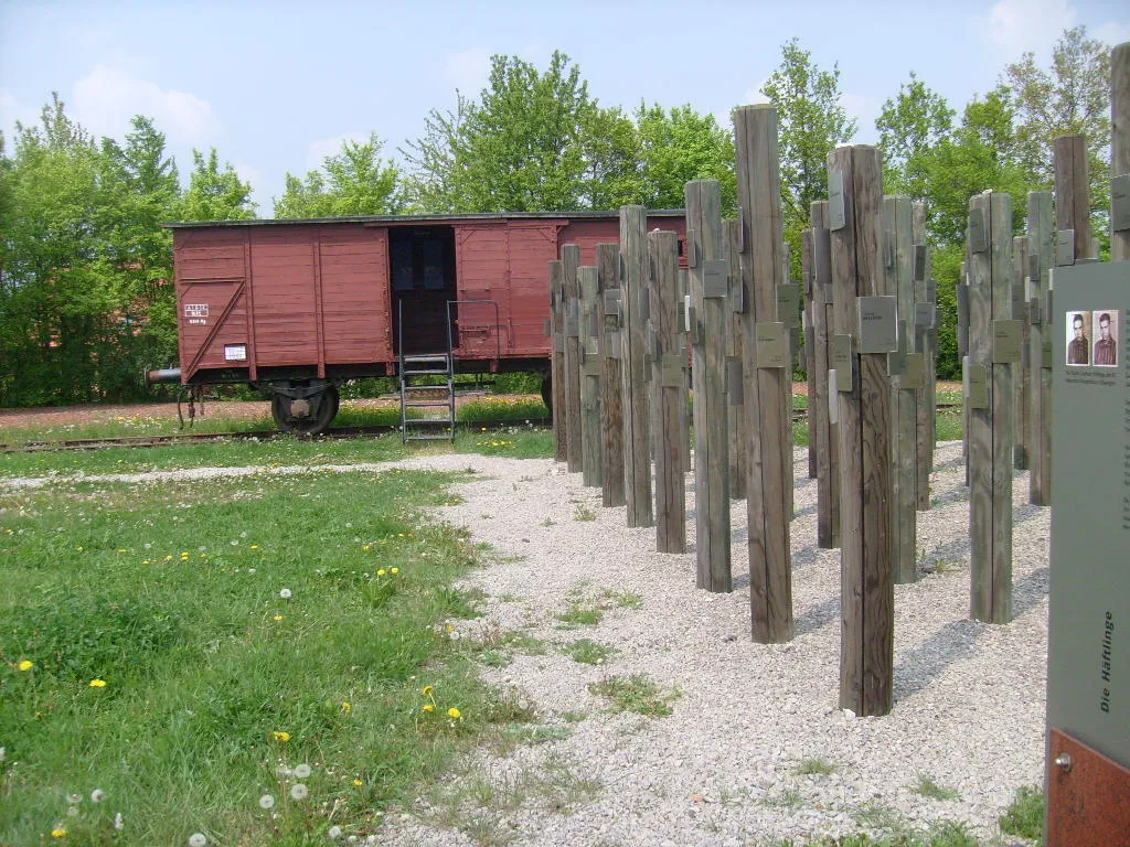
Hessental Concentration Camp Sarang · Public domain

Climate of Vohenstein
Best months for sightseeingBest months for sightseeing: June–September.
This month · November
A cold month
Day 7° · Night 1° · Rain 85 mm
- Hottest month
- July (day 24°)
- Coldest month
- January (night -3°)
- Wettest month
- June (97 mm)
- Driest month
- April (70 mm)
Bars: average monthly low and high temperature. Below: precipitation. Monthly averages for 1970–2000 at about 18 km resolution, adjusted for elevation. Highlighted months are mild and relatively dry. Source: WorldClim 2.1 (CC BY 4.0).
Show values as a table
| Month | Jan | Feb | Mar | Apr | May | Jun | Jul | Aug | Sep | Oct | Nov | Dec |
|---|---|---|---|---|---|---|---|---|---|---|---|---|
| Average high (°C) | 3° | 5° | 9° | 13° | 19° | 21° | 24° | 24° | 19° | 13° | 7° | 4° |
| Average low (°C) | -3° | -2° | 0° | 3° | 8° | 11° | 13° | 12° | 9° | 5° | 1° | -1° |
| Precipitation (mm) | 84 | 78 | 79 | 70 | 88 | 97 | 88 | 74 | 70 | 86 | 85 | 97 |
Other places to visit in this season: June July August September
How to get to Vohenstein
The nearest airport is Stuttgart Airport (STR), 55 km to the southwest as the crow flies. The nearest large city is Heilbronn, 38 km to the west.
Airports
- Stuttgart Airport (STR) Stuttgart 55 kmsouthwest
- Mannheim-City Airport (MHG) Mannheim 100 kmnorthwest
- Nuremberg Airport (NUE) Nuremberg 110 kmnortheast
Nearby large cities
- Heilbronn Population: 120.7K 38 kmwest
- Stuttgart Population: 612.7K 50 kmsouthwest
- Reutlingen Population: 112.6K 73 kmsouthwest
- Ulm Population: 120.5K 75 kmsouth
- Pforzheim Population: 119.3K 77 kmwest
Straight-line distances; road distances are longer. Airport data: OurAirports.
Day trips from Vohenstein
Within 100 km: 1,314 historic and cultural sites, 3,689 natural sites, 798 lakes, rivers and coasts.
0–25 km264 places
- Hessental Concentration Camp Historic site 7 kmNE
- Leinecksee Lake 23 kmS
- Ebnisee Lake 17 kmSW
- Reichenbachsee Lake 20 kmS
25–60 km1,609 places
- Umpfer River 55 kmN
- Lauter River 48 kmSW
- Pfaffensee Lake 56 kmSW
- Großer Lindleinsee Lake 52 kmNE
60–100 km3,928 places
- Elsenz River 78 kmNW
- Zusam River 85 kmSE
- Uzbach River 64 kmNE
- Lauter River 72 kmS
Straight-line distances.
Nearby attractions & nature
Everything nearby-
Bibers River, Baden-Wurttemberg0.6 km SE
-
Steinbühl Mountain, Rosengarten2.1 km S
-
Sulbühl Mountain, Oberrot3.3 km SW
-
Nameless Point Mountain, Michelbach an der Bilz4.1 km E
-
Ebersberg Mountain, Fichtenberg5.7 km S
-
Hessental Concentration Camp Historic site, Schwäbisch Hall6.9 km NE
Other cities and towns in Rosengarten
-
Rieden Village, Rosengarten2.1 km NW
-
 Tullau Village, Rosengarten4.4 km N
-
Sanzenbach Village, Rosengarten3.4 km W
-
Dendelbach Village, Rosengarten1.8 km W
-
Wilhelmsglück Village, Rosengarten2.2 km NE
-
Raibach Village, Rosengarten4.6 km N
Sources & licences
Data last updated: