Schwäbisch Gmünd
Located in Ostalbkreis, Regierungsbezirk Stuttgart Coordinates: 48°47′56″ N 9°47′56″ E
- Population
- 64,416
- 64.4K
- Elevation
- 327 m
- above sea level
- Local time
- UTC+01:00
- Europe/Berlin · UTC+01:00
- Places inside
- 70
- listed under Schwäbisch Gmünd
- Airports
- STR Stuttgart Airport44 km
- FMM Memmingen Allgau Airport96 km
About Schwäbisch Gmünd
Schwäbisch Gmünd is a village. Location: Ostalbkreis, Regierungsbezirk Stuttgart. Population: 64,416. Elevation: 327 m. The best months to visit are June–September. The nearest airport is Stuttgart Airport (44 km). Nearby sights include Schießtal and Bettringer Bach.
Photos of Schwäbisch Gmünd
-
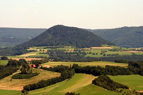
Stuifen Rosenzweig · CC BY-SA 3.0 -
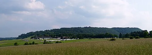
Kaltes Feld User:Kreuzschnabel · CC BY-SA 3.0 -
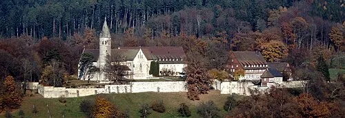
Lorch Monastery dealerofsalvation · CC BY-SA 4.0 -
Kleinkastell Kleindeinbach Vexillum · CC BY-SA 3.0


Climate of Schwäbisch Gmünd
Best months for sightseeingBest months for sightseeing: June–September.
This month · November
A cold month
Day 8° · Night 1° · Rain 78 mm
- Hottest month
- July (day 24°)
- Coldest month
- January (night -2°)
- Wettest month
- June (105 mm)
- Driest month
- February (67 mm)
Bars: average monthly low and high temperature. Below: precipitation. Monthly averages for 1970–2000 at about 18 km resolution, adjusted for elevation. Highlighted months are mild and relatively dry. Source: WorldClim 2.1 (CC BY 4.0).
Show values as a table
| Month | Jan | Feb | Mar | Apr | May | Jun | Jul | Aug | Sep | Oct | Nov | Dec |
|---|---|---|---|---|---|---|---|---|---|---|---|---|
| Average high (°C) | 4° | 5° | 10° | 13° | 19° | 21° | 24° | 24° | 19° | 14° | 8° | 5° |
| Average low (°C) | -2° | -2° | 1° | 4° | 8° | 11° | 13° | 13° | 9° | 5° | 1° | -1° |
| Precipitation (mm) | 71 | 67 | 69 | 69 | 86 | 105 | 94 | 81 | 69 | 76 | 78 | 81 |
Other places to visit in this season: June July August September
How to get to Schwäbisch Gmünd
The nearest airport is Stuttgart Airport (STR), 44 km to the west as the crow flies. The nearest large city is Stuttgart, 46 km to the west.
Airports
- Stuttgart Airport (STR) Stuttgart 44 kmwest
- Memmingen Allgau Airport (FMM) Memmingen 96 kmsouth
- Mannheim-City Airport (MHG) Mannheim 120 kmnorthwest
Nearby large cities
- Stuttgart Population: 612.7K 46 kmwest
- Ulm Population: 120.5K 47 kmsouth
- Reutlingen Population: 112.6K 56 kmsouthwest
- Heilbronn Population: 120.7K 57 kmnorthwest
- Pforzheim Population: 119.3K 81 kmwest
Straight-line distances; road distances are longer. Airport data: OurAirports.
Day trips from Schwäbisch Gmünd
Within 100 km: 1,033 historic and cultural sites, 3,470 natural sites, 758 lakes, rivers and coasts.
0–25 km354 places
- Leinecksee Lake 9 kmNW
- Ebnisee Lake 19 kmNW
- Reichenbachsee Lake 9 kmN
- Waldsee Lake 22 kmNW
25–60 km1,637 places
- Hessental Concentration Camp Historic site 34 kmN
- Lauter River 33 kmW
- Lauter River 43 kmS
- Pfaffensee Lake 51 kmW
60–100 km3,270 places
- Umpfer River 83 kmN
- Elsenz River 99 kmNW
- Zusam River 71 kmE
- Uzbach River 87 kmN
Straight-line distances.
Places in Schwäbisch Gmünd
70 placesBar: population relative to the most populous place in this list.
Cities & villages25
- Bargau · Village
- Burgholz · Village
- Degenfeld · Village
- Großdeinbach · Village
- Hangendeinbach · Village
- Herdtlinsweiler · Village
- Herlikofen · Village
- Hummelshalden · Village
- Hussenhofen · Village
- Klarenberg · Village
- Kleindeinbach · Village
- Kleinishof · Village
- Lindach · Village
- Metlangen · Village
- Oberbettringen · Village
- Radelstetten · Village
- Rechberg · Village
- Rechberg Hinterweiler · Village
- Rechberg Vorderweiler · Village
- Reitprechts · Village
- Sachsenhof · Village
- Schönbronn · Village
- Schurrenhof · Village
- Steinbacherhöfe · Village
- Stollenhof · Village
Mountains & nature7
- Bargauer Horn · Mountain
- Finsterhalde · Mountain
- Hart · Mountain
- Himmelsgarten · Natural site
- Kaltes Feld · Mountain
- Rechberg · Mountain
- Stadtgarten · Natural site
Lakes, rivers & coasts1
- Schießtalsee · Lake
Heritage & sights24
- Amtsgericht Schwäbisch Gmünd · Attraction
- Augustinuskirche · Attraction
- Aussegnungshalle · Attraction
- Bahnhofbrücke · Landmark
- Glockenturm · Attraction
- Heilig-Kreuz-Münster · Attraction
- Herrgottsruhkapelle · Attraction
- Himmelsstürmer · Landmark
- Hohenrechberg · Historic site
- Hohenrechberg Castle · Historic site
- Johanniskirche · Attraction
- Josefskapelle · Attraction
- Josenbrücke · Landmark
- Kastell Schirenhof · Historic site
- Kleinkastell Freimühle · Historic site
- Kleinkastell Kleindeinbach · Historic site
- Kroatensteg · Landmark
- Museum und Galerie im Prediger · Museum
- Remsbrücke · Landmark
- Rokokobrücke · Landmark
- Rokoko-Schlößchen · Historic site
- Schillersteg · Landmark
- Seilbrücke · Landmark
- St. Leonhard · Attraction
Nearby attractions & nature
Everything nearby-
Schießtal Natural site, Baden-Wurttemberg1.3 km E
-
Bettringer Bach River, Baden-Wurttemberg1.2 km W
-
Waldstetter Bach River, Baden-Wurttemberg2.2 km SE
-
Tiefenbach River, Baden-Wurttemberg2.9 km SW
-
Rotenbach River, Baden-Wurttemberg2.9 km SW
-
Stuifen Mountain, Waldstetten6.4 km S
Other cities and towns in Ostalbkreis
-
Täferrot Village, Täferrot6.3 km NE
-
 Zimmern Village, Schwäbisch Gmünd5.9 km E
-
Wustenriet Village, Schwäbisch Gmünd2.3 km W
-
Wetzgau Village, Schwäbisch Gmünd2.6 km NW
-
Schlatthof Village, Waldstetten3 km SE
-
Unterbettringen Village, Schwäbisch Gmünd3.5 km SE
Sources & licences
Data last updated: