Schwaikheim
Located in Rems-Murr-Kreis, Regierungsbezirk Stuttgart Coordinates: 48°52′39″ N 9°20′58″ E
- Population
- 10,028
- 10K
- Elevation
- 267 m
- above sea level
- Local time
- UTC+01:00
- Europe/Berlin · UTC+01:00
- Places inside
- 2
- listed under Schwaikheim
- Airports
- STR Stuttgart Airport23 km
- MHG Mannheim-City Airport90 km
About Schwaikheim
Schwaikheim is a village. Location: Rems-Murr-Kreis, Regierungsbezirk Stuttgart. Population: 10,028. Elevation: 267 m. The best months to visit are June–September. The nearest airport is Stuttgart Airport (23 km). Nearby sights include Sörenberg and Haselstein.
Photos of Schwaikheim
-
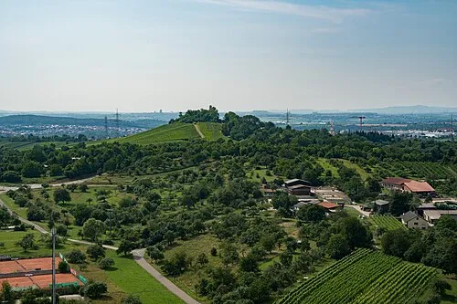
Sörenberg Laserlicht · CC BY-SA 4.0 -
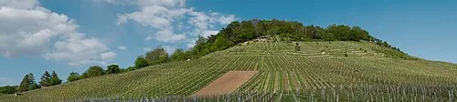
Kleinheppacher Kopf Laserlicht · CC BY-SA 4.0 -
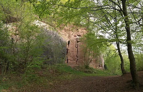
Haselstein Megatherium · CC BY-SA 4.0


Climate of Schwaikheim
Best months for sightseeingBest months for sightseeing: June–September.
This month · November
A cold month
Day 8° · Night 1° · Rain 76 mm
- Hottest month
- July (day 24°)
- Coldest month
- January (night -2°)
- Wettest month
- June (100 mm)
- Driest month
- February (63 mm)
Bars: average monthly low and high temperature. Below: precipitation. Monthly averages for 1970–2000 at about 18 km resolution, adjusted for elevation. Highlighted months are mild and relatively dry. Source: WorldClim 2.1 (CC BY 4.0).
Show values as a table
| Month | Jan | Feb | Mar | Apr | May | Jun | Jul | Aug | Sep | Oct | Nov | Dec |
|---|---|---|---|---|---|---|---|---|---|---|---|---|
| Average high (°C) | 4° | 6° | 10° | 14° | 19° | 21° | 24° | 24° | 19° | 14° | 8° | 5° |
| Average low (°C) | -2° | -2° | 1° | 3° | 8° | 11° | 13° | 12° | 9° | 5° | 1° | -1° |
| Precipitation (mm) | 65 | 63 | 66 | 66 | 92 | 100 | 90 | 74 | 70 | 75 | 76 | 79 |
Other places to visit in this season: June July August September
How to get to Schwaikheim
The nearest airport is Stuttgart Airport (STR), 23 km to the southwest as the crow flies. The nearest large city is Stuttgart, 16 km to the southwest.
Airports
- Stuttgart Airport (STR) Stuttgart 23 kmsouthwest
- Mannheim-City Airport (MHG) Mannheim 90 kmnorthwest
- Karlsruhe Baden-Baden Airport (FKB) Rheinmünster 94 kmwest
Nearby large cities
- Stuttgart Population: 612.7K 16 kmsouthwest
- Heilbronn Population: 120.7K 31 kmnorth
- Reutlingen Population: 112.6K 44 kmsouth
- Pforzheim Population: 119.3K 48 kmwest
- Karlsruhe Population: 283.8K 71 kmwest
Straight-line distances; road distances are longer. Airport data: OurAirports.
Day trips from Schwaikheim
Within 100 km: 1,064 historic and cultural sites, 3,612 natural sites, 831 lakes, rivers and coasts.
0–25 km534 places
- Lauter River 22 kmS
- Pfaffensee Lake 22 kmSW
- Bärensee Lake 23 kmSW
- Annasee Lake 21 kmN
25–60 km1,864 places
- Hessental Concentration Camp Historic site 40 kmNE
- Aalkistensee Lake 45 kmW
- Leinecksee Lake 25 kmE
- Reichenbachsee Lake 30 kmE
60–100 km3,109 places
- Umpfer River 79 kmN
- Elsenz River 70 kmNW
- Uzbach River 95 kmNE
- Lauter River 65 kmSE
Straight-line distances.
Places in Schwaikheim
2 placesBar: population relative to the most populous place in this list.
Mountains & nature1
- Waiblinger Berg · Mountain
Nearby attractions & nature
Everything nearby-
Sörenberg Mountain, Waiblingen2.9 km S
-
Haselstein Mountain, Winnenden4.5 km SE
-
Korber Kopf Mountain, Korb3.1 km SE
-
Kleinheppacher Kopf Mountain, Korb5.3 km SE
-
Hörnleskopf Mountain, Waiblingen4.3 km SE
-
Eichenhau Mountain, Waiblingen4.5 km SE
Other cities and towns in Rems-Murr-Kreis
-
Waiblingen Village, Rems-Murr-Kreis5.6 km SW
-
Burgstetten Village, Rems-Murr-Kreis5.9 km N
-
Burgstetten Village, Burgstetten5.9 km N
-
Hohenacker Village, Waiblingen2.8 km SW
-
 Bittenfeld Village, Waiblingen2.8 km NW
-
 Hegnach Village, Waiblingen4.3 km SW
Sources & licences
Data last updated: