- Elevation
- 229 m
- above sea level
- Local time
- UTC+01:00
- Europe/Berlin · UTC+01:00
- Airports
- STR Stuttgart Airport55 km
- MHG Mannheim-City Airport55 km
About Hammelsberg
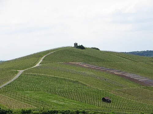
Hammelsberg is a mountain. Location: Heilbronn, Stadtkreis Heilbronn. Elevation: 229 m. The best months to visit are June–September. The nearest airport is Stuttgart Airport (55 km). Nearby sights include Rosenbuckel and Seebuckel.
Photos of Hammelsberg
-
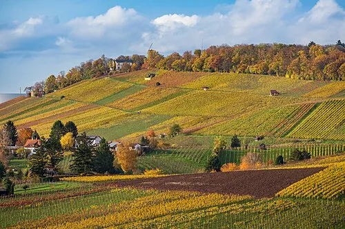
Wartberg Roman Eisele · CC BY-SA 4.0 -
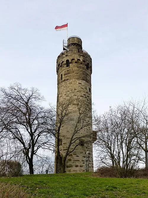
Heuchelberger Warte Muck · CC BY-SA 4.0 -
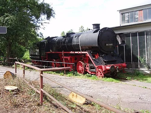
South German Railway Museum Xocolatl 18:34, 2 July 2007 · Public domain


Climate of Hammelsberg
Best months for sightseeingBest months for sightseeing: June–September.
This month · November
A cold month
Day 8° · Night 2° · Rain 76 mm
- Hottest month
- July (day 24°)
- Coldest month
- January (night -2°)
- Wettest month
- December (87 mm)
- Driest month
- April (56 mm)
Bars: average monthly low and high temperature. Below: precipitation. Monthly averages for 1970–2000 at about 18 km resolution, adjusted for elevation. Highlighted months are mild and relatively dry. Source: WorldClim 2.1 (CC BY 4.0).
Show values as a table
| Month | Jan | Feb | Mar | Apr | May | Jun | Jul | Aug | Sep | Oct | Nov | Dec |
|---|---|---|---|---|---|---|---|---|---|---|---|---|
| Average high (°C) | 4° | 5° | 10° | 14° | 19° | 22° | 24° | 24° | 20° | 14° | 8° | 5° |
| Average low (°C) | -2° | -1° | 1° | 4° | 8° | 11° | 13° | 13° | 9° | 5° | 2° | 0° |
| Precipitation (mm) | 73 | 67 | 69 | 56 | 80 | 84 | 80 | 59 | 66 | 75 | 76 | 87 |
Other places to visit in this season: June July August September
How to get to Hammelsberg
The nearest airport is Stuttgart Airport (STR), 55 km to the south as the crow flies. The nearest large city is Heilbronn, 8 km to the southeast.
Airports
- Stuttgart Airport (STR) Stuttgart 55 kmsouth
- Mannheim-City Airport (MHG) Mannheim 55 kmnorthwest
- Karlsruhe Baden-Baden Airport (FKB) Rheinmünster 89 kmsouthwest
Nearby large cities
- Heilbronn Population: 120.7K 8 kmsoutheast
- Heidelberg Population: 143.3K 41 kmnorthwest
- Stuttgart Population: 612.7K 45 kmsouth
- Pforzheim Population: 119.3K 46 kmsouthwest
- Karlsruhe Population: 283.8K 57 kmwest
Straight-line distances; road distances are longer. Airport data: OurAirports.
Day trips from Hammelsberg
Within 100 km: 1,193 historic and cultural sites, 3,888 natural sites, 869 lakes, rivers and coasts.
0–25 km364 places
- Annasee Lake 20 kmSE
- Zigeunerstock Mountain 10 kmNE
- Wunnenstein Mountain 20 kmSE
- Wolfsberg Mountain 18 kmSE
25–60 km1,937 places
- Hessental Concentration Camp Historic site 47 kmE
- Umpfer River 59 kmNE
- Elsenz River 34 kmNW
- Lauter River 58 kmS
60–100 km3,649 places
- Uzbach River 85 kmNE
- Modau River 85 kmNW
- Friesenheimer Insel Island 62 kmNW
- Kisselwörth Island 99 kmNW
Straight-line distances.
Nearest towns and villages
-
 Biberach Village, Heilbronn1.4 km NE
-
Landkreis Heilbronn Municipality, Regierungsbezirk Stuttgart5.2 km E
-
Kirchhausen Village, Heilbronn1.7 km W
-
Leingarten Village, Landkreis Heilbronn4.4 km SW
-
Leingarten Town, Leingarten4.3 km S
-
Bad Rappenau Village, Landkreis Heilbronn6 km NW
Nearby attractions & nature
Everything nearby-
Rosenbuckel Mountain, Heilbronn2.2 km SE
-
Seebuckel Mountain, Heilbronn2.2 km NW
-
Finkenberg Mountain, Heilbronn2.2 km NE
-
Hungerberg Mountain, Bad Rappenau3.1 km NW
-
Michelbach River, Baden-Wurttemberg1.9 km N
-
Grundelbach River, Baden-Wurttemberg1.9 km N
-
Hohes Ried Mountain, Bad Wimpfen3.7 km N
-
Taschenwald Natural site, Baden-Wurttemberg3.1 km SW
More nature in Germany
-
Hüttberg Mountain, Heilbronn4.4 km SE
-
Wartberg Mountain, Heilbronn7.9 km E
-
Stapfenhöhe Mountain, Heilbronn3.6 km W
-
Stiftsberg Mountain, Heilbronn7.5 km E
-
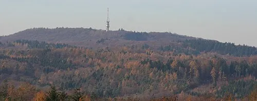 Schweinsberg Mountain, Heilbronn12 km SE
-
 Staufenberg Mountain, Heilbronn10 km SE
Sources & licences
Data last updated: · 2 independent sources