Landkreis Miltenberg
Located in Lower Franconia, Bavaria Coordinates: 49°46′27″ N 9°13′43″ E
- Population
- 127,547
- 127.5K
- Elevation
- 224 m
- above sea level
- Local time
- UTC+01:00
- Europe/Berlin · UTC+01:00
- Places inside
- 33
- listed under Landkreis Miltenberg
- Airports
- FRA Frankfurt Main Airport56 km
- MHG Mannheim-City Airport62 km
About Landkreis Miltenberg
Landkreis Miltenberg is a municipality. Location: Lower Franconia, Bavaria. Population: 127,547. Elevation: 224 m. The best months to visit are June–August. The nearest airport is Frankfurt Main Airport (56 km). Nearby sights include Röllbach and Atzenberg.
Photos of Landkreis Miltenberg
-
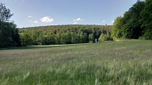
Sulzberg Salino01 · CC BY-SA 4.0 -
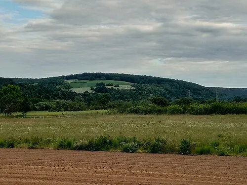
Plattenberg Salino01 · CC BY-SA 4.0 -
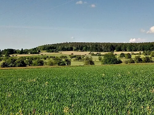
Hoheberg Salino01 · CC BY-SA 4.0 -
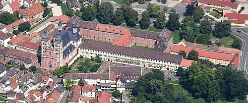
Amorbach Abbey Carsten Steger · CC BY-SA 4.0


Climate of Landkreis Miltenberg
Best months for sightseeingBest months for sightseeing: June–August.
This month · November
A cold month
Day 7° · Night 2° · Rain 78 mm
- Hottest month
- July (day 24°)
- Coldest month
- January (night -2°)
- Wettest month
- December (97 mm)
- Driest month
- April (56 mm)
Bars: average monthly low and high temperature. Below: precipitation. Monthly averages for 1970–2000 at about 18 km resolution, adjusted for elevation. Highlighted months are mild and relatively dry. Source: WorldClim 2.1 (CC BY 4.0).
Show values as a table
| Month | Jan | Feb | Mar | Apr | May | Jun | Jul | Aug | Sep | Oct | Nov | Dec |
|---|---|---|---|---|---|---|---|---|---|---|---|---|
| Average high (°C) | 3° | 5° | 9° | 13° | 19° | 21° | 24° | 23° | 19° | 13° | 7° | 4° |
| Average low (°C) | -2° | -2° | 1° | 4° | 8° | 11° | 13° | 13° | 9° | 6° | 2° | 0° |
| Precipitation (mm) | 82 | 69 | 72 | 56 | 66 | 74 | 76 | 59 | 63 | 77 | 78 | 97 |
How to get to Landkreis Miltenberg
The nearest airport is Frankfurt Main Airport (FRA), 56 km to the northwest as the crow flies. The nearest large city is Darmstadt, 43 km to the west.
Airports
- Frankfurt Main Airport (FRA) Frankfurt am Main 56 kmnorthwest
- Mannheim-City Airport (MHG) Mannheim 62 kmsouthwest
- Stuttgart Airport (STR) Stuttgart 121 kmsouth
Nearby large cities
- Darmstadt Population: 167K 43 kmwest
- Offenbach Population: 119.2K 49 kmnorthwest
- Würzburg Population: 133.7K 52 kmeast
- Frankfurt am Main Population: 650K 54 kmnorthwest
- Heidelberg Population: 143.3K 56 kmsouthwest
Straight-line distances; road distances are longer. Airport data: OurAirports.
Day trips from Landkreis Miltenberg
Within 100 km: 1,231 historic and cultural sites, 3,806 natural sites, 857 lakes, rivers and coasts.
0–25 km356 places
- Klosterweiher Lake 16 kmS
- Zieglerberg Mountain 14 kmN
- Ziegelberg Mountain 9 kmE
- Zeugplatte Mountain 17 kmNE
25–60 km1,716 places
- Umpfer River 44 kmSE
- Elsenz River 52 kmSW
- Modau River 55 kmW
- Neckarinsel Island 56 kmSW
60–100 km3,822 places
- Hessental Concentration Camp Historic site 84 kmSE
- Uzbach River 73 kmE
- Rüdesheimer Aue Island 96 kmW
- Petersaue Island 75 kmW
Straight-line distances.
Landkreis Miltenberg and similar cities
Side by side with cities of similar size in the same country: population, elevation and climate.
| Measure | Landkreis Miltenberg | Fürth | Wolfsburg | Recklinghausen |
|---|---|---|---|---|
| Population | 127.5K | 132K | 123.1K | 122.4K |
| Elevation | 224 m | 302 m | 65 m | 80 m |
| Summer day (hottest month) | 24° | 25° | 23° | 23° |
| Winter night (coldest month) | -2° | -3° | -2° | 0° |
| Annual rainfall | 869 mm | 718 mm | 610 mm | 888 mm |
| Best months | Jun–Aug | May–Sep | Jun–Aug | Jun–Aug |
| Distance | — | 131 km | 314 km | 250 km |
Climate values are 1970–2000 monthly averages; straight-line distance.
Places in Landkreis Miltenberg
33 places- 1 Erlenbach a.Main 9.7K
- 2 Miltenberg 9.4K
- 3 Elsenfeld, Markt 9.2K
- 4 Obernburg a.Main 8.6K
- 5 Sulzbach a.Main, Markt 7.4K
- 6 Klingenberg a.Main 6.1K
- 7 Kleinwallstadt, Markt 5.6K
- 8 Großheubach, Markt 5K
- 9 Mömlingen 4.8K
- 10 Wörth a.Main 4.8K
- 11 Niedernberg 4.7K
- 12 Leidersbach 4.6K
- 13 Großwallstadt 4.2K
- 14 Bürgstadt, Markt 4.2K
- 15 Eschau, Markt 3.9K
- 16 Amorbach 3.9K
- 17 Kleinheubach, Markt 3.6K
- 18 Faulbach 2.5K
- 19 Mönchberg, Markt 2.5K
- 20 Eichenbühl 2.5K
- 21 Collenberg 2.5K
- 22 Kirchzell, Markt 2.2K
- 23 Weilbach, Markt 2.1K
- 24 Hausen 1.8K
- 25 Schneeberg, Markt 1.8K
- 26 Röllbach 1.8K
- 27 Dorfprozelten 1.7K
- 28 Stadtprozelten 1.6K
- 29 Laudenbach 1.5K
- 30 Neunkirchen 1.4K
- 31 Altenbuch 1.2K
- 32 Rüdenau 724
Bar: population relative to the most populous place in this list.
Cities & villages1
- Ohrenbach · Village
Nearby attractions & nature
Everything nearby-
Röllbach River, Bavaria3.5 km W
-
Atzenberg Mountain, Uffing am Staffelsee4.8 km N
-
Rüdenauer Bach River, Bavaria5.6 km S
-
Buchrain Holz Natural site, Bavaria6.4 km E
-
Tannenbuckel Mountain, Freudenberg am Main8 km E
-
Scheuerbusch Natural site, Bavaria7.1 km SW
-
Künzbach River, Bavaria6.5 km N
-
Stellbergkopf Mountain, Freudenberg am Main8.8 km E
Sources & licences
Data last updated: