Kreisfreie Stadt Aschaffenburg
Located in Lower Franconia, Bavaria Coordinates: 49°58′01″ N 9°08′52″ E
- Population
- 73,091
- 73.1K
- Elevation
- 133 m
- above sea level
- Local time
- UTC+01:00
- Europe/Berlin · UTC+01:00
- Places inside
- 1
- listed under Kreisfreie Stadt Aschaffenburg
- Airports
- FRA Frankfurt Main Airport43 km
- MHG Mannheim-City Airport71 km
About Kreisfreie Stadt Aschaffenburg
Kreisfreie Stadt Aschaffenburg is a municipality. Location: Lower Franconia, Bavaria. Population: 73,091. Elevation: 133 m. The best months to visit are May–September. The nearest airport is Frankfurt Main Airport (43 km). Nearby sights include Gailbach and Wendelberg.
Photos of Kreisfreie Stadt Aschaffenburg
-
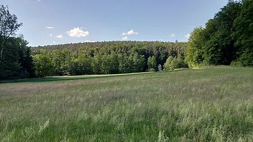
Sulzberg Salino01 · CC BY-SA 4.0 -
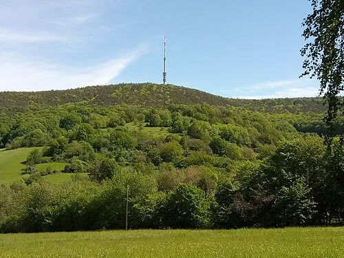
Pfaffenberg Salino01 · CC BY-SA 4.0 -
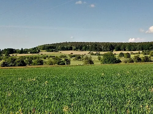
Hoheberg Salino01 · CC BY-SA 4.0 -
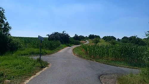
Bischberg Freak-Line-Community · CC BY-SA 4.0


Climate of Kreisfreie Stadt Aschaffenburg
Best months for sightseeingBest months for sightseeing: May–September.
This month · November
A cold month
Day 8° · Night 2° · Rain 71 mm
- Hottest month
- July (day 24°)
- Coldest month
- January (night -1°)
- Wettest month
- December (84 mm)
- Driest month
- April (53 mm)
Bars: average monthly low and high temperature. Below: precipitation. Monthly averages for 1970–2000 at about 18 km resolution, adjusted for elevation. Highlighted months are mild and relatively dry. Source: WorldClim 2.1 (CC BY 4.0).
Show values as a table
| Month | Jan | Feb | Mar | Apr | May | Jun | Jul | Aug | Sep | Oct | Nov | Dec |
|---|---|---|---|---|---|---|---|---|---|---|---|---|
| Average high (°C) | 4° | 5° | 10° | 14° | 20° | 22° | 24° | 24° | 20° | 14° | 8° | 5° |
| Average low (°C) | -1° | -1° | 2° | 4° | 8° | 12° | 13° | 13° | 9° | 6° | 2° | 0° |
| Precipitation (mm) | 68 | 60 | 64 | 53 | 65 | 71 | 79 | 59 | 62 | 69 | 71 | 84 |
Other places to visit in this season: May June July August September
How to get to Kreisfreie Stadt Aschaffenburg
The nearest airport is Frankfurt Main Airport (FRA), 43 km to the west as the crow flies. The nearest large city is Offenbach, 31 km to the northwest.
Airports
- Frankfurt Main Airport (FRA) Frankfurt am Main 43 kmwest
- Mannheim-City Airport (MHG) Mannheim 71 kmsouthwest
- Frankfurt-Hahn Airport (HHN) Frankfurt am Main (Lautzenhausen) 135 kmwest
Nearby large cities
- Offenbach Population: 119.2K 31 kmnorthwest
- Frankfurt am Main Population: 650K 37 kmnorthwest
- Darmstadt Population: 167K 37 kmwest
- Würzburg Population: 133.7K 61 kmeast
- Mainz Population: 222.9K 62 kmwest
Straight-line distances; road distances are longer. Airport data: OurAirports.
Day trips from Kreisfreie Stadt Aschaffenburg
Within 100 km: 1,188 historic and cultural sites, 3,936 natural sites, 818 lakes, rivers and coasts.
0–25 km358 places
- Steigkoppe Mountain 14 kmNE
- Zieglerberg Mountain 8 kmSE
- Zeugplatte Mountain 15 kmSE
- Weikertshöhe Mountain 24 kmE
25–60 km1,705 places
- Modau River 52 kmW
- Kisselwörth Island 58 kmW
- Langenaue Island 57 kmW
- Große Woog Lake 36 kmW
60–100 km3,879 places
- Umpfer River 63 kmSE
- Elsenz River 68 kmS
- Uzbach River 88 kmSE
- Ohe River 97 kmN
Straight-line distances.
Kreisfreie Stadt Aschaffenburg and similar cities
Side by side with cities of similar size in the same country: population, elevation and climate.
| Measure | Kreisfreie Stadt Aschaffenburg | Bayreuth | Detmold | Landshut |
|---|---|---|---|---|
| Population | 73.1K | 72.9K | 73.7K | 71.9K |
| Elevation | 133 m | 338 m | 135 m | 488 m |
| Summer day (hottest month) | 24° | 23° | 22° | 23° |
| Winter night (coldest month) | -1° | -3° | -1° | -4° |
| Annual rainfall | 805 mm | 810 mm | 969 mm | 807 mm |
| Best months | May–Sep | Jun–Aug | Jun–Aug | Jun–Aug |
| Distance | — | 174 km | 220 km | 271 km |
Climate values are 1970–2000 monthly averages; straight-line distance.
Places in Kreisfreie Stadt Aschaffenburg
1 placeBar: population relative to the most populous place in this list.
Nearby attractions & nature
Everything nearby-
Gailbach River, Bavaria1.3 km SW
-
Wendelberg Mountain, Haibach2.6 km E
-
Röderberg Mountain, Haibach2.6 km E
-
Aschaff River, Bavaria3.2 km W
-
Wildgraben River, Bavaria3.4 km W
-
Obernauer Wald Natural site, Bavaria3.9 km S
-
Grauenstein Mountain, Goldbach, Markt5.3 km N
-
Sulzberg Mountain, Sulzbach a.Main, Markt5.8 km SE
Sources & licences
Data last updated: