Landkreis Würzburg
Located in Lower Franconia, Bavaria Coordinates: 49°47′22″ N 9°49′42″ E
- Population
- 162,216
- 162.2K
- Elevation
- 285 m
- above sea level
- Local time
- UTC+01:00
- Europe/Berlin · UTC+01:00
- Places inside
- 52
- listed under Landkreis Würzburg
- Airports
- FRA Frankfurt Main Airport95 km
- NUE Nuremberg Airport96 km
About Landkreis Würzburg
Landkreis Würzburg is a municipality. Location: Lower Franconia, Bavaria. Population: 162,216. Elevation: 285 m. The best months to visit are June–September. The nearest airport is Frankfurt Main Airport (95 km). Nearby sights include Schloss Veitshöchheim and Büchelberg.
Photos of Landkreis Würzburg
-
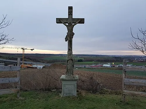
Wachtelberg Triplec85 · CC BY 4.0 -
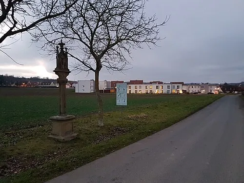
Höllberg Triplec85 · CC BY 4.0 -
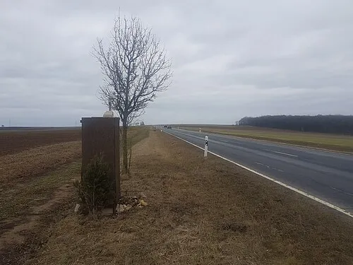
Geisberg Triplec85 · CC BY-SA 4.0 -
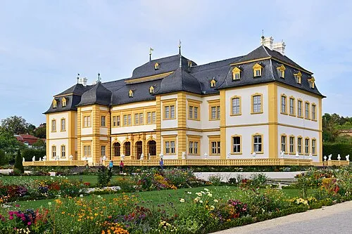
Schloss Veitshöchheim Haeferl · CC BY-SA 3.0 de


Climate of Landkreis Würzburg
Best months for sightseeingBest months for sightseeing: June–September.
This month · November
A cold month
Day 7° · Night 1° · Rain 61 mm
- Hottest month
- August (day 24°)
- Coldest month
- January (night -2°)
- Wettest month
- December (75 mm)
- Driest month
- April (49 mm)
Bars: average monthly low and high temperature. Below: precipitation. Monthly averages for 1970–2000 at about 18 km resolution, adjusted for elevation. Highlighted months are mild and relatively dry. Source: WorldClim 2.1 (CC BY 4.0).
Show values as a table
| Month | Jan | Feb | Mar | Apr | May | Jun | Jul | Aug | Sep | Oct | Nov | Dec |
|---|---|---|---|---|---|---|---|---|---|---|---|---|
| Average high (°C) | 3° | 5° | 9° | 13° | 19° | 21° | 24° | 24° | 19° | 13° | 7° | 4° |
| Average low (°C) | -2° | -2° | 1° | 3° | 8° | 11° | 13° | 12° | 9° | 5° | 1° | -1° |
| Precipitation (mm) | 61 | 53 | 57 | 49 | 60 | 72 | 66 | 56 | 50 | 61 | 61 | 75 |
Other places to visit in this season: June July August September
How to get to Landkreis Würzburg
The nearest airport is Frankfurt Main Airport (FRA), 95 km to the west as the crow flies. The nearest large city is Würzburg, 9 km to the east.
Airports
- Frankfurt Main Airport (FRA) Frankfurt am Main 95 kmwest
- Nuremberg Airport (NUE) Nuremberg 96 kmeast
- Mannheim-City Airport (MHG) Mannheim 101 kmwest
Nearby large cities
- Würzburg Population: 133.7K 9 kmeast
- Offenbach Population: 119.2K 84 kmnorthwest
- Heilbronn Population: 120.7K 85 kmsouthwest
- Darmstadt Population: 167K 85 kmwest
- Erlangen Population: 102.7K 88 kmeast
Straight-line distances; road distances are longer. Airport data: OurAirports.
Day trips from Landkreis Würzburg
Within 100 km: 1,372 historic and cultural sites, 4,032 natural sites, 844 lakes, rivers and coasts.
0–25 km487 places
- Zweierberg Mountain 3 kmSE
- Weidleinsberg Mountain 17 kmNW
- Steinfelder Berg Mountain 21 kmN
- Steinberg Mountain 25 kmNE
25–60 km1,764 places
- Umpfer River 28 kmS
- Uzbach River 37 kmSE
- Badsee Lake 45 kmE
- Wolfsee Lake 46 kmE
60–100 km3,997 places
- Hessental Concentration Camp Historic site 76 kmS
- Elsenz River 87 kmSW
- Modau River 98 kmW
- Neckarinsel Island 93 kmSW
Straight-line distances.
Landkreis Würzburg and similar cities
Side by side with cities of similar size in the same country: population, elevation and climate.
| Measure | Landkreis Würzburg | Leverkusen | Ludwigshafen am Rhein | Solingen |
|---|---|---|---|---|
| Population | 162.2K | 162.7K | 163.2K | 164.4K |
| Elevation | 285 m | 52 m | 97 m | 229 m |
| Summer day (hottest month) | 24° | 23° | 25° | 22° |
| Winter night (coldest month) | -2° | 1° | -1° | -1° |
| Annual rainfall | 721 mm | 811 mm | 669 mm | 1,087 mm |
| Best months | Jun–Sep | Jun–Aug | May–Sep | Jun–Aug |
| Distance | — | 245 km | 106 km | 248 km |
Climate values are 1970–2000 monthly averages; straight-line distance.
Places in Landkreis Würzburg
52 places- 1 Ochsenfurt 11.2K
- 2 Veitshöchheim 9.7K
- 3 Höchberg, Markt 9.6K
- 4 Rimpar, Markt 7.6K
- 5 Gerbrunn 6.5K
- 6 Giebelstadt, Markt 5.6K
- 7 Rottendorf 5.4K
- 8 Estenfeld 5.3K
- 9 Waldbüttelbrunn 4.9K
- 10 Kürnach 4.6K
- 11 Güntersleben 4.4K
- 12 Zell am Main 4.4K
- 13 Reichenberg, Markt 4.1K
- 14 Bergtheim 3.7K
- 15 Hettstadt 3.6K
- 16 Eisingen 3.4K
- 17 Randersacker, Markt 3.4K
- 18 Leinach 3.3K
- 19 Unterpleichfeld 3.1K
- 20 Margetshöchheim 3.1K
- 21 Eibelstadt 3.1K
- 22 Waldbrunn 2.9K
- 23 Thüngersheim 2.6K
- 24 Kist 2.6K
- 25 Helmstadt, Markt 2.5K
- 26 Hausen b.Würzburg 2.5K
- 27 Gaukönigshofen 2.5K
- 28 Theilheim 2.3K
- 29 Neubrunn, Markt 2.3K
- 30 Kirchheim 2.2K
- 31 Kleinrinderfeld 2K
- 32 Altertheim 2K
- 33 Uettingen 1.9K
- 34 Sommerhausen, Markt 1.9K
- 35 Erlabrunn 1.8K
- 36 Röttingen 1.7K
- 37 Greußenheim 1.6K
- 38 Remlingen, Markt 1.5K
- 39 Winterhausen, Markt 1.4K
- 40 Geroldshausen 1.4K
- 41 Aub 1.4K
- 42 Eisenheim 1.3K
- 43 Bütthard, Markt 1.3K
- 44 Frickenhausen a.Main, Markt 1.2K
- 45 Oberpleichfeld 1.1K
- 46 Prosselsheim 1.1K
- 47 Holzkirchen 936
- 48 Sonderhofen 871
- 49 Gelchsheim, Markt 853
- 50 Bieberehren 845
- 51 Tauberrettersheim 808
- 52 Riedenheim 746
Bar: population relative to the most populous place in this list.
Nearby attractions & nature
Everything nearby-
Schloss Veitshöchheim Historic site, Würzburg5.8 km NE
-
Büchelberg Mountain, Bavaria4.4 km SE
-
Tännig Natural site, Bavaria3.6 km N
-
Margetshöchheimer Wald Natural site, Bavaria4 km N
-
Ölberg Mountain, Würzburg6 km NE
-
Unglücksberg Mountain, Würzburg6.1 km SE
-
Alterbach River, Bavaria4.6 km W
-
Drachenacker Wald Natural site, Bavaria5.1 km SW
Sources & licences
Data last updated: