
- Elevation
- 286 m
- above sea level
- Local time
- UTC+01:00
- Europe/Berlin · UTC+01:00
- Airports
- NUE Nuremberg Airport40 km
- ERF Erfurt-Weimar Airport125 km
About Wernsdorf
Wernsdorf is a village. Location: Strullendorf, Landkreis Bamberg. Elevation: 286 m.
Wernsdorf is a small village located in Bavaria, Germany. It is in Upper Franconia, in the Bamberg district. Wernsdorf is a constituent community of Strullendorf and is located on the state roads 2188 and 2210, adjoining the neighbouring village of Amlingstadt. The population was recorded as 444 in 2009. There is a castle in the town, named the Schloss Wernsdorf.
Source: Wikipedia · CC BY-SA 4.0
Photos of Wernsdorf
-

Stephan van Helden · CC BY-SA 4.0 -

Stephan van Helden · CC BY-SA 4.0 -

Reinhold Möller Ermell · CC BY-SA 4.0 -
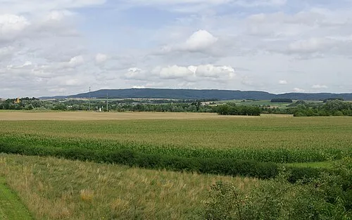
Friesener Warte Janericloebe · CC BY 3.0 -
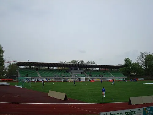
Fuchs-Park-Stadion TWsk · Public domain


Climate of Wernsdorf
Best months for sightseeingBest months for sightseeing: June–August.
This month · November
A cold month
Day 7° · Night 1° · Rain 68 mm
- Hottest month
- August (day 23°)
- Coldest month
- January (night -3°)
- Wettest month
- June (86 mm)
- Driest month
- April (54 mm)
Bars: average monthly low and high temperature. Below: precipitation. Monthly averages for 1970–2000 at about 18 km resolution, adjusted for elevation. Highlighted months are mild and relatively dry. Source: WorldClim 2.1 (CC BY 4.0).
Show values as a table
| Month | Jan | Feb | Mar | Apr | May | Jun | Jul | Aug | Sep | Oct | Nov | Dec |
|---|---|---|---|---|---|---|---|---|---|---|---|---|
| Average high (°C) | 3° | 4° | 9° | 13° | 19° | 21° | 23° | 23° | 19° | 13° | 7° | 4° |
| Average low (°C) | -3° | -3° | 0° | 3° | 8° | 11° | 13° | 12° | 9° | 5° | 1° | -1° |
| Precipitation (mm) | 69 | 57 | 64 | 54 | 63 | 86 | 84 | 62 | 65 | 69 | 68 | 84 |
How to get to Wernsdorf
The nearest airport is Nuremberg Airport (NUE), 40 km to the south as the crow flies. The nearest large city is Erlangen, 30 km to the south.
Airports
- Nuremberg Airport (NUE) Nuremberg 40 kmsouth
- Erfurt-Weimar Airport (ERF) Erfurt 125 kmnorth
- Karlovy Vary Airport (KLV) Karlovy Vary 142 kmeast
Nearby large cities
- Erlangen Population: 102.7K 30 kmsouth
- Fürth Population: 132K 43 kmsouth
- Nuremberg Population: 515.5K 45 kmsouth
- Würzburg Population: 133.7K 76 kmwest
- Regensburg Population: 151.4K 123 kmsoutheast
Straight-line distances; road distances are longer. Airport data: OurAirports.
Day trips from Wernsdorf
Within 100 km: 1,288 historic and cultural sites, 4,328 natural sites, 825 lakes, rivers and coasts.
0–25 km651 places
- Unterer Herrnsee Lake 14 kmSW
- Oberer Herrnsee Lake 14 kmSW
- Kleiner Bischofsweiher Lake 25 kmS
- Haarweiher Lake 14 kmSW
25–60 km2,175 places
- Waldstadion Weismain Landmark 31 kmNE
- Spitzelberg Mountain 46 kmSE
- Stollenberg Mountain 46 kmSE
- Deckersberg Mountain 53 kmSE
60–100 km3,615 places
- Umpfer River 99 kmW
- Uzbach River 70 kmSW
- Zipfelteich Lake 99 kmNE
- Süßenloher Weiher Lake 83 kmE
Straight-line distances.
Nearby attractions & nature
Everything nearby-
Schloß Wernsdorf Historic site, Strullendorf0.1 km NE
-
Friesener Warte Mountain, Hirschaid, Markt3.1 km SE
-
Krechelholz Natural site, Bavaria1.7 km W
-
Ziegenbach River, Bavaria1.5 km W
-
Geisfelder Bach River, Bavaria1.5 km W
-
Lichtholz Natural site, Bavaria1.9 km S
Other cities and towns in Strullendorf
-
 Geisfeld Village, Strullendorf2.5 km N
-
 Zeegendorf Village, Strullendorf4.4 km E
-
Mistendorf Village, Strullendorf3 km NE
Sources & licences
Data last updated: · 2 independent sources