Bestensee
Located in Landkreis Dahme-Spreewald, Brandenburg Coordinates: 52°15′00″ N 13°39′00″ E
- Population
- 9,171
- 9.2K
- Elevation
- 32 m
- above sea level
- Local time
- UTC+01:00
- Europe/Berlin · UTC+01:00
- Places inside
- 6
- listed under Bestensee
- Airports
- BER Berlin Brandenburg Airport16 km
- DRS Dresden Airport124 km
About Bestensee
Bestensee is a village. Location: Landkreis Dahme-Spreewald, Brandenburg. Population: 9,171. Elevation: 32 m. The best months to visit are May–August. The nearest airport is Berlin Brandenburg Airport (16 km). Nearby sights include Glunzer Bach and Todnitz.
Photos of Bestensee
-
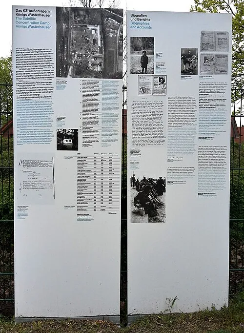
Königs Wusterhausen Concentration Camp Leon Becker · CC0

Climate of Bestensee
Best months for sightseeingBest months for sightseeing: May–August.
This month · November
A cold month
Day 7° · Night 2° · Rain 43 mm
- Hottest month
- July (day 24°)
- Coldest month
- January (night -3°)
- Wettest month
- July (70 mm)
- Driest month
- April (32 mm)
Bars: average monthly low and high temperature. Below: precipitation. Monthly averages for 1970–2000 at about 18 km resolution, adjusted for elevation. Highlighted months are mild and relatively dry. Source: WorldClim 2.1 (CC BY 4.0).
Show values as a table
| Month | Jan | Feb | Mar | Apr | May | Jun | Jul | Aug | Sep | Oct | Nov | Dec |
|---|---|---|---|---|---|---|---|---|---|---|---|---|
| Average high (°C) | 3° | 4° | 8° | 13° | 19° | 22° | 24° | 24° | 19° | 13° | 7° | 4° |
| Average low (°C) | -3° | -3° | 0° | 3° | 8° | 11° | 13° | 13° | 9° | 5° | 2° | -1° |
| Precipitation (mm) | 40 | 34 | 38 | 32 | 52 | 53 | 70 | 59 | 46 | 35 | 43 | 47 |
How to get to Bestensee
The nearest airport is Berlin Brandenburg Airport (BER), 16 km to the northwest as the crow flies. The nearest large city is Berlin, 35 km to the northwest.
Airports
- Berlin Brandenburg Airport (BER) Berlin 16 kmnorthwest
- Dresden Airport (DRS) Dresden 124 kmsouth
- Leipzig/Halle Airport (LEJ) Schkeuditz 134 kmsouthwest
Nearby large cities
- Berlin Population: 3.4M 35 kmnorthwest
- Potsdam Population: 184.8K 43 kmnorthwest
- Dresden Population: 564.9K 134 kmsouth
- Leipzig Population: 505K 134 kmsouthwest
- Magdeburg Population: 244.3K 139 kmwest
Straight-line distances; road distances are longer. Airport data: OurAirports.
Day trips from Bestensee
Within 100 km: 454 historic and cultural sites, 1,526 natural sites, 1,243 lakes, rivers and coasts.
0–25 km272 places
- Dahme River River 23 kmN
- Ziestsee Lake 7 kmE
- Ziestsee Lake 10 kmE
- Zeuthener See Lake 12 kmN
25–60 km1,282 places
- Schlachtensee Lake 36 kmNW
- Valentinswerder Island 45 kmNW
- Scharfenberg Island 45 kmNW
- Freibad Tegelsee Beach 46 kmNW
60–100 km1,669 places
- Lutzke River 74 kmSE
- Strandbad Beach 88 kmN
- Mittelbruch Island 75 kmW
- Buhnenwerder Island 82 kmW
Straight-line distances.
Places in Bestensee
6 placesBar: population relative to the most populous place in this list.
Cities & villages2
- Hintersiedlung · Village
- Kleinbesten · Village
Mountains & nature1
- Pätzer Berg · Mountain
Lakes, rivers & coasts1
- Großer Horst · Island
Nearby attractions & nature
Everything nearby-
Glunzer Bach River, Brandenburg<0.1 km N
-
Todnitz Lake, Brandenburg0.3 km N
-
Seechen Lake, Brandenburg1 km NW
-
Pätzer Vordersee Lake, Brandenburg1.9 km S
-
Weinberg Mountain, Heidesee3.1 km E
-
Zeesener See Lake, Brandenburg2.2 km N
Other cities and towns in Landkreis Dahme-Spreewald

Sources & licences
Data last updated: