Stahnsdorf
Located in Landkreis Potsdam-Mittelmark, Brandenburg Coordinates: 52°21′31″ N 13°11′30″ E
- Population
- 16,087
- 16.1K
- Elevation
- 50 m
- above sea level
- Local time
- UTC+01:00
- Europe/Berlin · UTC+01:00
- Places inside
- 7
- listed under Stahnsdorf
- Airports
- BER Berlin Brandenburg Airport21 km
- LEJ Leipzig/Halle Airport123 km
About Stahnsdorf
Stahnsdorf is a village. Location: Landkreis Potsdam-Mittelmark, Brandenburg. Population: 16,087. Elevation: 50 m. The best months to visit are May–August. The nearest airport is Berlin Brandenburg Airport (21 km). Nearby sights include Parforceheide and Seeberg.
Photos of Stahnsdorf
-
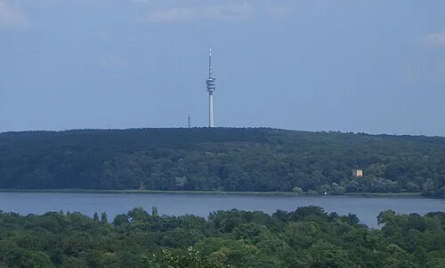
Schäferberg Wladyslaw Sojka · CC BY-SA 3.0 -
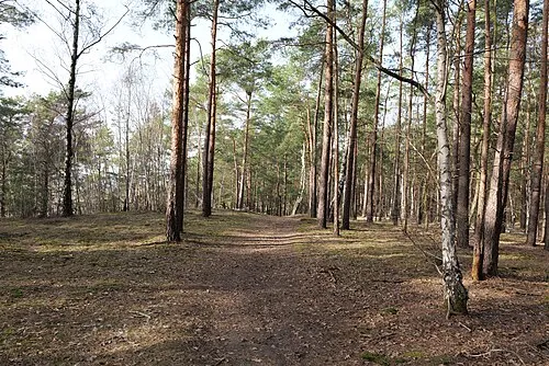
Saarmunder Berg Leonhard Lenz · CC0 -
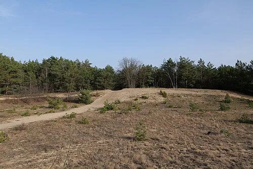
Eichberg Leonhard Lenz · CC0 -
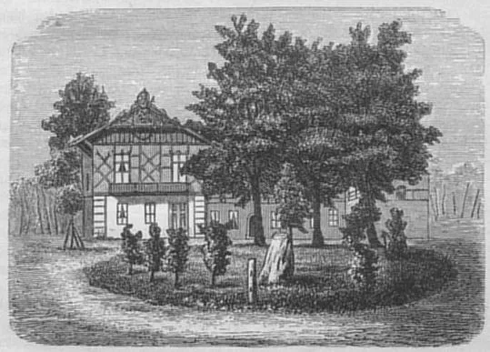
Jagdschloß Dreilinden The original uploader was Lienhard Schulz at German Wikipedia · Public domain


Climate of Stahnsdorf
Best months for sightseeingBest months for sightseeing: May–August.
This month · November
A cold month
Day 7° · Night 2° · Rain 43 mm
- Hottest month
- July (day 24°)
- Coldest month
- January (night -2°)
- Wettest month
- June (64 mm)
- Driest month
- February (35 mm)
Bars: average monthly low and high temperature. Below: precipitation. Monthly averages for 1970–2000 at about 18 km resolution, adjusted for elevation. Highlighted months are mild and relatively dry. Source: WorldClim 2.1 (CC BY 4.0).
Show values as a table
| Month | Jan | Feb | Mar | Apr | May | Jun | Jul | Aug | Sep | Oct | Nov | Dec |
|---|---|---|---|---|---|---|---|---|---|---|---|---|
| Average high (°C) | 3° | 4° | 8° | 13° | 19° | 22° | 24° | 23° | 18° | 13° | 7° | 4° |
| Average low (°C) | -2° | -2° | 1° | 4° | 9° | 12° | 14° | 13° | 9° | 5° | 2° | -1° |
| Precipitation (mm) | 41 | 35 | 40 | 38 | 51 | 64 | 54 | 58 | 43 | 37 | 43 | 54 |
How to get to Stahnsdorf
The nearest airport is Berlin Brandenburg Airport (BER), 21 km to the east as the crow flies. The nearest large city is Potsdam, 10 km to the northwest.
Airports
- Berlin Brandenburg Airport (BER) Berlin 21 kmeast
- Leipzig/Halle Airport (LEJ) Schkeuditz 123 kmsouthwest
- Dresden Airport (DRS) Dresden 142 kmsouth
Nearby large cities
- Potsdam Population: 184.8K 10 kmnorthwest
- Berlin Population: 3.4M 24 kmnortheast
- Magdeburg Population: 244.3K 110 kmwest
- Leipzig Population: 505K 127 kmsouthwest
- Halle Population: 237.9K 128 kmsouthwest
Straight-line distances; road distances are longer. Airport data: OurAirports.
Day trips from Stahnsdorf
Within 100 km: 541 historic and cultural sites, 1,768 natural sites, 1,496 lakes, rivers and coasts.
0–25 km492 places
- Schlachtensee Lake 10 kmN
- Valentinswerder Island 23 kmN
- Scharfenberg Island 24 kmN
- Freibad Tegelsee Beach 25 kmN
25–60 km1,105 places
- Dahme River River 28 kmE
- Mittelbruch Island 42 kmW
- Buhnenwerder Island 49 kmW
- Insel im Bützsee Island 57 kmN
60–100 km2,208 places
- Strandbad Beach 90 kmNE
- Der Raatz Island 78 kmN
- Großer Horst Island 96 kmN
- Wolletzseeinseln Island 88 kmNE
Straight-line distances.
Places in Stahnsdorf
7 placesBar: population relative to the most populous place in this list.
Cities & villages6
- Güterfelde · Village
- Kienwerder · Village
- Kolonie Drewitz · Neighbourhood
- Marggraffshof · Village
- Schenkenhorst · Village
- Sputendorf · Village
Nearby attractions & nature
Everything nearby-
Parforceheide Natural site, Brandenburg2.9 km NW
-
Seeberg Mountain, Kleinmachnow4.9 km N
-
Hirten-Graben River, Brandenburg3.8 km W
-
Mühlenberg Mountain, Teltow4.6 km NE
-
Jahnsberg Mountain, Nuthetal4.7 km S
-
Jagdschloß Dreilinden Historic site, Berlin6.3 km N
Other cities and towns in Landkreis Potsdam-Mittelmark
-
 Nuthetal Village, Landkreis Potsdam-Mittelmark7.9 km SW
-
Michendorf Village, Landkreis Potsdam-Mittelmark13 km SW
-
 Ruhlsdorf Village, Teltow5.1 km E
-
 Dreilinden Village, Kleinmachnow5.1 km N
-
 Bergholz-Rehbrücke Village, Nuthetal6 km W
-
Philippsthal Village, Nuthetal4.4 km SW
Sources & licences
Data last updated: