Marienkirchhofsberg
Located in Angermünde, Landkreis Uckermark Coordinates: 53°06′57″ N 14°00′20″ E
- Elevation
- 18 m
- above sea level
- Airports
- SZZ Solidarity Szczecin–Goleniów Airport79 km
- HDF Heringsdorf Airport85 km
About Marienkirchhofsberg
Marienkirchhofsberg is a mountain. Location: Angermünde, Landkreis Uckermark. Elevation: 18 m. The best months to visit are June–September. The nearest airport is Solidarity Szczecin–Goleniów Airport (79 km). Nearby sights include Hahnenberg and Weinberg.
Climate of Marienkirchhofsberg
Best months for sightseeingBest months for sightseeing: June–September.
This month · November
A cold month
Day 7° · Night 1° · Rain 40 mm
- Hottest month
- August (day 24°)
- Coldest month
- January (night -3°)
- Wettest month
- June (61 mm)
- Driest month
- February (28 mm)
Bars: average monthly low and high temperature. Below: precipitation. Monthly averages for 1970–2000 at about 18 km resolution, adjusted for elevation. Highlighted months are mild and relatively dry. Source: WorldClim 2.1 (CC BY 4.0).
Show values as a table
| Month | Jan | Feb | Mar | Apr | May | Jun | Jul | Aug | Sep | Oct | Nov | Dec |
|---|---|---|---|---|---|---|---|---|---|---|---|---|
| Average high (°C) | 2° | 3° | 8° | 13° | 19° | 21° | 24° | 24° | 19° | 13° | 7° | 4° |
| Average low (°C) | -3° | -2° | 0° | 3° | 7° | 11° | 13° | 12° | 9° | 5° | 1° | -1° |
| Precipitation (mm) | 34 | 28 | 33 | 33 | 51 | 61 | 60 | 57 | 44 | 34 | 40 | 38 |
Other places to visit in this season: June July August September
How to get to Marienkirchhofsberg
The nearest airport is Solidarity Szczecin–Goleniów Airport (SZZ), 79 km to the northeast as the crow flies. The nearest large city is Berlin, 77 km to the southwest.
Airports
- Solidarity Szczecin–Goleniów Airport (SZZ) Szczecin(Glewice) 79 kmnortheast
- Heringsdorf Airport (HDF) Zirchow 85 kmnorth
- Berlin Brandenburg Airport (BER) Berlin 91 kmsouth
Nearby large cities
- Berlin Population: 3.4M 77 kmsouthwest
- Potsdam Population: 184.8K 102 kmsouthwest
- Rostock Population: 198.3K 164 kmnorthwest
- Magdeburg Population: 244.3K 195 kmsouthwest
- Leipzig Population: 505K 227 kmsouthwest
Straight-line distances; road distances are longer. Airport data: OurAirports.
Day trips from Marienkirchhofsberg
Within 100 km: 406 historic and cultural sites, 1,542 natural sites, 1,425 lakes, rivers and coasts.
0–25 km329 places
- Strandbad Beach 11 kmS
- Burgwallinsel Island 12 kmNW
- Wolletzseeinseln Island 13 kmSW
- Herrenwerder Island 25 kmE
25–60 km1,109 places
- Der Raatz Island 50 kmW
- Langes Werder Island 49 kmW
- Fischers Werder Island 49 kmW
- Hohes Werder Island 48 kmW
60–100 km1,935 places
- Usedom Island Island 91 kmN
- Wolin Island 95 kmN
- Schlachtensee Lake 92 kmSW
- Valentinswerder Island 80 kmSW
Straight-line distances.
Nearest towns and villages
-
Biesenbrow Village, Angermünde0.7 km NE
-
Altenhof Village, Angermünde1.5 km N
-
Neu-Günterberg Village, Angermünde3.1 km W
-
Günterberg Village, Angermünde3.5 km SW
-
 Zichow Village, Landkreis Uckermark7.7 km N
-
Leopoldsthal Village, Angermünde3.7 km N
Nearby attractions & nature
Everything nearby-
Hahnenberg Mountain, Angermünde1.2 km NE
-
Weinberg Mountain, Mecklenburg-Vorpommern1.4 km NW
-
Kauelsberg Mountain, Angermünde2.3 km W
-
Papenberg Mountain, Angermünde3.3 km SW
-
Paselberg Mountain, Angermünde3.3 km W
-
Langer Berg Mountain, Zichow3.9 km N
-
Landiner Abzugsgraben River, Brandenburg2.7 km E
-
Fuchsberg Mountain, Mecklenburg-Vorpommern3.7 km NW
More nature in Germany
-
Weinberg Mountain, Angermünde5.9 km NW
-
Tiergarten Natural site, Angermünde7.1 km SW
-
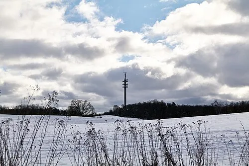 Telegraphenberg Mountain, Angermünde15 km SW
-
Hammelberg Mountain, Angermünde13 km W
-
Naturshutzgebiet Fischteiche Natural site, Angermünde9 km SW
-
Naturerlebnispark Natural site, Angermünde9.3 km S
Sources & licences
Data last updated: