Tarpenbek
Located in Free and Hanseatic City of Hamburg, Germany Coordinates: 53°36′03″ N 9°59′14″ E
- Elevation
- 7 m
- above sea level
- Local time
- UTC+01:00
- Europe/Berlin · UTC+01:00
- Airports
- HAM Hamburg Helmut Schmidt Airport3 km
- LBC Lübeck Blankensee Airport53 km
About Tarpenbek
Tarpenbek is a river. Location: Free and Hanseatic City of Hamburg, Germany. The best months to visit are June–August. The nearest airport is Hamburg Helmut Schmidt Airport (3 km). Nearby sights include Kollau and Stadtpark Hamburg.
Photos of Tarpenbek
-

Bille Reinhard Kraasch · CC BY-SA 4.0 -

German Theater Schauspielhaus Liberaler Humanist · CC BY-SA 3.0 -
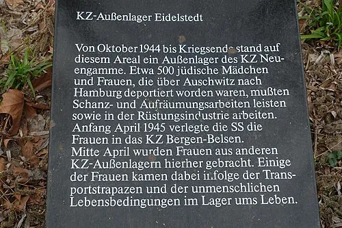
Hamburg-Eidelstedt Concentration Camp selber erstellt · CC BY-SA 4.0 -
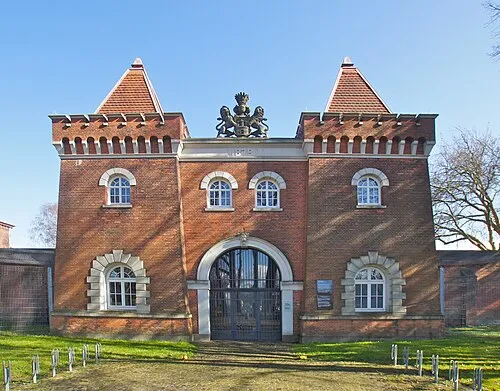
Early Camp Hamburg-Fuhlsbüttel flamenc · CC BY-SA 3.0 -
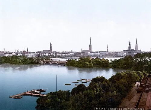
Lombardsbrücke Unknown author Unknown author · Public domain


Climate of Tarpenbek
Best months for sightseeingBest months for sightseeing: June–August.
This month · November
A cold month
Day 8° · Night 3° · Rain 68 mm
- Hottest month
- August (day 22°)
- Coldest month
- January (night -1°)
- Wettest month
- July (73 mm)
- Driest month
- February (43 mm)
Bars: average monthly low and high temperature. Below: precipitation. Monthly averages for 1970–2000 at about 18 km resolution, adjusted for elevation. Highlighted months are mild and relatively dry. Source: WorldClim 2.1 (CC BY 4.0).
Show values as a table
| Month | Jan | Feb | Mar | Apr | May | Jun | Jul | Aug | Sep | Oct | Nov | Dec |
|---|---|---|---|---|---|---|---|---|---|---|---|---|
| Average high (°C) | 4° | 5° | 8° | 12° | 18° | 21° | 22° | 22° | 18° | 13° | 8° | 5° |
| Average low (°C) | -1° | -1° | 1° | 4° | 8° | 11° | 13° | 13° | 10° | 6° | 3° | 0° |
| Precipitation (mm) | 62 | 43 | 60 | 48 | 55 | 72 | 73 | 71 | 68 | 64 | 68 | 73 |
How to get to Tarpenbek
The nearest airport is Hamburg Helmut Schmidt Airport (HAM), 3 km to the north as the crow flies. The nearest large city is Lübeck, 55 km to the northeast.
Airports
- Hamburg Helmut Schmidt Airport (HAM) Hamburg 3 kmnorth
- Lübeck Blankensee Airport (LBC) Lübeck 53 kmnortheast
- Sea-Airport Cuxhaven/Nordholz / Nordholz Naval Airbase (FCN) Wurster Nordseeküste 90 kmwest
Nearby large cities
- Lübeck Population: 212.2K 55 kmnortheast
- Kiel Population: 252.7K 81 kmnorth
- Bremerhaven Population: 118.6K 94 kmwest
- Bremen Population: 546.5K 98 kmsouthwest
- Oldenburg Population: 159.2K 129 kmsouthwest
Straight-line distances; road distances are longer. Airport data: OurAirports.
Day trips from Tarpenbek
Within 100 km: 404 historic and cultural sites, 2,983 natural sites, 1,321 lakes, rivers and coasts.
0–25 km369 places
- Viertbusch Natural site 24 kmSE
- Hanskalbsand Island 21 kmW
- Gurlittinsel Island 5 kmS
- Billerhuder Insel Island 8 kmSE
25–60 km1,557 places
- Aubek River 53 kmN
- Rhinplate Island 43 kmNW
- Pagensand Island 33 kmW
- Kleine Insel Island 59 kmNE
60–100 km2,782 places
- Ziegelwerder Island 99 kmE
- Warnau River 84 kmS
- Spock River 65 kmN
- Hundestrand Beach 70 kmNE
Straight-line distances.
Nearest towns and villages
-
 Eppendorf Neighbourhood, Hamburg0.9 km S
-
Hamburg-Nord Neighbourhood, Hamburg1.3 km S
-
 Groß Borstel Neighbourhood, Hamburg1.5 km N
-
 Winterhude Neighbourhood, Hamburg1.8 km SE
-
 Harvestehude Neighbourhood, Hamburg2.5 km S
-
 Hoheluft-West Neighbourhood, Hamburg2.6 km SW
Nearby attractions & nature
Everything nearby-
Kollau River, Free and Hanseatic City of Hamburg1.5 km W
-
Stadtpark Hamburg Natural site, Hamburg2.1 km E
-
Alster River, Germany2.3 km S
-
Stadtparksee Lake, Hamburg2.7 km E
-
Tierpark Hagenbeck Natural site, Hamburg3.3 km W
-
Niendorfer Gehege Natural site, Hamburg3.8 km W
-
Außenalster Lake, Free and Hanseatic City of Hamburg4.2 km S
-
Early Camp Hamburg-Fuhlsbüttel Historic site, Hamburg3.2 km NE
More lakes, rivers and coasts in Germany
-
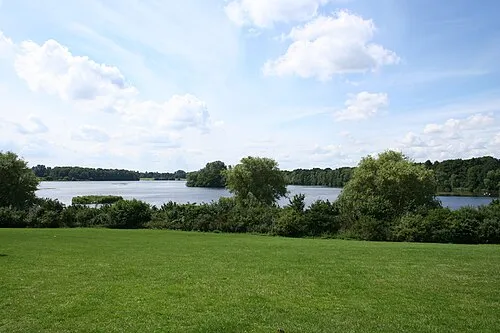 Öjendorfer See Lake, Free and Hanseatic City of Hamburg11 km SE
-
Bille River, Free and Hanseatic City of Hamburg7.2 km S
-
Gurlittinsel Island, Hamburg4.8 km S
-
Binnen-Alster Lake, Free and Hanseatic City of Hamburg5.2 km S
-
Susebek River, Hamburg4.9 km NE
-
Osterbek River, Hamburg5 km E
Sources & licences
Data last updated: