Kreisfreie Stadt Wolfsburg
Local name: Wolfsburg
Located in Lower Saxony, Germany Coordinates: 52°25′25″ N 10°46′33″ E
- Population
- 129,560
- 129.6K
- Elevation
- 65 m
- above sea level
- Local time
- UTC+01:00
- Europe/Berlin · UTC+01:00
- Places inside
- 1
- listed under Kreisfreie Stadt Wolfsburg
- Airports
- HAJ Hannover Airport74 km
- HAM Hamburg Helmut Schmidt Airport144 km
About Kreisfreie Stadt Wolfsburg
Kreisfreie Stadt Wolfsburg is a municipality. Location: Lower Saxony, Germany. Population: 129,560. Elevation: 65 m.
Wolfsburg (German: [ˈvɔlfsbʊʁk] ; Eastphalian: Wulfsborg) is the fifth-largest city in the German state of Lower Saxony. It lies on the river Aller, 75 kilometres (47 mi) east of Hanover and 230 kilometres (143 mi) west of Berlin. Wolfsburg is famous as the location of Volkswagen AG's headquarters and, until it was overtaken by Tesla Gigafactory Texas in 2022, the world's biggest car plant.
Source: Wikipedia · CC BY-SA 4.0
Photos of Kreisfreie Stadt Wolfsburg
-
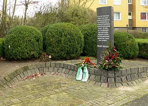
Wolfsburg-Laagberg Concentration Camp Axel Hindemith · CC BY-SA 3.0

Places bordering Kreisfreie Stadt Wolfsburg
- Calberlah
- Danndorf
- Lehre
Twin towns and sister cities of Kreisfreie Stadt Wolfsburg
- Puebla· Mexico
- Toyohashi· Japan
Source: Wikidata. Only places with a page on this site are shown.
Population of Kreisfreie Stadt Wolfsburg over time
| 2011 | 120,889 | |
|---|---|---|
| 2013 | 122,457 | |
| 2015 | 125,550 | |
| 2016 | 125,309 | |
| 2017 | 125,244 | |
| 2018 | 125,408 | |
| 2019 | 125,555 | |
| 2021 | 123,949 | |
| 2022 | 125,961 | |
| 2023 | 127,256 | |
| 2024 | 129,560 | |
| 2025 | 129,813 |
Censuses and official estimates; source: Wikidata.
Climate of Kreisfreie Stadt Wolfsburg
Best months for sightseeingBest months for sightseeing: June–August.
This month · November
A cold month
Day 8° · Night 2° · Rain 49 mm
- Hottest month
- August (day 23°)
- Coldest month
- January (night -2°)
- Wettest month
- June (67 mm)
- Driest month
- February (37 mm)
Bars: average monthly low and high temperature. Below: precipitation. Monthly averages for 1970–2000 at about 18 km resolution, adjusted for elevation. Highlighted months are mild and relatively dry. Source: WorldClim 2.1 (CC BY 4.0).
Show values as a table
| Month | Jan | Feb | Mar | Apr | May | Jun | Jul | Aug | Sep | Oct | Nov | Dec |
|---|---|---|---|---|---|---|---|---|---|---|---|---|
| Average high (°C) | 3° | 4° | 8° | 13° | 18° | 21° | 23° | 23° | 18° | 13° | 8° | 5° |
| Average low (°C) | -2° | -2° | 1° | 3° | 8° | 11° | 13° | 12° | 9° | 6° | 2° | 0° |
| Precipitation (mm) | 47 | 37 | 47 | 43 | 52 | 67 | 59 | 62 | 48 | 44 | 49 | 55 |
How to get to Kreisfreie Stadt Wolfsburg
The nearest airport is Hannover Airport (HAJ), 74 km to the west as the crow flies. The nearest large city is Wolfsburg, 1 km to the southeast.
Airports
- Hannover Airport (HAJ) Hannover 74 kmwest
- Hamburg Helmut Schmidt Airport (HAM) Hamburg 144 kmnorth
- Kassel Airport (KSF) Calden 147 kmsouthwest
Nearby large cities
- Wolfsburg Population: 123.1K 1 kmsoutheast
- Braunschweig Population: 244.7K 24 kmsouthwest
- Salzgitter Population: 105K 39 kmsouthwest
- Magdeburg Population: 244.3K 67 kmsoutheast
- Hanover Population: 515.1K 71 kmwest
Straight-line distances; road distances are longer. Airport data: OurAirports.
Day trips from Kreisfreie Stadt Wolfsburg
Within 100 km: 426 historic and cultural sites, 3,288 natural sites, 769 lakes, rivers and coasts.
0–25 km202 places
- Schapenbruch Teich Lake 21 kmSW
- Kreuzteich Lake 22 kmSW
- Allersee Lake 3 kmE
- Waldsee Lake 18 kmW
25–60 km1,121 places
- Wiehe River 35 kmNW
- Aue River 42 kmS
- Aue River 49 kmS
- Hardausee Lake 55 kmNW
60–100 km3,160 places
- Sundern Natural site 84 kmNW
- Warnau River 93 kmNW
- Schalk River 70 kmS
- Sarre River 63 kmSE
Straight-line distances.
Kreisfreie Stadt Wolfsburg and similar cities
Side by side with cities of similar size in the same country: population, elevation and climate.
| Measure | Kreisfreie Stadt Wolfsburg | Fürth | Würzburg | Wolfsburg |
|---|---|---|---|---|
| Population | 129.6K | 132K | 133.7K | 123.1K |
| Elevation | 65 m | 302 m | 204 m | 65 m |
| Summer day (hottest month) | 23° | 25° | 24° | 23° |
| Winter night (coldest month) | -2° | -3° | -2° | -2° |
| Annual rainfall | 610 mm | 718 mm | 659 mm | 610 mm |
| Best months | Jun–Aug | May–Sep | May–Sep | Jun–Aug |
| Distance | — | 328 km | 298 km | 0 km |
Climate values are 1970–2000 monthly averages; straight-line distance.
Places in Kreisfreie Stadt Wolfsburg
1 placeBar: population relative to the most populous place in this list.
Nearby attractions & nature
Everything nearby-
Wolfsburgermoor Natural site, Lower Saxony3.4 km NE
-
Wipper Aller River, Germany4.9 km E
-
Hohnstedter Holz Natural site, Lower Saxony6.8 km SW
-
Barnsdorfer Wald Natural site, Lower Saxony7 km SE
-
Stahlberg Mountain, Tappenbeck6.2 km NW
-
Hehlinger Holz Natural site, Lower Saxony7.8 km E
-
Blockshornberg Mountain, Weyhausen6.5 km NW
-
Kohlreben Mountain, Königslutter am Elm9.2 km S
Other cities and towns in Lower Saxony
-
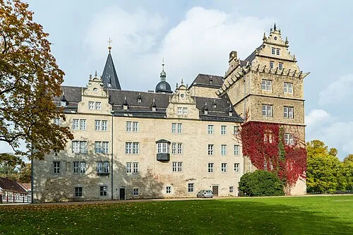 Wolfsburg City, Wolfsburg<0.1 km SE
-
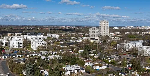 Detmerode Town, Wolfsburg4.3 km SW
-
Helmstedt (district) Municipality, Lower Saxony19 km SE
-
Landkreis Gifhorn Municipality, Lower Saxony21 km NW
-
Kreisfreie Stadt Braunschweig Municipality, Lower Saxony22 km SW
-
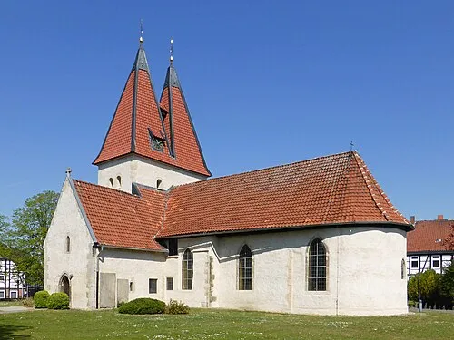 Lehre Town, Lehre13 km SW
Sources & licences
Data last updated: · 2 independent sources