Norder Christian Eberhards Polder
Located in Bunde, Landkreis Leer Coordinates: 53°14′19″ N 7°17′18″ E
- Elevation
- 2 m
- above sea level
- Local time
- UTC+01:00
- Europe/Berlin · UTC+01:00
- Airports
- GRQ Groningen Airport Eelde49 km
- BRE Bremen Airport103 km
About Norder Christian Eberhards Polder
Norder Christian Eberhards Polder is a village. Location: Bunde, Landkreis Leer. Elevation: 2 m. The best months to visit are June–August. The nearest airport is Groningen Airport Eelde (49 km). Nearby sights include Heester Tief and Langes Tief.
Climate of Norder Christian Eberhards Polder
Best months for sightseeingBest months for sightseeing: June–August.
This month · November
A cold month
Day 8° · Night 3° · Rain 77 mm
- Hottest month
- August (day 22°)
- Coldest month
- January (night -1°)
- Wettest month
- November (77 mm)
- Driest month
- February (43 mm)
Bars: average monthly low and high temperature. Below: precipitation. Monthly averages for 1970–2000 at about 18 km resolution, adjusted for elevation. Highlighted months are mild and relatively dry. Source: WorldClim 2.1 (CC BY 4.0).
Show values as a table
| Month | Jan | Feb | Mar | Apr | May | Jun | Jul | Aug | Sep | Oct | Nov | Dec |
|---|---|---|---|---|---|---|---|---|---|---|---|---|
| Average high (°C) | 4° | 5° | 8° | 12° | 17° | 19° | 21° | 22° | 18° | 13° | 8° | 5° |
| Average low (°C) | -1° | -1° | 1° | 3° | 7° | 10° | 12° | 12° | 10° | 6° | 3° | 1° |
| Precipitation (mm) | 65 | 43 | 57 | 43 | 52 | 74 | 76 | 65 | 72 | 68 | 77 | 69 |
How to get to Norder Christian Eberhards Polder
The nearest airport is Groningen Airport Eelde (GRQ), 49 km to the west as the crow flies. The nearest large city is Groningen, 48 km to the west.
Airports
- Groningen Airport Eelde (GRQ) Groningen 49 kmwest
- Bremen Airport (BRE) Bremen 103 kmeast
- Sea-Airport Cuxhaven/Nordholz / Nordholz Naval Airbase (FCN) Wurster Nordseeküste 108 kmnortheast
Nearby large cities
- Groningen Population: 244.8K 48 kmwest
- Oldenburg Population: 159.2K 63 kmeast
- Bremerhaven Population: 118.6K 93 kmnortheast
- Leeuwarden Population: 124.5K 99 kmwest
- Bremen Population: 546.5K 103 kmeast
Straight-line distances; road distances are longer. Airport data: OurAirports.
Day trips from Norder Christian Eberhards Polder
Within 100 km: 133 historic and cultural sites, 673 natural sites, 474 lakes, rivers and coasts.
0–25 km69 places
- Hatzumer Sand Island 9 kmNE
- Wolfmeer Lake 16 kmE
- Uphuser Meer Lake 15 kmN
- Twekmeer Lake 16 kmNE
25–60 km465 places
- East Frisian Islands Island 56 kmN
- Norderney Island 53 kmN
- Borkum Island 55 kmNW
- Baltrum Island 55 kmN
60–100 km746 places
- Insel Spiekeroog Island 65 kmNE
- Strand Harlesiel Beach 63 kmNE
- Friesenstrand Beach 74 kmNE
- Nordstrand Beach 67 kmNE
Straight-line distances.
Nearby attractions & nature
Everything nearby-
Heester Tief River, Lower Saxony1 km SE
-
Langes Tief River, Lower Saxony5 km N
-
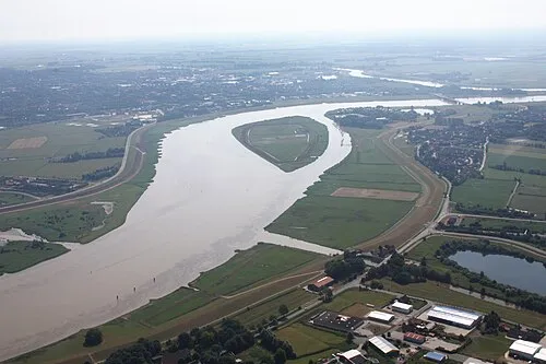 Bingumer Sand Island, Lower Saxony8.7 km E
-
Quertief River, Lower Saxony6.8 km N
-
Naturschutzgebiet Emsauen Natural site, Jemgum8.6 km NE
-
Hatzumer Sand Island, Moormerland8.6 km NE
Other cities and towns in Bunde
-
Landschaftspolder Village, Bunde2.6 km W
-
Heinitzpolder Village, Bunde3.9 km NW
-
Kanalpolder Village, Bunde3.5 km W
-
Ditzumerhammrich Village, Bunde4.4 km N
-
Lüttjeloog Village, Bunde4.4 km SW
-
 Wymeer Village, Bunde12 km S
Sources & licences
Data last updated: