Ludwigslust-Parchim
Located in Mecklenburg-Vorpommern, Germany Coordinates: 53°25′20″ N 11°30′33″ E
- Population
- 208,092
- 208.1K
- Elevation
- 41 m
- above sea level
- Local time
- UTC+01:00
- Europe/Berlin · UTC+01:00
- Places inside
- 142
- listed under Ludwigslust-Parchim
- Airports
- LBC Lübeck Blankensee Airport67 km
- RLG Rostock-Laage Airport75 km
About Ludwigslust-Parchim
Ludwigslust-Parchim is a municipality. Location: Mecklenburg-Vorpommern, Germany. Population: 208,092. Elevation: 41 m. The best months to visit are June–August. The nearest airport is Lübeck Blankensee Airport (67 km). Nearby sights include Tuckhuder Tannen and Alte Stör.
Photos of Ludwigslust-Parchim
-
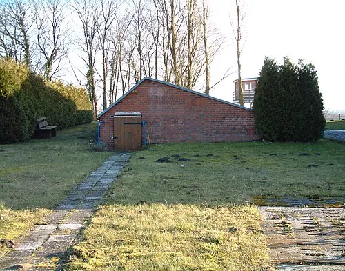
Boizenburg Concentration Camp infestus_969 · CC BY-SA 3.0 de -
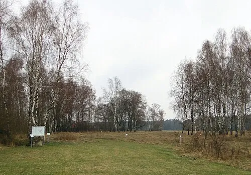
Neustadt-Glewe Concentration Camp Niteshift · CC BY-SA 3.0 -
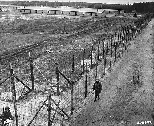
Wöbbelin Concentration Camp Ralph Forney · Public domain


Climate of Ludwigslust-Parchim
Best months for sightseeingBest months for sightseeing: June–August.
This month · November
A cold month
Day 7° · Night 2° · Rain 52 mm
- Hottest month
- July (day 23°)
- Coldest month
- January (night -2°)
- Wettest month
- July (69 mm)
- Driest month
- February (36 mm)
Bars: average monthly low and high temperature. Below: precipitation. Monthly averages for 1970–2000 at about 18 km resolution, adjusted for elevation. Highlighted months are mild and relatively dry. Source: WorldClim 2.1 (CC BY 4.0).
Show values as a table
| Month | Jan | Feb | Mar | Apr | May | Jun | Jul | Aug | Sep | Oct | Nov | Dec |
|---|---|---|---|---|---|---|---|---|---|---|---|---|
| Average high (°C) | 3° | 4° | 8° | 13° | 18° | 21° | 23° | 23° | 18° | 13° | 7° | 4° |
| Average low (°C) | -2° | -2° | 1° | 3° | 8° | 11° | 13° | 12° | 9° | 5° | 2° | -1° |
| Precipitation (mm) | 48 | 36 | 43 | 43 | 50 | 64 | 69 | 59 | 51 | 44 | 52 | 53 |
How to get to Ludwigslust-Parchim
The nearest airport is Lübeck Blankensee Airport (LBC), 67 km to the northwest as the crow flies. For international flights: Hamburg Helmut Schmidt Airport (HAM) (103 km). The nearest large city is Lübeck, 74 km to the northwest.
Airports
- Lübeck Blankensee Airport (LBC) Lübeck 67 kmnorthwest
- Rostock-Laage Airport (RLG) Laage 75 kmnortheast
- Hamburg Helmut Schmidt Airport (HAM) Hamburg 103 kmwest
Nearby large cities
- Lübeck Population: 212.2K 74 kmnorthwest
- Rostock Population: 198.3K 85 kmnortheast
- Wolfsburg Population: 123.1K 122 kmsouthwest
- Kiel Population: 252.7K 135 kmnorthwest
- Magdeburg Population: 244.3K 144 kmsouth
Straight-line distances; road distances are longer. Airport data: OurAirports.
Day trips from Ludwigslust-Parchim
Within 100 km: 324 historic and cultural sites, 3,356 natural sites, 1,248 lakes, rivers and coasts.
0–25 km260 places
- Ziegelwerder Island 22 kmN
- Tannenwerder (Toteninsel) Island 22 kmN
- Schwaneninsel Island 24 kmN
- Wockersee Lake 23 kmE
25–60 km1,571 places
- Köppernitz River 53 kmN
- Lieps Island 37 kmN
- Fischwerder Island 54 kmNW
- Kleiner Werder Island 44 kmNW
60–100 km3,097 places
- Poel Island Island 64 kmN
- Viertbusch Natural site 80 kmW
- Beke River 64 kmNE
- Hundestrand Beach 85 kmNW
Straight-line distances.
Ludwigslust-Parchim and similar cities
Side by side with cities of similar size in the same country: population, elevation and climate.
| Measure | Ludwigslust-Parchim | Lübeck | Hagen | Rostock |
|---|---|---|---|---|
| Population | 208.1K | 212.2K | 199K | 198.3K |
| Elevation | 41 m | 16 m | 111 m | 18 m |
| Summer day (hottest month) | 23° | 22° | 23° | 22° |
| Winter night (coldest month) | -2° | -2° | -1° | -2° |
| Annual rainfall | 612 mm | 674 mm | 980 mm | 596 mm |
| Best months | Jun–Aug | Jun–Aug | Jun–Aug | Jun–Aug |
| Distance | — | 74 km | 358 km | 85 km |
Climate values are 1970–2000 monthly averages; straight-line distance.
Places in Ludwigslust-Parchim
142 places- 61 Prislich 711
- 62 Lübesse 689
- 63 Kuhstorf 686
- 64 Passow 686
- 65 Brahlstorf 679
- 66 Schwanheide 678
- 67 Techentin 658
- 68 Teldau 657
- 69 Kirch Jesar 657
- 70 Warsow 652
- 71 Kogel 643
- 72 Picher 632
- 73 Cambs 619
- 74 Gresse 619
- 75 Karstädt 597
- 76 Ziegendorf 597
- 77 Nostorf 583
- 78 Kloster Tempzin 577
- 79 Barkhagen 572
- 80 Hoort 564
- 81 Gallin 555
- 82 Lüblow 550
- 83 Göhlen 546
- 84 Grebs-Niendorf 538
- 85 Redefin 532
- 86 Bandenitz 531
- 87 Gehlsbach 518
- 88 Karrenzin 516
- 89 Neu Poserin 497
- 90 Brenz 488
- 91 Bengerstorf 482
- 92 Uelitz 482
- 93 Gammelin 481
- 94 Warlow 475
- 95 Langen Brütz 473
- 96 Moraas 470
- 97 Barnin 466
- 98 Warlitz 463
- 99 Kritzow 457
- 100 Dersenow 447
- 101 Besitz 443
- 102 Gorlosen 441
- 103 Witzin 437
- 104 Zapel 436
- 105 Pritzier 436
- 106 Gallin-Kuppentin 431
- 107 Blievenstorf 428
- 108 Borkow 415
- 109 Malk Göhren 414
- 110 Pätow-Steegen 404
- 111 Zierzow 399
- 112 Kobrow 392
- 113 Groß Godems 382
- 114 Blankenberg 379
- 115 Kreien 366
- 116 Tessin b. Boizenburg 364
- 117 Hohen Pritz 362
- 118 Milow 362
- 119 Granzin 360
- 120 Alt Zachun 354
Bar: population relative to the most populous place in this list.
Nearby attractions & nature
Everything nearby-
Tuckhuder Tannen Natural site, Mecklenburg-Vorpommern1.1 km SE
-
Alte Stör River, Mecklenburg-Vorpommern4 km E
-
Rastower Tannenkamp Natural site, Mecklenburg-Vorpommern4.5 km W
-
Bürgerholz Natural site, Mecklenburg-Vorpommern4.6 km S
-
Neustädter See Lake, Mecklenburg-Vorpommern4.9 km SE
-
Drellengraben River, Mecklenburg-Vorpommern5.1 km E
-
Im Hau Natural site, Mecklenburg-Vorpommern5.7 km NE
-
Wildpark Natural site, Mecklenburg-Vorpommern6.6 km W
Sources & licences
Data last updated: