Städteregion Aachen
Located in Cologne District, North Rhine-Westphalia Coordinates: 50°45′14″ N 6°14′31″ E
- Population
- 582,410
- 582.4K
- Elevation
- 208 m
- above sea level
- Local time
- UTC+01:00
- Europe/Berlin · UTC+01:00
- Places inside
- 10
- listed under Städteregion Aachen
- Airports
- MST Maastricht Aachen Airport38 km
- LGG Liège Airport58 km
About Städteregion Aachen
Städteregion Aachen is a municipality. Location: Cologne District, North Rhine-Westphalia. Population: 582,410. Elevation: 208 m. The best months to visit are June–August. The nearest airport is Maastricht Aachen Airport (38 km). Nearby sights include Brander Wald and Münster Wald.
Photos of Städteregion Aachen
-
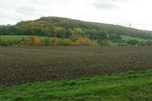
Friedrich Ahoerstemeier · CC BY-SA 4.0

Climate of Städteregion Aachen
Best months for sightseeingBest months for sightseeing: June–August.
This month · November
A cold month
Day 8° · Night 3° · Rain 74 mm
- Hottest month
- August (day 22°)
- Coldest month
- February (night 0°)
- Wettest month
- July (82 mm)
- Driest month
- April (59 mm)
Bars: average monthly low and high temperature. Below: precipitation. Monthly averages for 1970–2000 at about 18 km resolution, adjusted for elevation. Highlighted months are mild and relatively dry. Source: WorldClim 2.1 (CC BY 4.0).
Show values as a table
| Month | Jan | Feb | Mar | Apr | May | Jun | Jul | Aug | Sep | Oct | Nov | Dec |
|---|---|---|---|---|---|---|---|---|---|---|---|---|
| Average high (°C) | 5° | 5° | 9° | 12° | 17° | 20° | 22° | 22° | 18° | 14° | 8° | 6° |
| Average low (°C) | 0° | 0° | 2° | 4° | 8° | 11° | 13° | 13° | 10° | 7° | 3° | 1° |
| Precipitation (mm) | 74 | 72 | 75 | 59 | 71 | 75 | 82 | 75 | 70 | 65 | 74 | 79 |
How to get to Städteregion Aachen
The nearest airport is Maastricht Aachen Airport (MST), 38 km to the northwest as the crow flies. The nearest large city is Aachen, 11 km to the west.
Airports
- Maastricht Aachen Airport (MST) Maastricht 38 kmnorthwest
- Liège Airport (LGG) Grâce-Hollogne 58 kmwest
- Cologne Bonn Airport (CGN) Köln (Cologne) 65 kmeast
Nearby large cities
- Aachen Population: 265.2K 11 kmwest
- Maastricht Population: 122.4K 40 kmwest
- Liège Population: 195.3K 49 kmwest
- Mönchengladbach Population: 261.7K 50 kmnorth
- Cologne Population: 1M 54 kmeast
Straight-line distances; road distances are longer. Airport data: OurAirports.
Day trips from Städteregion Aachen
Within 100 km: 462 historic and cultural sites, 2,071 natural sites, 916 lakes, rivers and coasts.
0–25 km204 places
- Lac d'Eupen Lake 18 kmSW
- Schimperbos Natural site 18 kmW
- Raerener Wald Natural site 14 kmSW
- Preuswald Natural site 16 kmW
25–60 km1,097 places
- Île du Moulin Island 50 kmSW
- Île Monsin Island 44 kmW
- Île de Franche Garenne Island 40 kmW
- Lac de la Gileppe Lake 26 kmSW
60–100 km2,148 places
- Lac de Nisramont Lake 79 kmSW
- Wetsberg Mountain 91 kmNW
- Weefberg Mountain 95 kmW
- Voortberg Mountain 94 kmW
Straight-line distances.
Städteregion Aachen and similar cities
Side by side with cities of similar size in the same country: population, elevation and climate.
| Measure | Städteregion Aachen | Dortmund | Essen | Dresden |
|---|---|---|---|---|
| Population | 582.4K | 588.5K | 593.1K | 564.9K |
| Elevation | 208 m | 96 m | 83 m | 116 m |
| Summer day (hottest month) | 22° | 24° | 23° | 25° |
| Winter night (coldest month) | 0° | -1° | 0° | -2° |
| Annual rainfall | 871 mm | 857 mm | 967 mm | 653 mm |
| Best months | Jun–Aug | Jun–Aug | Jun–Aug | May–Sep |
| Distance | — | 120 km | 95 km | 528 km |
Climate values are 1970–2000 monthly averages; straight-line distance.
Places in Städteregion Aachen
10 places- 1 Aachen 262.7K
- 2 Stolberg (Rhld.) 57.7K
- 3 Eschweiler 57.5K
- 4 Alsdorf 48.8K
- 5 Herzogenrath 48.6K
- 6 Würselen 40.1K
- 7 Baesweiler 29.2K
- 8 Simmerath 16.6K
- 9 Monschau 12.4K
- 10 Roetgen 8.8K
Bar: population relative to the most populous place in this list.
Nearby attractions & nature
Everything nearby-
Brander Wald Natural site, North Rhine-Westphalia3.4 km W
-
Münster Wald Natural site, North Rhine-Westphalia3.7 km S
-
Hasselbach River, North Rhine-Westphalia3.9 km S
-
Eschweiler Wald Natural site, North Rhine-Westphalia4.6 km N
-
Gressenicher Wald Natural site, North Rhine-Westphalia4.7 km E
-
Vichtbach River, North Rhine-Westphalia4.2 km N
-
Forst Wenau Natural site, North Rhine-Westphalia4.7 km SE
-
Saubach River, North Rhine-Westphalia4.9 km NW
Other cities and towns in Cologne District
-
Stolberg Town, Stolberg (Rhld.)2.5 km NW
-
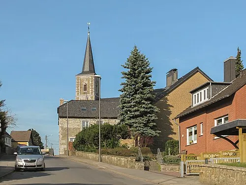 Walheim - Hahn Town, Aachen6.9 km SW
-
Kreis Düren Municipality, Cologne District18 km NE
-
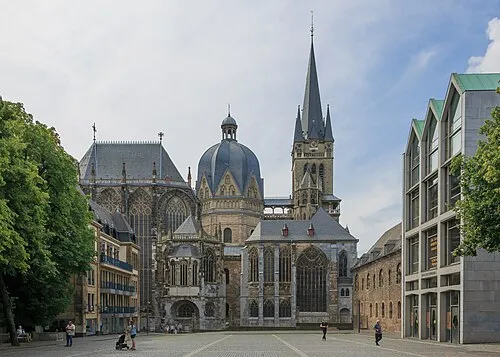 Aachen City, Aachen11 km W
-
Eschweiler Town, Eschweiler7.5 km N
-
Würselen Town, Würselen10 km NW
Sources & licences
Data last updated: