
- Elevation
- 17 m
- above sea level
- Local time
- UTC+01:00
- Europe/Berlin · UTC+01:00
- Airports
- NRN Weeze (Niederrhein) Airport26 km
- EIN Eindhoven Airport67 km
About Schenkenschanz
Schenkenschanz is a village. Location: Kleve, Kreis Kleve. Elevation: 17 m.
Schenkenschanz is a small community in North Rhine-Westphalia, Germany that was incorporated into the town of Kleve (Cleves) in 1969. Schenkenschanz is site of the former Schenkenschans fortress that was of significance in the Dutch Revolt.
Source: Wikipedia · CC BY-SA 4.0
Photos of Schenkenschanz
-

Pieter Delicaat · CC BY-SA 4.0 -

Pieter Delicaat · CC BY-SA 4.0 -

Foto Cramers Kunstanstalt, Dortmund · CC BY 4.0 -
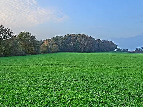
Hingstberg Pieter Delicaat · CC BY-SA 4.0 -
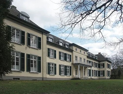
Gnadenthal Sir Gawain · CC BY-SA 3.0


Climate of Schenkenschanz
Best months for sightseeingBest months for sightseeing: June–August.
This month · November
A cold month
Day 9° · Night 3° · Rain 71 mm
- Hottest month
- August (day 23°)
- Coldest month
- February (night 0°)
- Wettest month
- December (77 mm)
- Driest month
- April (45 mm)
Bars: average monthly low and high temperature. Below: precipitation. Monthly averages for 1970–2000 at about 18 km resolution, adjusted for elevation. Highlighted months are mild and relatively dry. Source: WorldClim 2.1 (CC BY 4.0).
Show values as a table
| Month | Jan | Feb | Mar | Apr | May | Jun | Jul | Aug | Sep | Oct | Nov | Dec |
|---|---|---|---|---|---|---|---|---|---|---|---|---|
| Average high (°C) | 5° | 6° | 9° | 13° | 18° | 20° | 23° | 23° | 19° | 14° | 9° | 6° |
| Average low (°C) | 0° | 0° | 2° | 4° | 8° | 11° | 13° | 12° | 10° | 6° | 3° | 1° |
| Precipitation (mm) | 69 | 48 | 66 | 45 | 58 | 70 | 68 | 57 | 70 | 67 | 71 | 77 |
How to get to Schenkenschanz
The nearest airport is Weeze (Niederrhein) Airport (NRN), 26 km to the south as the crow flies. The nearest large city is Nijmegen, 18 km to the west.
Airports
- Weeze (Niederrhein) Airport (NRN) Weeze 26 kmsouth
- Eindhoven Airport (EIN) Eindhoven 67 kmsouthwest
- Düsseldorf Airport (DUS) Düsseldorf 76 kmsoutheast
Nearby large cities
- Nijmegen Population: 177.4K 18 kmwest
- Arnhem Population: 162.4K 21 kmnorthwest
- Apeldoorn Population: 136.7K 43 kmnorth
- Venlo Population: 102K 52 kmsouth
- Moers Population: 103.5K 56 kmsoutheast
Straight-line distances; road distances are longer. Airport data: OurAirports.
Day trips from Schenkenschanz
Within 100 km: 236 historic and cultural sites, 449 natural sites, 300 lakes, rivers and coasts.
0–25 km71 places
- Wijlermeer Lake 11 kmW
- Strang Lake 5 kmE
- Schmales Meer Lake 23 kmE
- Millinger Meer Lake 20 kmE
25–60 km263 places
- Kasteel Arcen Historic site 41 kmS
- Schrolik Lake 55 kmS
- Poelvenn Lake 54 kmS
- Lange Renne Lake 29 kmSE
60–100 km651 places
- Putjensberg Mountain 63 kmN
- Zandbergen Natural site 99 kmSW
- Zeven-Heerlijkhedenheide Natural site 89 kmSW
- Wegmeerheide Natural site 93 kmSW
Straight-line distances.
Nearby attractions & nature
Everything nearby-
Gnadenthal Historic site, Kleve3.3 km S
-
Salmorth Natural site, North Rhine-Westphalia1.6 km E
-
Alter Rhein River, North Rhine-Westphalia1.7 km NW
-
Sternberg Mountain, Kleve4.9 km S
-
Kleverberg Mountain, Kleve5.9 km S
-
Forst Tiergarten Natural site, North Rhine-Westphalia4.5 km S
Other cities and towns in Kleve
-
 Bimmen Village, Kleve3.8 km NW
-
Keeken Village, Kleve2.8 km W
-
Rindern Village, Kleve3 km S
-
Brienen Village, Kleve3 km SE
-
 Donsbrüggen Village, Kleve4.6 km S
-
Griethausen Village, Kleve4.1 km E
Sources & licences
Data last updated: · 2 independent sources