Norder Teich
Located in Regierungsbezirk Detmold, North Rhine-Westphalia Coordinates: 51°53′05″ N 9°01′56″ E
- Elevation
- 153 m
- above sea level
- Local time
- UTC+01:00
- Europe/Berlin · UTC+01:00
- Airports
- PAD Paderborn Lippstadt Airport42 km
- KSF Kassel Airport58 km
About Norder Teich
Norder Teich is a lake. Location: Regierungsbezirk Detmold, North Rhine-Westphalia. Elevation: 153 m. The best months to visit are June–August. The nearest airport is Paderborn Lippstadt Airport (42 km). Nearby sights include Bellen-Berg and Beller Holz.
Photos of Norder Teich
-
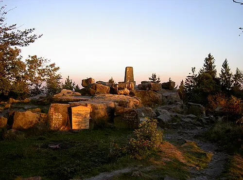
Velmerstot User:Mada · CC BY-SA 2.5 -
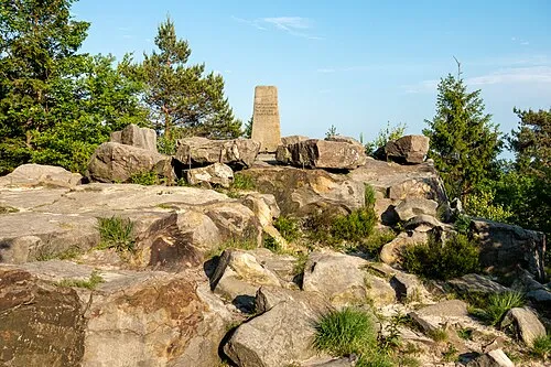
Lippischer Velmerstot Tsungam · CC BY-SA 4.0 -
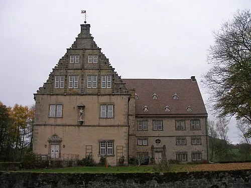
Thienhausen Klaus Graf · CC BY-SA 3.0


Climate of Norder Teich
Best months for sightseeingBest months for sightseeing: June–August.
This month · November
A cold month
Day 8° · Night 3° · Rain 79 mm
- Hottest month
- August (day 22°)
- Coldest month
- January (night -1°)
- Wettest month
- December (94 mm)
- Driest month
- April (57 mm)
Bars: average monthly low and high temperature. Below: precipitation. Monthly averages for 1970–2000 at about 18 km resolution, adjusted for elevation. Highlighted months are mild and relatively dry. Source: WorldClim 2.1 (CC BY 4.0).
Show values as a table
| Month | Jan | Feb | Mar | Apr | May | Jun | Jul | Aug | Sep | Oct | Nov | Dec |
|---|---|---|---|---|---|---|---|---|---|---|---|---|
| Average high (°C) | 4° | 4° | 8° | 12° | 17° | 20° | 22° | 22° | 18° | 13° | 8° | 5° |
| Average low (°C) | -1° | -1° | 1° | 4° | 8° | 10° | 12° | 12° | 10° | 6° | 3° | 0° |
| Precipitation (mm) | 91 | 65 | 77 | 57 | 69 | 78 | 88 | 82 | 79 | 74 | 79 | 94 |
How to get to Norder Teich
The nearest airport is Paderborn Lippstadt Airport (PAD), 42 km to the southwest as the crow flies. The nearest large city is Paderborn, 27 km to the southwest.
Airports
- Paderborn Lippstadt Airport (PAD) Büren 42 kmsouthwest
- Kassel Airport (KSF) Calden 58 kmsoutheast
- Hannover Airport (HAJ) Hannover 78 kmnortheast
Nearby large cities
- Paderborn Population: 142.2K 27 kmsouthwest
- Bielefeld Population: 331.9K 38 kmnorthwest
- Kassel Population: 197.2K 71 kmsoutheast
- Hanover Population: 515.1K 72 kmnortheast
- Göttingen Population: 122.1K 73 kmsoutheast
Straight-line distances; road distances are longer. Airport data: OurAirports.
Day trips from Norder Teich
Within 100 km: 308 historic and cultural sites, 3,817 natural sites, 806 lakes, rivers and coasts.
0–25 km322 places
- Grimke River 24 kmSW
- Ziegenberg Mountain 19 kmSW
- Zedling Mountain 16 kmW
- Zangenberg Mountain 23 kmS
25–60 km1,181 places
- Wande River 52 kmS
- Erpe River 52 kmS
- Ohe River 57 kmNE
- Naure River 41 kmS
60–100 km3,428 places
- Werse River 94 kmW
- Valme River 73 kmSW
- Schalk River 97 kmE
- Ogge River 75 kmS
Straight-line distances.
Nearest towns and villages
-
 Bad Meinberg Neighbourhood, Horn-Bad Meinberg3.6 km W
-
Billerbeck Village, Horn-Bad Meinberg0.7 km SE
-
Horn-Bad Meinberg Village, Kreis Lippe6 km W
-
Ottenhausen Village, Steinheim1.6 km S
-
Steinheim Village, Kreis Höxter6.1 km SE
-
Vahlhausen Village, Horn-Bad Meinberg1.9 km W
Nearby attractions & nature
Everything nearby-
Bellen-Berg Mountain, Horn-Bad Meinberg2.1 km SW
-
Beller Holz Natural site, North Rhine-Westphalia2 km NW
-
Staumberg Mountain, Steinheim2.4 km SE
-
Ottenhausen Blockhouse Historic site, Steinheim1.4 km S
-
Niederbeller Bach River, Regierungsbezirk Detmold2.5 km NE
-
Olkers Mountain, Horn-Bad Meinberg4.6 km SW
-
Sammtholz Natural site, North Rhine-Westphalia4.5 km SW
-
Hahnenberg Mountain, Steinheim5.8 km E
Sources & licences
Data last updated: