Werre
Located in Regierungsbezirk Detmold, North Rhine-Westphalia Coordinates: 52°13′07″ N 8°49′11″ E
- Elevation
- 48 m
- above sea level
- Local time
- UTC+01:00
- Europe/Berlin · UTC+01:00
- Airports
- HAJ Hannover Airport65 km
- PAD Paderborn Lippstadt Airport69 km
About Werre
Werre is a river. Location: Regierungsbezirk Detmold, North Rhine-Westphalia. The best months to visit are June–August. The nearest airport is Hannover Airport (65 km). Nearby sights include Kaarbach and Dützerberg.
Photos of Werre
-
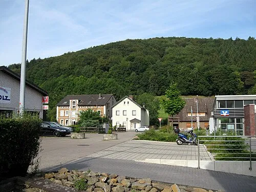
Klusberg Gwexter · Public domain -
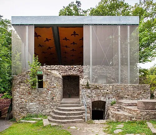
Burg Vlotho Grugerio · CC BY-SA 3.0


Climate of Werre
Best months for sightseeingBest months for sightseeing: June–August.
This month · November
A cold month
Day 8° · Night 3° · Rain 63 mm
- Hottest month
- August (day 23°)
- Coldest month
- February (night -1°)
- Wettest month
- June (78 mm)
- Driest month
- February (50 mm)
Bars: average monthly low and high temperature. Below: precipitation. Monthly averages for 1970–2000 at about 18 km resolution, adjusted for elevation. Highlighted months are mild and relatively dry. Source: WorldClim 2.1 (CC BY 4.0).
Show values as a table
| Month | Jan | Feb | Mar | Apr | May | Jun | Jul | Aug | Sep | Oct | Nov | Dec |
|---|---|---|---|---|---|---|---|---|---|---|---|---|
| Average high (°C) | 4° | 5° | 9° | 13° | 18° | 21° | 23° | 23° | 18° | 14° | 8° | 5° |
| Average low (°C) | 0° | -1° | 2° | 4° | 8° | 11° | 13° | 13° | 10° | 6° | 3° | 1° |
| Precipitation (mm) | 68 | 50 | 63 | 50 | 60 | 78 | 67 | 68 | 69 | 62 | 63 | 76 |
How to get to Werre
The nearest airport is Hannover Airport (HAJ), 65 km to the northeast as the crow flies. The nearest large city is Bielefeld, 28 km to the southwest.
Airports
- Hannover Airport (HAJ) Hannover 65 kmnortheast
- Paderborn Lippstadt Airport (PAD) Büren 69 kmsouth
- Münster Osnabrück Airport (FMO) Greven 78 kmwest
Nearby large cities
- Bielefeld Population: 331.9K 28 kmsouthwest
- Osnabrück Population: 166.5K 53 kmwest
- Paderborn Population: 142.2K 56 kmsouth
- Hanover Population: 515.1K 65 kmeast
- Münster Population: 308.3K 87 kmwest
Straight-line distances; road distances are longer. Airport data: OurAirports.
Day trips from Werre
Within 100 km: 276 historic and cultural sites, 2,634 natural sites, 818 lakes, rivers and coasts.
0–25 km144 places
- Bergsee Oberlübbe Lake 10 kmNW
- Hartigsee Lake 19 kmS
- Windheimer See Lake 24 kmNE
- Wein-Berg Mountain 14 kmE
25–60 km1,076 places
- Grimke River 50 kmS
- Badeinsel Island 46 kmNE
- Lake Steinhude Lake 45 kmNE
- Rothenküler Teich Lake 48 kmNE
60–100 km2,508 places
- Sundern Natural site 90 kmNE
- Warnau River 92 kmNE
- Wande River 92 kmS
- Erpe River 91 kmS
Straight-line distances.
Nearest towns and villages
-
Bad Oeynhausen Town, Bad Oeynhausen1.7 km SW
-
Bad Oeynhausen Village, Kreis Minden-Lübbecke3.1 km S
-
Rehme Village, Bad Oeynhausen0.8 km SE
-
Hahnenkamp Village, Bad Oeynhausen0.6 km NE
-
Eidinghausen Village, Bad Oeynhausen1.6 km W
-
Dörgen Village, Bad Oeynhausen1.2 km W
Nearby attractions & nature
Everything nearby-
Kaarbach River, North Rhine-Westphalia2.5 km W
-
Dützerberg Mountain, Bad Oeynhausen4.1 km NE
-
Eidinghauser Berg Mountain, Bad Oeynhausen4.1 km N
-
Lutternsche Egge Mountain, Bad Oeynhausen4.4 km N
-
Huxhöhe Mountain, Porta Westfalica6 km E
-
Häverstädter Berg Mountain, Minden5.1 km NE
-
Klusberg Mountain, Vlotho7.2 km S
-
Wittekinds Berg Mountain, Porta Westfalica6.2 km NE
Sources & licences
Data last updated: