Beckum
Located in Kreis Warendorf, Regierungsbezirk Münster Coordinates: 51°45′23″ N 8°01′04″ E

- Population
- 37,133
- 37.1K
- Elevation
- 105 m
- above sea level
- Local time
- UTC+01:00
- Europe/Berlin · UTC+01:00
- Places inside
- 22
- listed under Beckum
- Airports
- DTM Dortmund Airport39 km
- PAD Paderborn Lippstadt Airport44 km
About Beckum
Beckum is a village. Location: Kreis Warendorf, Regierungsbezirk Münster. Population: 37,133. Elevation: 105 m.
Beckum (German pronunciation: [ˈbɛkʊm] ; Westphalian: Biäkem) is a town in the northern part of North Rhine-Westphalia, Germany. It is about 20 km (12 miles) north-east of Hamm and 35 km (22 miles) south-east of Münster. It gives its name to the nearby Beckum Hills.
Source: Wikipedia · CC BY-SA 4.0
Photos of Beckum
-

Alf van Beem · CC0 -

NordNordWest · CC BY-SA 3.0 de -

NordNordWest · CC BY-SA 3.0 de -

GeorgDerReisende · CC BY-SA 4.0 -

Nussret · CC BY-SA 3.0


Population of Beckum over time
| 1975 | 38,374 | |
|---|---|---|
| 2011 | 36,101 | |
| 2014 | 36,135 | |
| 2015 | 36,560 | |
| 2017 | 36,689 | |
| 2019 | 36,646 | |
| 2021 | 36,737 | |
| 2022 | 37,333 | |
| 2023 | 37,452 | |
| 2024 | 37,133 | |
| 2025 | 37,110 |
Censuses and official estimates; source: Wikidata.
Climate of Beckum
Best months for sightseeingBest months for sightseeing: June–September.
This month · November
A cold month
Day 9° · Night 3° · Rain 66 mm
- Hottest month
- July (day 23°)
- Coldest month
- February (night -1°)
- Wettest month
- August (92 mm)
- Driest month
- April (37 mm)
Bars: average monthly low and high temperature. Below: precipitation. Monthly averages for 1970–2000 at about 18 km resolution, adjusted for elevation. Highlighted months are mild and relatively dry. Source: WorldClim 2.1 (CC BY 4.0).
Show values as a table
| Month | Jan | Feb | Mar | Apr | May | Jun | Jul | Aug | Sep | Oct | Nov | Dec |
|---|---|---|---|---|---|---|---|---|---|---|---|---|
| Average high (°C) | 5° | 6° | 9° | 13° | 18° | 21° | 23° | 23° | 18° | 14° | 9° | 6° |
| Average low (°C) | -1° | -1° | 1° | 3° | 8° | 10° | 12° | 12° | 9° | 6° | 3° | 1° |
| Precipitation (mm) | 62 | 50 | 52 | 37 | 67 | 66 | 89 | 92 | 56 | 55 | 66 | 68 |
Other places to visit in this season: June July August September
How to get to Beckum
The nearest airport is Dortmund Airport (DTM), 39 km to the southwest as the crow flies. The nearest large city is Hamm, 16 km to the southwest.
Airports
- Dortmund Airport (DTM) Dortmund 39 kmsouthwest
- Paderborn Lippstadt Airport (PAD) Büren 44 kmeast
- Münster Osnabrück Airport (FMO) Greven 48 kmnorthwest
Nearby large cities
- Hamm Population: 179K 16 kmsouthwest
- Münster Population: 308.3K 35 kmnorthwest
- Dortmund Population: 588.5K 47 kmsouthwest
- Bielefeld Population: 331.9K 47 kmnortheast
- Paderborn Population: 142.2K 51 kmeast
Straight-line distances; road distances are longer. Airport data: OurAirports.
Day trips from Beckum
Within 100 km: 265 historic and cultural sites, 2,868 natural sites, 796 lakes, rivers and coasts.
0–25 km106 places
- Ahse River 15 kmSW
- Alte Ahse Lake 16 kmSW
- Rhynerberg Mountain 18 kmSW
- Kurricker Berg Mountain 18 kmW
25–60 km1,099 places
- Else River 48 kmSW
- Else River 60 kmS
- Werse River 39 kmNW
- Valme River 51 kmSE
60–100 km2,724 places
- Wande River 85 kmSE
- Erpe River 85 kmSE
- Weibe River 98 kmS
- Ogge River 77 kmSE
Straight-line distances.
Places in Beckum
22 placesBar: population relative to the most populous place in this list.
Cities & villages16
- Dalmer · Village
- Dünninghausen · Village
- Elker · Village
- Geißler · Village
- Hesseler · Village
- Hinteler · Village
- Höckelmer · Village
- Holter · Village
- Holtmar · Village
- Neubeckum · Village
- Roland · Village
- Unterberg Eins · Village
- Unterberg Zwei · Village
- Vellern · Village
- Werl · Village
- Werse · Village
Mountains & nature4
- Brunsberg · Mountain
- Flimmerberg · Mountain
- Höxberg · Mountain
- Onkhausberg · Mountain
Heritage & sights1
- Fernmeldeturm Beckum · Landmark
Nearby attractions & nature
Everything nearby-
Machenberg Mountain, Oelde7.5 km E
-
Beckumer Berge Mountain, North Rhine-Westphalia6.6 km SE
-
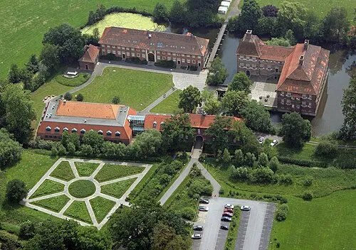 Schloß Oberwerries Historic site, Hamm11 km SW
-
Diestedder Berg Mountain, Wadersloh9.1 km E
-
Frölicher Bach River, North Rhine-Westphalia6.9 km S
-
Göttfrieger Bach River, North Rhine-Westphalia7 km S
Other cities and towns in Kreis Warendorf
-
 Vorhelm Village, Ahlen7.5 km NW
-
 Dolberg Village, Ahlen8.6 km SW
-
 Sünninghausen Village, Oelde9.3 km E
-
 Enniger Village, Ennigerloh9.6 km NW
Sources & licences
Data last updated: · 2 independent sources