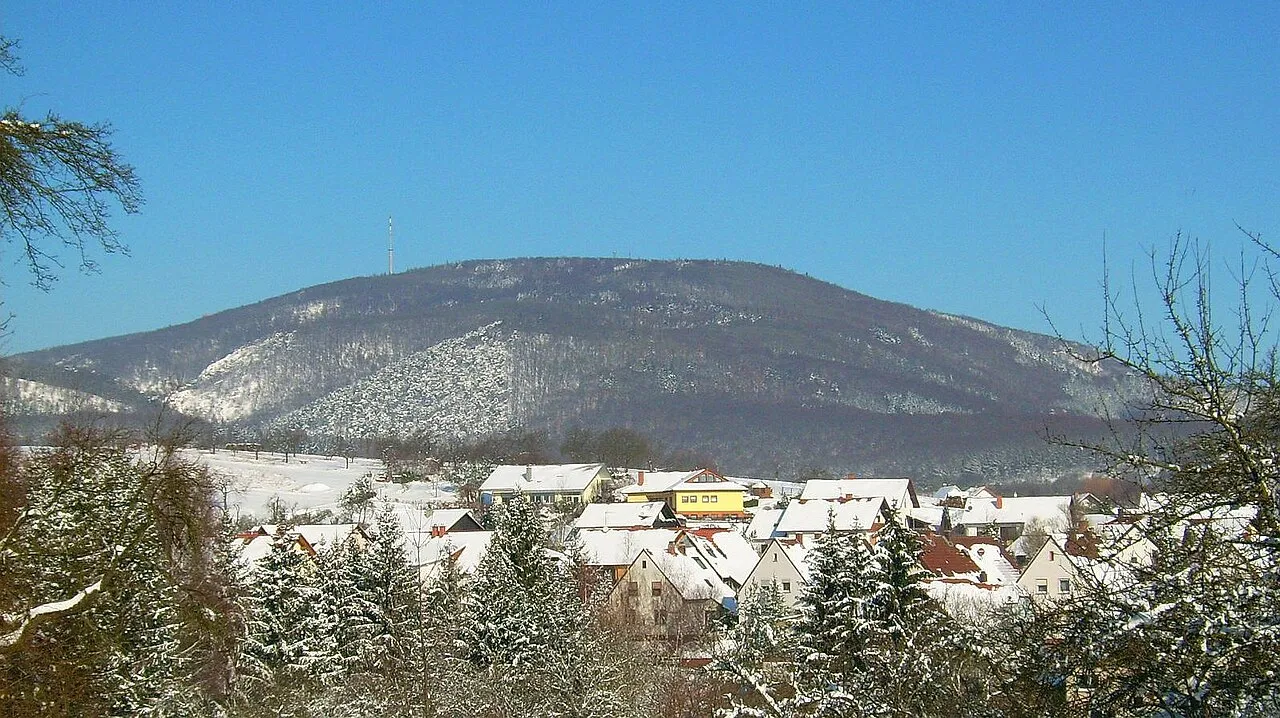
- Elevation
- 687 m
- above sea level
- Local time
- UTC+01:00
- Europe/Berlin · UTC+01:00
- Airports
- MHG Mannheim-City Airport47 km
- HHN Frankfurt-Hahn Airport59 km
About Donnersberg
Donnersberg is a mountain. Location: Dannenfels, Donnersbergkreis. Elevation: 687 m.
The Donnersberg (German pronunciation: [ˈdɔnɐsbɛʁk] ; literally: "thunder mountain") is the highest peak of the Palatinate (German: Pfalz) region of Germany. The mountain lies between the towns of Rockenhausen and Kirchheimbolanden, in the Donnersbergkreis district, which is named after the mountain. The highway A63 runs along the southern edge of the Donnersberg. European walking route E8 runs across the mountain.
Source: Wikipedia · CC BY-SA 4.0
Photos of Donnersberg
-

Mr. Bob Dalton · CC BY-SA 4.0 -

Unknown author Unknown author · CC BY-SA 3.0 de -

Serius · CC BY-SA 3.0 -

Kreuzschnabel · CC BY-SA 3.0 -

Danny Steaven · CC BY 1.0


Climate of Donnersberg
Best months for sightseeingBest months for sightseeing: June–August.
This month · November
A cold month
Day 5° · Night -1° · Rain 54 mm
- Hottest month
- August (day 21°)
- Coldest month
- January (night -4°)
- Wettest month
- May (64 mm)
- Driest month
- February (43 mm)
Bars: average monthly low and high temperature. Below: precipitation. Monthly averages for 1970–2000 at about 18 km resolution, adjusted for elevation. Highlighted months are mild and relatively dry. Source: WorldClim 2.1 (CC BY 4.0).
Show values as a table
| Month | Jan | Feb | Mar | Apr | May | Jun | Jul | Aug | Sep | Oct | Nov | Dec |
|---|---|---|---|---|---|---|---|---|---|---|---|---|
| Average high (°C) | 1° | 2° | 6° | 10° | 15° | 18° | 21° | 21° | 16° | 10° | 5° | 2° |
| Average low (°C) | -4° | -4° | -1° | 1° | 6° | 9° | 11° | 10° | 7° | 3° | -1° | -3° |
| Precipitation (mm) | 44 | 43 | 44 | 44 | 64 | 61 | 64 | 51 | 50 | 55 | 54 | 58 |
How to get to Donnersberg
The nearest airport is Mannheim-City Airport (MHG), 47 km to the east as the crow flies. For international flights: Frankfurt-Hahn Airport (HHN) (59 km). The nearest large city is Ludwigshafen am Rhein, 42 km to the east.
Airports
- Mannheim-City Airport (MHG) Mannheim 47 kmeast
- Frankfurt-Hahn Airport (HHN) Frankfurt am Main (Lautzenhausen) 59 kmnorthwest
- Frankfurt Main Airport (FRA) Frankfurt am Main 64 kmnortheast
Nearby large cities
- Ludwigshafen am Rhein Population: 163.2K 42 kmeast
- Mannheim Population: 308K 43 kmeast
- Mainz Population: 222.9K 48 kmnortheast
- Wiesbaden Population: 288.8K 56 kmnortheast
- Darmstadt Population: 167K 60 kmnortheast
Straight-line distances; road distances are longer. Airport data: OurAirports.
Day trips from Donnersberg
Within 100 km: 941 historic and cultural sites, 3,765 natural sites, 809 lakes, rivers and coasts.
0–25 km336 places
- Zuckerberg Mountain 19 kmN
- Zimmerberg Mountain 18 kmSE
- Ziegelsberg Mountain 25 kmW
- Zeller Berg Mountain 17 kmE
25–60 km1,855 places
- Modau River 45 kmNE
- Rüdesheimer Aue Island 39 kmN
- Petersaue Island 51 kmNE
- Mariannenaue Island 45 kmN
60–100 km3,324 places
- Elsenz River 69 kmE
- Aar River 83 kmN
- Hatzenporter Werth Island 76 kmNW
- Neckarinsel Island 61 kmSE
Straight-line distances.
Nearest towns and villages
-
Dannenfels Village, Dannenfels2.1 km E
-
 Jakobsweiler Village, Donnersbergkreis2.7 km E
-
 Ruppertsecken Village, Donnersbergkreis3.6 km NW
-
 Steinbach am Donnersberg Village, Donnersbergkreis3.8 km SE
-
Jakobsweiler Village, Jakobsweiler2.7 km E
-
 Imsbach Village, Donnersbergkreis5.2 km SW
Nearby attractions & nature
Everything nearby-
Gebrannter Berg Mountain, Dannenfels0.9 km W
-
Signal Mountain, Dannenfels1.2 km E
-
Hühnerberg Mountain, Rockenhausen1.4 km S
-
Kübelberg Mountain, Rockenhausen2.2 km SW
-
Eichelberg Mountain, Kirchheimbolanden2.1 km N
-
Dorntreiberkopf Mountain, Imsbach2.7 km SW
-
Sendeturm Donnersberg Landmark, Dannenfels0.7 km E
-
Reipoltskircher Berg Mountain, Börrstadt2.5 km S
Sources & licences
Data last updated: · 2 independent sources