- Elevation
- 424 m
- above sea level
- Local time
- UTC+01:00
- Europe/Berlin · UTC+01:00
- Airports
- CGN Cologne Bonn Airport54 km
- HHN Frankfurt-Hahn Airport55 km
About Warte
Warte is a mountain. Location: Leimbach, Landkreis Ahrweiler. Elevation: 424 m. The best months to visit are June–August. The nearest airport is Cologne Bonn Airport (54 km). Nearby sights include Hüstert and Hardt.
Photos of Warte
-
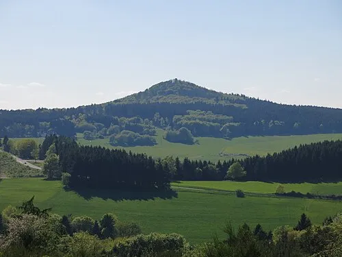
Hohe Acht Jörg Braukmann · CC BY-SA 3.0 -
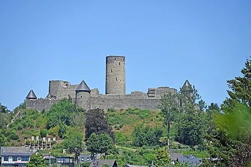
Nürburg Thomas Hummel · CC BY-SA 4.0


Climate of Warte
Best months for sightseeingBest months for sightseeing: June–August.
This month · November
A cold month
Day 7° · Night 2° · Rain 78 mm
- Hottest month
- July (day 21°)
- Coldest month
- February (night -2°)
- Wettest month
- December (86 mm)
- Driest month
- April (59 mm)
Bars: average monthly low and high temperature. Below: precipitation. Monthly averages for 1970–2000 at about 18 km resolution, adjusted for elevation. Highlighted months are mild and relatively dry. Source: WorldClim 2.1 (CC BY 4.0).
Show values as a table
| Month | Jan | Feb | Mar | Apr | May | Jun | Jul | Aug | Sep | Oct | Nov | Dec |
|---|---|---|---|---|---|---|---|---|---|---|---|---|
| Average high (°C) | 3° | 4° | 8° | 11° | 16° | 19° | 21° | 21° | 17° | 12° | 7° | 4° |
| Average low (°C) | -2° | -2° | 1° | 3° | 7° | 10° | 12° | 11° | 9° | 5° | 2° | -1° |
| Precipitation (mm) | 78 | 64 | 75 | 59 | 68 | 72 | 74 | 62 | 70 | 69 | 78 | 86 |
How to get to Warte
The nearest airport is Cologne Bonn Airport (CGN), 54 km to the north as the crow flies. The nearest large city is Bonn, 39 km to the north.
Airports
- Cologne Bonn Airport (CGN) Köln (Cologne) 54 kmnorth
- Frankfurt-Hahn Airport (HHN) Frankfurt am Main (Lautzenhausen) 55 kmsoutheast
- Luxembourg-Findel International Airport (LUX) Luxembourg 100 kmsouthwest
Nearby large cities
- Bonn Population: 330.6K 39 kmnorth
- Koblenz Population: 107.3K 47 kmeast
- Cologne Population: 1M 60 kmnorth
- Bergisch Gladbach Population: 106.2K 67 kmnorth
- Leverkusen Population: 162.7K 71 kmnorth
Straight-line distances; road distances are longer. Airport data: OurAirports.
Day trips from Warte
Within 100 km: 599 historic and cultural sites, 3,038 natural sites, 875 lakes, rivers and coasts.
0–25 km607 places
- Laacher See Lake 24 kmE
- Talsperre Steinbach Lake 23 kmN
- Rodder Maar Lake 20 kmNE
- König-See Lake 19 kmNE
25–60 km1,572 places
- Lac de Robertville Lake 57 kmW
- Steinkopf Mountain 58 kmW
- Schartenknopf Mountain 39 kmW
- Roderhöhe Mountain 48 kmW
60–100 km2,333 places
- Île du Moulin Island 96 kmW
- Île Monsin Island 96 kmW
- Île de Franche Garenne Island 94 kmW
- Lac de la Gileppe Lake 70 kmW
Straight-line distances.
Nearest towns and villages
Nearby attractions & nature
Everything nearby-
Hüstert Mountain, Adenau1.2 km SW
-
Hardt Mountain, Leimbach1.3 km NE
-
Kirchberg Mountain, Adenau0.9 km S
-
Hohn Mountain, Leimbach1.6 km N
-
Staufskopf Mountain, Leimbach1.9 km E
-
Mittelhardt Mountain, Adenau2.3 km E
-
Alte Burg Mountain, Reifferscheid2.5 km W
-
Hohe Rott Mountain, Leimbach3.2 km NE
Sources & licences
Data last updated: · 2 independent sources