Morbach
Located in Landkreis Bernkastel-Wittlich, Rhineland-Palatinate Coordinates: 49°49′15″ N 7°06′00″ E
- Population
- 10,542
- 10.5K
- Elevation
- 450 m
- above sea level
- Local time
- UTC+01:00
- Europe/Berlin · UTC+01:00
- Places inside
- 28
- listed under Morbach
- Airports
- HHN Frankfurt-Hahn Airport18 km
- SCN Saarbrücken Airport67 km
About Morbach
Morbach is a village. Location: Landkreis Bernkastel-Wittlich, Rhineland-Palatinate. Population: 10,542. Elevation: 450 m. The best months to visit are June–August. The nearest airport is Frankfurt-Hahn Airport (18 km). Nearby sights include Haardtkopf and Sensweiler Höhe.
Photos of Morbach
-
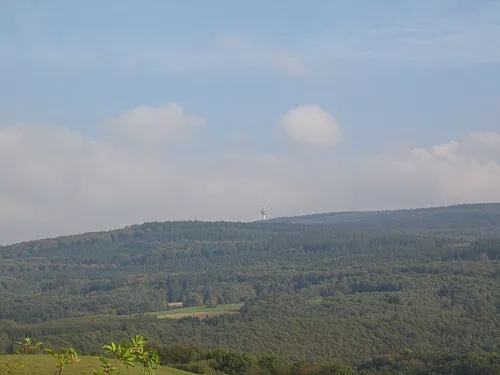
Kahlheid Mabol! · CC BY-SA 3.0

Climate of Morbach
Best months for sightseeingBest months for sightseeing: June–August.
This month · November
A cold month
Day 6° · Night 1° · Rain 98 mm
- Hottest month
- July (day 21°)
- Coldest month
- February (night -2°)
- Wettest month
- December (114 mm)
- Driest month
- August (68 mm)
Bars: average monthly low and high temperature. Below: precipitation. Monthly averages for 1970–2000 at about 18 km resolution, adjusted for elevation. Highlighted months are mild and relatively dry. Source: WorldClim 2.1 (CC BY 4.0).
Show values as a table
| Month | Jan | Feb | Mar | Apr | May | Jun | Jul | Aug | Sep | Oct | Nov | Dec |
|---|---|---|---|---|---|---|---|---|---|---|---|---|
| Average high (°C) | 2° | 3° | 7° | 11° | 16° | 19° | 21° | 21° | 17° | 12° | 6° | 3° |
| Average low (°C) | -2° | -2° | 0° | 3° | 7° | 10° | 12° | 12° | 9° | 5° | 1° | -1° |
| Precipitation (mm) | 98 | 80 | 88 | 70 | 83 | 84 | 78 | 68 | 79 | 94 | 98 | 114 |
How to get to Morbach
The nearest airport is Frankfurt-Hahn Airport (HHN), 18 km to the northeast as the crow flies. The nearest large city is Trier, 34 km to the west.
Airports
- Frankfurt-Hahn Airport (HHN) Frankfurt am Main (Lautzenhausen) 18 kmnortheast
- Saarbrücken Airport (SCN) Saarbrücken 67 kmsouth
- Luxembourg-Findel International Airport (LUX) Luxembourg 68 kmwest
Nearby large cities
- Trier Population: 100.1K 34 kmwest
- Saarbrücken Population: 183K 66 kmsouth
- Koblenz Population: 107.3K 68 kmnortheast
- Mainz Population: 222.9K 87 kmeast
- Wiesbaden Population: 288.8K 87 kmeast
Straight-line distances; road distances are longer. Airport data: OurAirports.
Day trips from Morbach
Within 100 km: 571 historic and cultural sites, 3,581 natural sites, 824 lakes, rivers and coasts.
0–25 km242 places
- Talsperre Nonnweiler Lake 24 kmS
- Steinbachtalsperre Lake 10 kmSE
- Usarkopf Mountain 5 kmSE
- Steinkopf Mountain 14 kmSW
25–60 km1,558 places
- Sauer River 43 kmW
- Our River 58 kmW
- Hatzenporter Werth Island 50 kmNE
- Weinfelder Maar Lake 43 kmNW
60–100 km3,176 places
- Lac de Robertville Lake 99 kmNW
- Montagne de Stockem Mountain 98 kmW
- Steinkopf Mountain 78 kmNW
- Steiner Berg Mountain 89 kmNW
Straight-line distances.
Places in Morbach
28 placesBar: population relative to the most populous place in this list.
Cities & villages22
- Bischofsdhron · Village
- Dörrwiese · Village
- Elzerath · Village
- Gonzerath · Village
- Götzenfeld · Village
- Gutenthal · Village
- Haag · Village
- Heinzerath · Village
- Hinzerath · Village
- Hoxel · Village
- Hundheim · Village
- Hunolstein · Village
- Merscheid · Village
- Morscheid-Riedenburg · Village
- Odert · Village
- Rapperath · Village
- Riedenburg · Village
- Sankt Kuno · Village
- Wederath · Village
- Weiperath · Village
- Wenigerath · Village
- Wolzburg · Village
Mountains & nature3
- Hellenberg · Mountain
- Kahlheid · Mountain
- Steingerüttelkopf · Mountain
Heritage & sights2
- Burg Baldenau · Historic site
- Fernmeldeturm Allenbach · Landmark
Nearby attractions & nature
Everything nearby-
Haardtkopf Mountain, Veldenz4.2 km NW
-
Sensweiler Höhe Mountain, Langweiler5.1 km SE
-
Sendemast Haardtkopf Landmark, Gornhausen4.3 km NW
-
Ranzenkopf Mountain, Wintrich5.4 km W
-
Wahlholz Natural site, Rhineland-Palatinate4.7 km NW
-
Usarkopf Mountain, Wirschweiler5.1 km SE
Sources & licences
Data last updated: