Landkreis Bernkastel-Wittlich
Located in Rhineland-Palatinate, Germany Coordinates: 49°56′35″ N 6°58′51″ E
- Population
- 113,187
- 113.2K
- Elevation
- 337 m
- above sea level
- Local time
- UTC+01:00
- Europe/Berlin · UTC+01:00
- Places inside
- 107
- listed under Landkreis Bernkastel-Wittlich
- Airports
- HHN Frankfurt-Hahn Airport20 km
- LUX Luxembourg-Findel International Airport66 km
About Landkreis Bernkastel-Wittlich
Landkreis Bernkastel-Wittlich is a municipality. Location: Rhineland-Palatinate, Germany. Population: 113,187. Elevation: 337 m. The best months to visit are June–August. The nearest airport is Frankfurt-Hahn Airport (20 km). Nearby sights include Oestelbach and Bieber Bach.
Photos of Landkreis Bernkastel-Wittlich
-
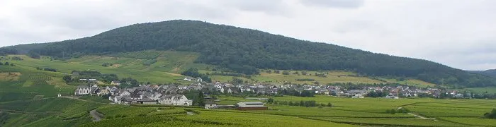
Monzeler Hüttenkopf user:Dkvtig_wc · CC BY 3.0 -
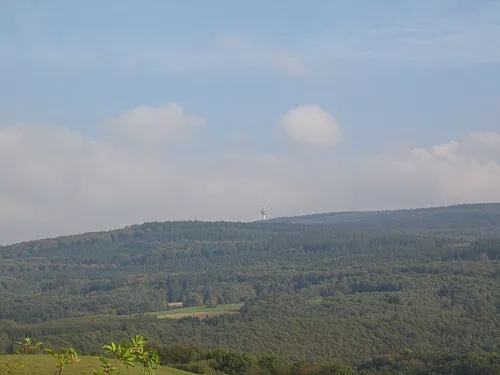
Kahlheid Mabol! · CC BY-SA 3.0


Climate of Landkreis Bernkastel-Wittlich
Best months for sightseeingBest months for sightseeing: June–August.
This month · November
A cold month
Day 7° · Night 2° · Rain 70 mm
- Hottest month
- July (day 23°)
- Coldest month
- February (night -2°)
- Wettest month
- December (79 mm)
- Driest month
- April (53 mm)
Bars: average monthly low and high temperature. Below: precipitation. Monthly averages for 1970–2000 at about 18 km resolution, adjusted for elevation. Highlighted months are mild and relatively dry. Source: WorldClim 2.1 (CC BY 4.0).
Show values as a table
| Month | Jan | Feb | Mar | Apr | May | Jun | Jul | Aug | Sep | Oct | Nov | Dec |
|---|---|---|---|---|---|---|---|---|---|---|---|---|
| Average high (°C) | 3° | 5° | 9° | 13° | 18° | 20° | 23° | 23° | 18° | 13° | 7° | 4° |
| Average low (°C) | -1° | -2° | 1° | 3° | 7° | 10° | 12° | 12° | 9° | 5° | 2° | 0° |
| Precipitation (mm) | 68 | 56 | 61 | 53 | 66 | 70 | 69 | 58 | 64 | 69 | 70 | 79 |
How to get to Landkreis Bernkastel-Wittlich
The nearest airport is Frankfurt-Hahn Airport (HHN), 20 km to the east as the crow flies. The nearest large city is Trier, 32 km to the southwest.
Airports
- Frankfurt-Hahn Airport (HHN) Frankfurt am Main (Lautzenhausen) 20 kmeast
- Luxembourg-Findel International Airport (LUX) Luxembourg 66 kmsouthwest
- Saarbrücken Airport (SCN) Saarbrücken 82 kmsouth
Nearby large cities
- Trier Population: 100.1K 32 kmsouthwest
- Koblenz Population: 107.3K 63 kmnortheast
- Saarbrücken Population: 183K 79 kmsouth
- Bonn Population: 330.6K 88 kmnorth
- Wiesbaden Population: 288.8K 92 kmeast
Straight-line distances; road distances are longer. Airport data: OurAirports.
Day trips from Landkreis Bernkastel-Wittlich
Within 100 km: 529 historic and cultural sites, 3,380 natural sites, 840 lakes, rivers and coasts.
0–25 km215 places
- Pulvermaar Lake 21 kmN
- Meerfelder Maar Lake 24 kmNW
- Zoonenberg Mountain 24 kmSW
- Usarkopf Mountain 21 kmSE
25–60 km1,704 places
- Schartenknopf Mountain 60 kmNW
- Sauer River 41 kmSW
- Our River 49 kmW
- Hatzenporter Werth Island 44 kmNE
60–100 km2,830 places
- Lac d'Eupen Lake 98 kmNW
- Lac de Nisramont Lake 97 kmW
- Lac de Robertville Lake 83 kmNW
- Mont de la Tour de Coo Mountain 94 kmNW
Straight-line distances.
Landkreis Bernkastel-Wittlich and similar cities
Side by side with cities of similar size in the same country: population, elevation and climate.
| Measure | Landkreis Bernkastel-Wittlich | Reutlingen | Remscheid | Bremerhaven |
|---|---|---|---|---|
| Population | 113.2K | 112.6K | 117.1K | 118.6K |
| Elevation | 337 m | 374 m | 351 m | 2 m |
| Summer day (hottest month) | 23° | 23° | 21° | 21° |
| Winter night (coldest month) | -2° | -2° | -2° | 0° |
| Annual rainfall | 783 mm | 906 mm | 1,153 mm | 726 mm |
| Best months | Jun–Aug | Jun–Sep | Jun–Aug | Jun–Aug |
| Distance | — | 229 km | 138 km | 417 km |
Climate values are 1970–2000 monthly averages; straight-line distance.
Places in Landkreis Bernkastel-Wittlich
107 places- 61 Flußbach 430
- 62 Esch 422
- 63 Eckfeld 377
- 64 Gladbach 370
- 65 Arenrath 364
- 66 Wallscheid 362
- 67 Burg (Mosel) 351
- 68 Meerfeld 351
- 69 Eisenschmitt 336
- 70 Kesten 332
- 71 Breit 325
- 72 Greimerath 284
- 73 Kommen 282
- 74 Oberöfflingen 282
- 75 Deuselbach 275
- 76 Niederscheidweiler 266
- 77 Hilscheid 261
- 78 Hochscheid 254
- 79 Talling 245
- 80 Pantenburg 244
- 81 Schönberg 234
- 82 Gipperath 231
- 83 Starkenburg 214
- 84 Büdlich 209
- 85 Karl 205
- 86 Gornhausen 197
- 87 Oberscheidweiler 183
- 88 Heidweiler 170
- 89 Dierscheid 164
- 90 Neunkirchen 163
- 91 Schladt 154
- 92 Immert 150
- 93 Heckenmünster 139
- 94 Gielert 132
- 95 Dhronecken 130
- 96 Burtscheid 115
- 97 Lückenburg 101
- 98 Dodenburg 95
- 99 Gräfendhron 95
- 100 Diefenbach 92
- 101 Etgert 66
- 102 Schwarzenborn 59
- 103 Merschbach 58
- 104 Rorodt 55
- 105 Willwerscheid 54
- 106 Musweiler 45
- 107 Dierfeld 15
Bar: population relative to the most populous place in this list.
Nearby attractions & nature
Everything nearby-
Oestelbach River, Rhineland-Palatinate1.3 km S
-
Bieber Bach River, Rhineland-Palatinate2.2 km NW
-
Lieser Bach River, Rhineland-Palatinate3.6 km SE
-
Frohnbach River, Rhineland-Palatinate3.7 km SE
-
Veldenzer Bach River, Rhineland-Palatinate3.7 km SE
-
Sterenbach River, Rhineland-Palatinate4.8 km NW
-
Mundwald Natural site, Rhineland-Palatinate6.9 km W
-
Mosel Berge Mountain, Rhineland-Palatinate11 km SW
Sources & licences
Data last updated: