- Elevation
- 314 m
- above sea level
- Local time
- UTC+01:00
- Europe/Berlin · UTC+01:00
- Airports
- SCN Saarbrücken Airport23 km
- FKB Karlsruhe Baden-Baden Airport70 km
About Truppacher Höhe
Truppacher Höhe is a mountain. Location: Contwig, Südwestpfalz. Elevation: 314 m. The best months to visit are June–August. The nearest airport is Saarbrücken Airport (23 km). Nearby sights include Gestütter Höhe and Scheid.
Climate of Truppacher Höhe
Best months for sightseeingBest months for sightseeing: June–August.
This month · November
A cold month
Day 7° · Night 1° · Rain 85 mm
- Hottest month
- July (day 23°)
- Coldest month
- February (night -2°)
- Wettest month
- December (98 mm)
- Driest month
- April (58 mm)
Bars: average monthly low and high temperature. Below: precipitation. Monthly averages for 1970–2000 at about 18 km resolution, adjusted for elevation. Highlighted months are mild and relatively dry. Source: WorldClim 2.1 (CC BY 4.0).
Show values as a table
| Month | Jan | Feb | Mar | Apr | May | Jun | Jul | Aug | Sep | Oct | Nov | Dec |
|---|---|---|---|---|---|---|---|---|---|---|---|---|
| Average high (°C) | 4° | 5° | 9° | 13° | 18° | 21° | 23° | 23° | 19° | 13° | 7° | 5° |
| Average low (°C) | -2° | -2° | 0° | 3° | 7° | 10° | 12° | 11° | 8° | 5° | 1° | -1° |
| Precipitation (mm) | 75 | 70 | 68 | 58 | 77 | 76 | 73 | 59 | 67 | 81 | 85 | 98 |
How to get to Truppacher Höhe
The nearest airport is Saarbrücken Airport (SCN), 23 km to the west as the crow flies. For international flights: Karlsruhe Baden-Baden Airport (FKB) (70 km). The nearest large city is Saarbrücken, 30 km to the west.
Airports
- Saarbrücken Airport (SCN) Saarbrücken 23 kmwest
- Karlsruhe Baden-Baden Airport (FKB) Rheinmünster 70 kmsoutheast
- Strasbourg Airport (SXB) Strasbourg 79 kmsouth
Nearby large cities
- Saarbrücken Population: 183K 30 kmwest
- Karlsruhe Population: 283.8K 76 kmeast
- Strasbourg Population: 274.8K 76 kmsouth
- Ludwigshafen am Rhein Population: 163.2K 80 kmeast
- Trier Population: 100.1K 81 kmnorthwest
Straight-line distances; road distances are longer. Airport data: OurAirports.
Day trips from Truppacher Höhe
Within 100 km: 643 historic and cultural sites, 2,698 natural sites, 657 lakes, rivers and coasts.
0–25 km338 places
- Ziegelberg Mountain 21 kmN
- Wasserstein Mountain 23 kmNE
- Steinhübel Mountain 18 kmNE
- Schwobacher Berg Mountain 11 kmN
25–60 km1,551 places
- Gelterswoog Lake 27 kmNE
- Talsperre Nonnweiler Lake 53 kmNW
- Bostalsee Lake 45 kmNW
- Ottweiler Wingertsweier Lake 26 kmNW
60–100 km2,109 places
- Sauer River 86 kmNW
- Syre River 85 kmNW
- Unditz River 94 kmS
- Rench River 74 kmSE
Straight-line distances.
Nearest towns and villages
-
Contwig Town, Contwig2.1 km NE
-
 Stambach Village, Contwig2.9 km NE
-
Kreisfreie Stadt Zweibrücken Municipality, Rhineland-Palatinate3.9 km NW
-
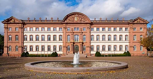 Zweibrücken Town, Zweibrücken3.8 km W
-
Zweibrücken Village, Kreisfreie Stadt Zweibrücken4.3 km NW
-
Offweilerhof Village, Contwig1.6 km SE
Nearby attractions & nature
Everything nearby-
Gestütter Höhe Mountain, Contwig1.4 km E
-
Scheid Mountain, Zweibrücken3.3 km N
-
Scheelwieser Kopf Mountain, Contwig4.4 km NE
-
Pottschütthöhe Mountain, Contwig4.6 km NE
-
Auerbach River, Rhineland-Palatinate2.9 km NW
-
Hellbach River, Rhineland-Palatinate3.1 km NW
-
Himmelsberg Mountain, Zweibrücken5.6 km N
-
Felsalbe River, Rhineland-Palatinate3.5 km S
Sources & licences
Data last updated: · 2 independent sources