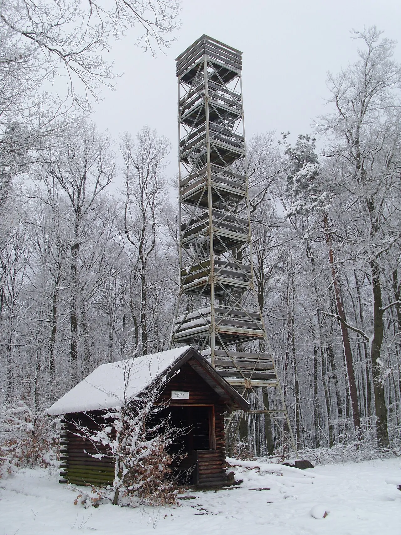
- Elevation
- 513 m
- above sea level
- Local time
- UTC+01:00
- Europe/Berlin · UTC+01:00
- Airports
- FKB Karlsruhe Baden-Baden Airport45 km
- SCN Saarbrücken Airport48 km
About Großer Eyberg
Großer Eyberg is a mountain. Location: Dahn, Südwestpfalz. Elevation: 513 m.
The Großer Eyberg is a 513-metre-high (1,683 ft) hill in the southern Palatine Forest in Germany. It lies in the county of Südwestpfalz in the borough of Dahn in an area known as the Dahner Felsenland, a part of the Wasgau. This region which comprises the southern part of the Palatine Forest and the northern part of the Vosges Mountains. It is the highest hill in the western Wasgau.
Source: Wikipedia · CC BY-SA 4.0
Photos of Großer Eyberg
-

Lindelkopf Palatinatian · CC BY 3.0 -
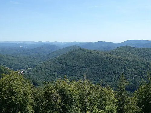
Kappelstein Steffen 962 · CC BY-SA 4.0 -
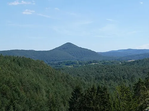
Jüngstberg Steffen 962 · CC BY-SA 4.0 -
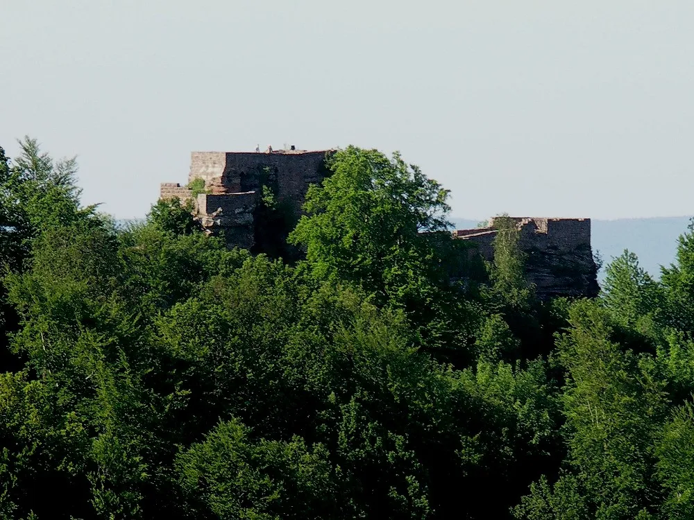
Wegelnburg The original uploader was Dokape at German Wikipedia · CC BY-SA 3.0


Climate of Großer Eyberg
Best months for sightseeingBest months for sightseeing: June–August.
This month · November
A cold month
Day 6° · Night 0° · Rain 77 mm
- Hottest month
- July (day 21°)
- Coldest month
- February (night -3°)
- Wettest month
- December (85 mm)
- Driest month
- April (58 mm)
Bars: average monthly low and high temperature. Below: precipitation. Monthly averages for 1970–2000 at about 18 km resolution, adjusted for elevation. Highlighted months are mild and relatively dry. Source: WorldClim 2.1 (CC BY 4.0).
Show values as a table
| Month | Jan | Feb | Mar | Apr | May | Jun | Jul | Aug | Sep | Oct | Nov | Dec |
|---|---|---|---|---|---|---|---|---|---|---|---|---|
| Average high (°C) | 2° | 4° | 8° | 12° | 16° | 19° | 21° | 21° | 17° | 12° | 6° | 3° |
| Average low (°C) | -3° | -3° | 0° | 2° | 6° | 9° | 11° | 10° | 8° | 4° | 0° | -2° |
| Precipitation (mm) | 65 | 63 | 63 | 58 | 82 | 83 | 74 | 60 | 67 | 78 | 77 | 85 |
How to get to Großer Eyberg
The nearest airport is Karlsruhe Baden-Baden Airport (FKB), 45 km to the southeast as the crow flies. The nearest large city is Karlsruhe, 49 km to the east.
Airports
- Karlsruhe Baden-Baden Airport (FKB) Rheinmünster 45 kmsoutheast
- Saarbrücken Airport (SCN) Saarbrücken 48 kmwest
- Strasbourg Airport (SXB) Strasbourg 66 kmsouth
Nearby large cities
- Karlsruhe Population: 283.8K 49 kmeast
- Saarbrücken Population: 183K 55 kmwest
- Strasbourg Population: 274.8K 60 kmsouth
- Ludwigshafen am Rhein Population: 163.2K 64 kmnortheast
- Mannheim Population: 308K 66 kmnortheast
Straight-line distances; road distances are longer. Airport data: OurAirports.
Day trips from Großer Eyberg
Within 100 km: 679 historic and cultural sites, 3,337 natural sites, 694 lakes, rivers and coasts.
0–25 km587 places
- Zwieselkopf Mountain 17 kmNE
- Zündelsberg Mountain 7 kmS
- Zuckerberg Mountain 21 kmE
- Zöllerberg Mountain 5 kmSE
25–60 km1,211 places
- Rench River 52 kmS
- Insel Flotzgrün Island 53 kmE
- Gelterswoog Lake 30 kmN
- Altrhein Kleiner Bodensee Lake 44 kmE
60–100 km2,912 places
- Unditz River 76 kmS
- Elsenz River 82 kmE
- Modau River 93 kmNE
- Rüdesheimer Aue Island 96 kmN
Straight-line distances.
Nearest towns and villages
-
Dahn Village, Dahn3.6 km NE
-
Bruchweiler-Bärenbach Village, Bruchweiler-Bärenbach3.7 km E
-
Bruchweiler-Bärenbach Village, Südwestpfalz3.7 km E
-
Fischbach bei Dahn Village, Südwestpfalz4.7 km SW
-
Rumbach Village, Südwestpfalz4.1 km SE
-
Rumbach Village, Rumbach4.1 km SE
Nearby attractions & nature
Everything nearby-
Dretschberger Kopf Mountain, Dahn1 km S
-
Großes Taubeneck Mountain, Dahn0.9 km NW
-
Kleiner Eyberg Mountain, Dahn1.2 km NE
-
Kleiner Deckenberg Mountain, Dahn1.5 km SW
-
Dörrntalberg Mountain, Bruchweiler-Bärenbach2.5 km S
-
Kaletschkopf Mountain, Dahn2.5 km NW
-
Kleiner Mückenkopf Mountain, Dahn2.6 km W
-
Großer Mückenkopf Mountain, Fischbach bei Dahn3 km W
Sources & licences
Data last updated: · 2 independent sources