
- Elevation
- 250 m
- above sea level
- Local time
- UTC+01:00
- Europe/Berlin · UTC+01:00
- Airports
- SCN Saarbrücken Airport28 km
- LUX Luxembourg-Findel International Airport58 km
About Thalexweiler
Thalexweiler is a village. Location: Lebach, Landkreis Saarlouis. Elevation: 250 m.
Thalexweiler is a very small village in the southwest German province of Saarland. The next big city is Lebach. The main part of the village has been founded in 1235 but some parts are a little bit older. The church of the village has been first mentioned in historical documents in the 9th century. The village has approximately 2100 inhabitants which live on an area of 541 ha.
Source: Wikipedia · CC BY-SA 4.0
At a glance
- Area
- 5.4 km²
Source: Wikidata
Photos of Thalexweiler
-
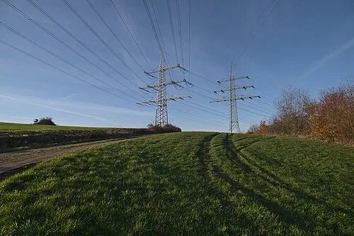
Wünschberg Flocci Nivis · CC BY 4.0 -
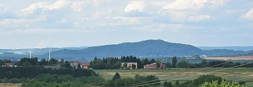
Schaumberg LoKiLeCh · CC BY-SA 3.0


Climate of Thalexweiler
Best months for sightseeingBest months for sightseeing: June–August.
This month · November
A cold month
Day 7° · Night 2° · Rain 98 mm
- Hottest month
- July (day 23°)
- Coldest month
- January (night -1°)
- Wettest month
- December (113 mm)
- Driest month
- August (64 mm)
Bars: average monthly low and high temperature. Below: precipitation. Monthly averages for 1970–2000 at about 18 km resolution, adjusted for elevation. Highlighted months are mild and relatively dry. Source: WorldClim 2.1 (CC BY 4.0).
Show values as a table
| Month | Jan | Feb | Mar | Apr | May | Jun | Jul | Aug | Sep | Oct | Nov | Dec |
|---|---|---|---|---|---|---|---|---|---|---|---|---|
| Average high (°C) | 4° | 5° | 9° | 13° | 18° | 21° | 23° | 23° | 19° | 13° | 7° | 5° |
| Average low (°C) | -1° | -1° | 1° | 3° | 8° | 10° | 12° | 12° | 9° | 6° | 2° | 0° |
| Precipitation (mm) | 94 | 80 | 82 | 66 | 81 | 81 | 79 | 64 | 75 | 91 | 98 | 113 |
How to get to Thalexweiler
The nearest airport is Saarbrücken Airport (SCN), 28 km to the south as the crow flies. For international flights: Luxembourg-Findel International Airport (LUX) (58 km). The nearest large city is Saarbrücken, 24 km to the south.
Airports
- Saarbrücken Airport (SCN) Saarbrücken 28 kmsouth
- Luxembourg-Findel International Airport (LUX) Luxembourg 58 kmwest
- Frankfurt-Hahn Airport (HHN) Frankfurt am Main (Lautzenhausen) 60 kmnorth
Nearby large cities
- Saarbrücken Population: 183K 24 kmsouth
- Trier Population: 100.1K 42 kmnorthwest
- Metz Population: 123.9K 68 kmsouthwest
- Nancy Population: 105.1K 102 kmsouthwest
- Ludwigshafen am Rhein Population: 163.2K 108 kmeast
Straight-line distances; road distances are longer. Airport data: OurAirports.
Day trips from Thalexweiler
Within 100 km: 390 historic and cultural sites, 2,683 natural sites, 608 lakes, rivers and coasts.
0–25 km366 places
- Talsperre Nonnweiler Lake 20 kmN
- Bostalsee Lake 15 kmNE
- Ottweiler Wingertsweier Lake 16 kmE
- Bomberg Mountain 11 kmE
25–60 km932 places
- Sauer River 45 kmNW
- Gelterswoog Lake 53 kmE
- Steinbachtalsperre Lake 41 kmNE
- Zoonenberg Mountain 49 kmNW
60–100 km2,383 places
- Montagne de Stockem Mountain 92 kmW
- Bois de Willancourt Natural site 93 kmW
- Weid Busch Natural site 95 kmW
- Bois de Vance Natural site 96 kmW
Straight-line distances.
Nearby attractions & nature
Everything nearby-
Mehlberg Mountain, Lebach1.1 km NW
-
Heinzenberg Mountain, Lebach1.5 km E
-
Donnerhübel Mountain, Lebach2.1 km NW
-
Klapperberg Mountain, Lebach2.2 km NW
-
Steinberg Mountain, Lebach2.2 km W
-
Lindenberg Mountain, Lebach2.5 km NW
Sources & licences
Data last updated: · 2 independent sources