Neunkirchen
Located in Nohfelden, Landkreis Sankt Wendel Coordinates: 49°33′03″ N 7°03′31″ E
- Elevation
- 423 m
- above sea level
- Local time
- UTC+01:00
- Europe/Berlin · UTC+01:00
- Airports
- SCN Saarbrücken Airport38 km
- HHN Frankfurt-Hahn Airport46 km
About Neunkirchen
Neunkirchen is a village. Location: Nohfelden, Landkreis Sankt Wendel. Elevation: 423 m.
Neunkirchen is a village of the municipality of Nohfelden in Saarland, Germany, near the source of the River Nahe. To distinguish it from other places of the same name, it is sometimes called "Neunkirchen (Nahe)". Until the end of 1973, Neunkirchen was a municipality in its own right. It includes the small settlements of Elsenberger Mühle (or Amtsschultheissenmühle) and Nohmühle.
Source: Wikipedia · CC BY-SA 4.0
At a glance
- Area
- 8.6 km²
Source: Wikidata
Photos of Neunkirchen
-
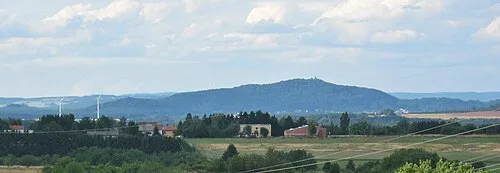
Schaumberg LoKiLeCh · CC BY-SA 3.0 -
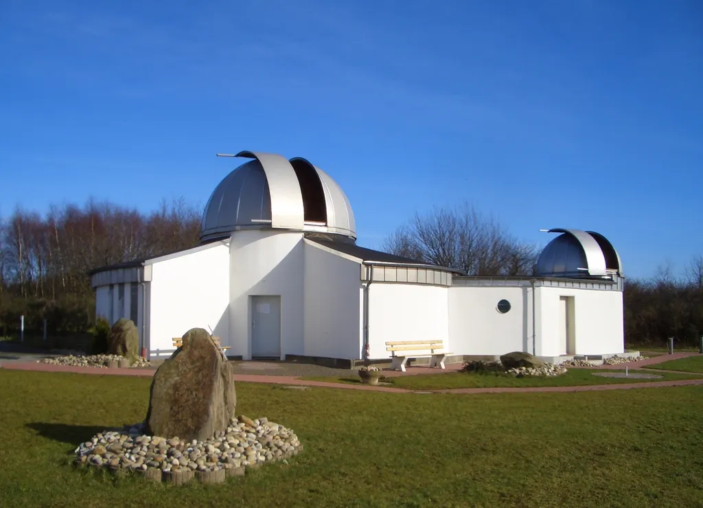
Peterberg Observatory Philippe Grand-Montagne · CC BY 2.5


Climate of Neunkirchen
Best months for sightseeingBest months for sightseeing: June–August.
This month · November
A cold month
Day 6° · Night 1° · Rain 97 mm
- Hottest month
- July (day 22°)
- Coldest month
- February (night -3°)
- Wettest month
- December (112 mm)
- Driest month
- August (65 mm)
Bars: average monthly low and high temperature. Below: precipitation. Monthly averages for 1970–2000 at about 18 km resolution, adjusted for elevation. Highlighted months are mild and relatively dry. Source: WorldClim 2.1 (CC BY 4.0).
Show values as a table
| Month | Jan | Feb | Mar | Apr | May | Jun | Jul | Aug | Sep | Oct | Nov | Dec |
|---|---|---|---|---|---|---|---|---|---|---|---|---|
| Average high (°C) | 2° | 3° | 7° | 11° | 16° | 19° | 22° | 21° | 17° | 12° | 6° | 3° |
| Average low (°C) | -2° | -3° | 0° | 2° | 6° | 10° | 11° | 11° | 8° | 5° | 1° | -1° |
| Precipitation (mm) | 95 | 80 | 84 | 66 | 80 | 82 | 78 | 65 | 76 | 92 | 97 | 112 |
How to get to Neunkirchen
The nearest airport is Saarbrücken Airport (SCN), 38 km to the south as the crow flies. For international flights: Frankfurt-Hahn Airport (HHN) (46 km). The nearest large city is Saarbrücken, 36 km to the south.
Airports
- Saarbrücken Airport (SCN) Saarbrücken 38 kmsouth
- Frankfurt-Hahn Airport (HHN) Frankfurt am Main (Lautzenhausen) 46 kmnorth
- Luxembourg-Findel International Airport (LUX) Luxembourg 62 kmwest
Nearby large cities
- Saarbrücken Population: 183K 36 kmsouth
- Trier Population: 100.1K 38 kmnorthwest
- Metz Population: 123.9K 80 kmsouthwest
- Koblenz Population: 107.3K 97 kmnorth
- Mainz Population: 222.9K 100 kmnortheast
Straight-line distances; road distances are longer. Airport data: OurAirports.
Day trips from Neunkirchen
Within 100 km: 464 historic and cultural sites, 3,004 natural sites, 682 lakes, rivers and coasts.
0–25 km387 places
- Talsperre Nonnweiler Lake 9 kmNW
- Bostalsee Lake 2 kmNE
- Ottweiler Wingertsweier Lake 18 kmSE
- Bomberg Mountain 12 kmS
25–60 km1,061 places
- Sauer River 44 kmNW
- Gelterswoog Lake 49 kmE
- Steinbachtalsperre Lake 28 kmNE
- Zoonenberg Mountain 42 kmNW
60–100 km2,702 places
- Montagne de Stockem Mountain 96 kmW
- Steinkopf Mountain 96 kmNW
- Schartenknopf Mountain 98 kmNW
- Preis Berg Mountain 97 kmNW
Straight-line distances.
Nearby attractions & nature
Everything nearby-
Röllenberg Mountain, Nohfelden1.1 km SE
-
Losenberg Mountain, Nohfelden2.4 km S
-
Eckersberg Mountain, Nohfelden2.7 km W
-
Sengert Mountain, Nohfelden3.4 km SW
-
Leißberg Mountain, Oberthal3.1 km SE
-
Momberg Mountain, Oberthal3.1 km S
Other cities and towns in Nohfelden
-
Eiweiler Village, Nohfelden3.1 km W
-
Gonnesweiler Village, Nohfelden2.8 km NE
-
Türkismühle Village, Nohfelden4.7 km NE
-
 Sötern Village, Nohfelden4.9 km N
-
 Walhausen Village, Nohfelden5 km E
-
Eckelhausen Neighbourhood, Nohfelden3 km N
Sources & licences
Data last updated: · 2 independent sources