Bliesmengen-Bolchen
Located in Mandelbachtal, Saarpfalz-Kreis Coordinates: 49°08′59″ N 7°06′54″ E

- Elevation
- 209 m
- above sea level
- Local time
- UTC+01:00
- Europe/Berlin · UTC+01:00
- Airports
- SCN Saarbrücken Airport7 km
- ETZ Metz-Nancy-Lorraine Airport66 km
About Bliesmengen-Bolchen
Bliesmengen-Bolchen is a village. Location: Mandelbachtal, Saarpfalz-Kreis. Elevation: 209 m.
Bliesmengen-Bolchen is a part of the Mandelbachtal municipality within Saarpfalz-Kreis, Saarland, Germany. Its name comes from the two villages that made up the town, Bliesmengen and Bliesbolchen, that united in 1900 and had historically been closely related. In 1974 it became part of the new municipality Mandelbachtal.
Source: Wikipedia · CC BY-SA 4.0
Photos of Bliesmengen-Bolchen
-

atreyu · CC BY-SA 3.0 -
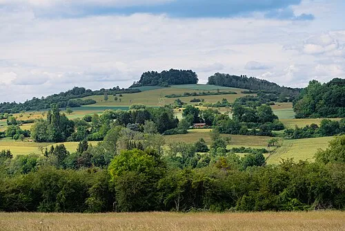
Gebberg Flocci Nivis · CC BY 4.0


Climate of Bliesmengen-Bolchen
Best months for sightseeingBest months for sightseeing: June–September.
This month · November
A cold month
Day 8° · Night 2° · Rain 81 mm
- Hottest month
- July (day 24°)
- Coldest month
- January (night -1°)
- Wettest month
- December (92 mm)
- Driest month
- April (56 mm)
Bars: average monthly low and high temperature. Below: precipitation. Monthly averages for 1970–2000 at about 18 km resolution, adjusted for elevation. Highlighted months are mild and relatively dry. Source: WorldClim 2.1 (CC BY 4.0).
Show values as a table
| Month | Jan | Feb | Mar | Apr | May | Jun | Jul | Aug | Sep | Oct | Nov | Dec |
|---|---|---|---|---|---|---|---|---|---|---|---|---|
| Average high (°C) | 4° | 6° | 10° | 14° | 19° | 22° | 24° | 24° | 20° | 14° | 8° | 5° |
| Average low (°C) | -1° | -1° | 2° | 4° | 8° | 11° | 13° | 13° | 10° | 6° | 2° | 0° |
| Precipitation (mm) | 71 | 65 | 64 | 56 | 75 | 74 | 69 | 58 | 66 | 78 | 81 | 92 |
Other places to visit in this season: June July August September
How to get to Bliesmengen-Bolchen
The nearest airport is Saarbrücken Airport (SCN), 7 km to the north as the crow flies. For international flights: Strasbourg Airport (SXB) (78 km). The nearest large city is Saarbrücken, 12 km to the northwest.
Airports
- Saarbrücken Airport (SCN) Saarbrücken 7 kmnorth
- Metz-Nancy-Lorraine Airport (ETZ) Goin 66 kmwest
- Strasbourg Airport (SXB) Strasbourg 78 kmsoutheast
Nearby large cities
- Saarbrücken Population: 183K 12 kmnorthwest
- Metz Population: 123.9K 69 kmwest
- Trier Population: 100.1K 76 kmnorthwest
- Strasbourg Population: 274.8K 78 kmsoutheast
- Nancy Population: 105.1K 86 kmsouthwest
Straight-line distances; road distances are longer. Airport data: OurAirports.
Day trips from Bliesmengen-Bolchen
Within 100 km: 395 historic and cultural sites, 2,231 natural sites, 547 lakes, rivers and coasts.
0–25 km159 places
- Sonnenberg Mountain 10 kmNW
- Sommerberg Mountain 22 kmNW
- Nußkopf Mountain 22 kmN
- Kasberg Mountain 20 kmNW
25–60 km1,262 places
- Gelterswoog Lake 50 kmNE
- Talsperre Nonnweiler Lake 53 kmN
- Bostalsee Lake 46 kmN
- Ottweiler Wingertsweier Lake 30 kmN
60–100 km1,752 places
- Sauer River 78 kmNW
- Eisch River 99 kmNW
- Unditz River 96 kmSE
- Rench River 82 kmSE
Straight-line distances.
Nearby attractions & nature
Everything nearby-
Breiter Wald Natural site, Saarland1.3 km E
-
Buchholz Natural site, Saarland1.9 km NE
-
Mandelbach River, Saarland2.4 km SE
-
Ransbacher Berg Mountain, Kleinblittersdorf3.7 km NW
-
Mühlenwald Natural site, Saarland3.2 km SW
-
Krehberg Mountain, Mandelbachtal5.3 km NE
Other cities and towns in Mandelbachtal
-
 Habkirchen Village, Mandelbachtal2.4 km SE
-
 Bebelsheim Village, Mandelbachtal3.7 km NE
-
 Wittersheim Village, Mandelbachtal5.1 km NE
-
 Ormesheim Village, Mandelbachtal5.6 km N
-
Gräfinthal Village, Mandelbachtal1.2 km N
-
 Erfweiler-Ehlingen Neighbourhood, Mandelbachtal7 km NE
Sources & licences
Data last updated: · 2 independent sources