- Population
- 290
- 290
- Elevation
- 59 m
- above sea level
- Local time
- UTC+01:00
- Europe/Berlin · UTC+01:00
- Airports
- HAJ Hannover Airport112 km
- LEJ Leipzig/Halle Airport130 km
About Potzehne
Potzehne is a village. Location: Gardelegen, Altmarkkreis Salzwedel. Population: 290. Elevation: 59 m.
Potzehne is a village and a former municipality in the district Altmarkkreis Salzwedel, in Saxony-Anhalt, Germany. Since 1 January 2010, it is part of the town Gardelegen.
Source: Wikipedia · CC BY-SA 4.0
At a glance
- Area
- 15.8 km²
Source: Wikidata
Photos of Potzehne
-
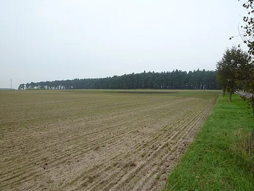
Lauseberg Nuxvonhier · Public domain

Climate of Potzehne
Best months for sightseeingBest months for sightseeing: June–August.
This month · November
A cold month
Day 7° · Night 2° · Rain 44 mm
- Hottest month
- July (day 23°)
- Coldest month
- January (night -2°)
- Wettest month
- July (60 mm)
- Driest month
- February (34 mm)
Bars: average monthly low and high temperature. Below: precipitation. Monthly averages for 1970–2000 at about 18 km resolution, adjusted for elevation. Highlighted months are mild and relatively dry. Source: WorldClim 2.1 (CC BY 4.0).
Show values as a table
| Month | Jan | Feb | Mar | Apr | May | Jun | Jul | Aug | Sep | Oct | Nov | Dec |
|---|---|---|---|---|---|---|---|---|---|---|---|---|
| Average high (°C) | 3° | 4° | 8° | 13° | 19° | 21° | 23° | 23° | 19° | 14° | 7° | 4° |
| Average low (°C) | -2° | -2° | 1° | 4° | 8° | 11° | 13° | 12° | 9° | 6° | 2° | -1° |
| Precipitation (mm) | 41 | 34 | 40 | 39 | 52 | 58 | 60 | 57 | 46 | 39 | 44 | 46 |
How to get to Potzehne
The nearest airport is Hannover Airport (HAJ), 112 km to the west as the crow flies. The nearest large city is Wolfsburg, 38 km to the west.
Airports
- Hannover Airport (HAJ) Hannover 112 kmwest
- Leipzig/Halle Airport (LEJ) Schkeuditz 130 kmsoutheast
- Berlin Brandenburg Airport (BER) Berlin 148 kmeast
Nearby large cities
- Wolfsburg Population: 123.1K 38 kmwest
- Magdeburg Population: 244.3K 40 kmsoutheast
- Braunschweig Population: 244.7K 59 kmwest
- Salzgitter Population: 105K 71 kmsouthwest
- Hanover Population: 515.1K 110 kmwest
Straight-line distances; road distances are longer. Airport data: OurAirports.
Day trips from Potzehne
Within 100 km: 404 historic and cultural sites, 2,795 natural sites, 729 lakes, rivers and coasts.
0–25 km190 places
- Zißberg Mountain 24 kmNW
- Ziegenberg Mountain 16 kmW
- Zeethenscher Berg Mountain 6 kmE
- Zackelberg Mountain 16 kmSE
25–60 km934 places
- Sarre River 50 kmS
- Ehle River 37 kmSE
- Aue River 57 kmSW
- Tietal Lake 59 kmS
60–100 km2,804 places
- Wiehe River 70 kmW
- Schalk River 92 kmSW
- Ehle River 61 kmS
- Aue River 64 kmSW
Straight-line distances.
Nearby attractions & nature
Everything nearby-
Drei Hügel Mountain, Gardelegen3.1 km NE
-
Salauer Berg Mountain, Gardelegen2.8 km E
-
Lunau Natural site, Saxony-Anhalt2.5 km N
-
Wanne River, Saxony-Anhalt3.3 km S
-
Schwarzer Berg Mountain, Gardelegen5.7 km N
-
Zeethenscher Berg Mountain, Gardelegen5.7 km E
Other cities and towns in Gardelegen


Sources & licences
Data last updated: · 2 independent sources