- Elevation
- 1,024 m
- above sea level
- Local time
- UTC+01:00
- Europe/Berlin · UTC+01:00
- Airports
- KSF Kassel Airport93 km
- ERF Erfurt-Weimar Airport94 km
About Königsberg
Königsberg is a mountain. Location: Wernigerode, Landkreis Harz. Elevation: 1,024 m.
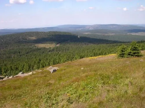
The Königsberg is a neighbouring peak of the Brocken and, at 1033.5 m above sea level the third highest elevation in the Harz mountains. It lies on a long ridge that runs from southeast to northwest about 1.5 km south of the Brocken's summit. Near its summit on the northwest side is the rock formation of Hirschhörner (max. 1,023.2 m). To the east the land descends to the Schwarze Schluftwasser, a small tributary of the Kalte Bode which flows south of the mountain.
Source: Wikipedia · CC BY-SA 4.0
At a glance
- Topographic prominence
- 39 m
Source: Wikidata
Photos of Königsberg
-

Lukas Beck · CC BY 4.0 -

Lukas Beck · CC BY 4.0 -

Kassandro · CC BY-SA 4.0 -
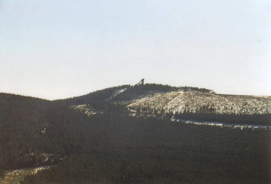
Wurmberg User Steffen Mokosch on de.wikipedia · CC BY-SA 3.0 -
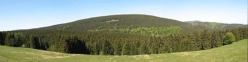
Rehberg Kassandro · CC BY-SA 3.0


Climate of Königsberg
Best months for sightseeingBest months for sightseeing: August.
This month · November
A wet month
Day 2° · Night -3° · Rain 134 mm
- Hottest month
- August (day 16°)
- Coldest month
- January (night -7°)
- Wettest month
- December (160 mm)
- Driest month
- May (79 mm)
Bars: average monthly low and high temperature. Below: precipitation. Monthly averages for 1970–2000 at about 18 km resolution, adjusted for elevation. Highlighted months are mild and relatively dry. Source: WorldClim 2.1 (CC BY 4.0).
Show values as a table
| Month | Jan | Feb | Mar | Apr | May | Jun | Jul | Aug | Sep | Oct | Nov | Dec |
|---|---|---|---|---|---|---|---|---|---|---|---|---|
| Average high (°C) | -2° | -1° | 1° | 5° | 11° | 14° | 16° | 16° | 12° | 8° | 2° | -1° |
| Average low (°C) | -7° | -7° | -5° | -2° | 3° | 6° | 8° | 8° | 5° | 1° | -3° | -5° |
| Precipitation (mm) | 141 | 101 | 129 | 89 | 79 | 111 | 106 | 97 | 101 | 115 | 134 | 160 |
Other places to visit in this season: August
How to get to Königsberg
The nearest airport is Kassel Airport (KSF), 93 km to the southwest as the crow flies. The nearest large city is Salzgitter, 43 km to the north.
Airports
- Kassel Airport (KSF) Calden 93 kmsouthwest
- Erfurt-Weimar Airport (ERF) Erfurt 94 kmsouth
- Hannover Airport (HAJ) Hannover 98 kmnorthwest
Nearby large cities
- Salzgitter Population: 105K 43 kmnorth
- Braunschweig Population: 244.7K 53 kmnorth
- Göttingen Population: 122.1K 54 kmsouthwest
- Wolfsburg Population: 123.1K 72 kmnorth
- Magdeburg Population: 244.3K 81 kmnortheast
Straight-line distances; road distances are longer. Airport data: OurAirports.
Day trips from Königsberg
Within 100 km: 478 historic and cultural sites, 3,873 natural sites, 797 lakes, rivers and coasts.
0–25 km599 places
- Schalk River 12 kmNW
- Zillerbachtalsperre Lake 12 kmE
- Talsperre Wendefurth Lake 22 kmE
- Unter Hahnebalzer Teich Lake 21 kmW
25–60 km1,720 places
- Sarre River 58 kmNE
- Bere River 29 kmS
- Aue River 32 kmNE
- Aue River 25 kmNE
60–100 km2,829 places
- Buchenwald concentration camp Historic site 97 kmSE
- Wiehe River 89 kmN
- Ohe River 74 kmNW
- Frieda River 74 kmSW
Straight-line distances.
Nearest towns and villages
-
Brockenhaus Village, Wernigerode1.8 km NE
-
 Schierke Village, Wernigerode5.2 km SE
-
Braunlage Village, Landkreis Goslar6.3 km S
-
 Elend Village, Oberharz am Brocken7.9 km SE
-
 Torfhaus Village, Clausthal-Zellerfeld4.4 km W
-
 Königskrug Village, Braunlage5 km S
Nearby attractions & nature
Everything nearby-
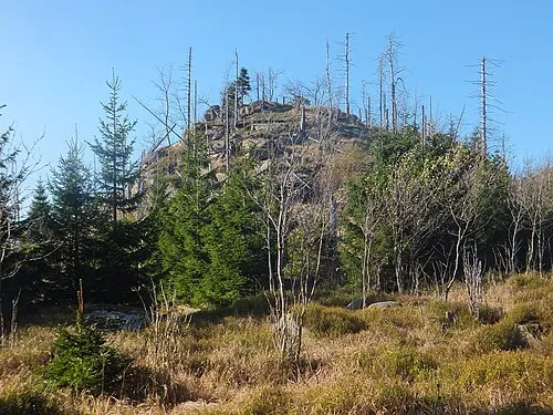 Quitschenberg Mountain, Lower Saxony1.6 km NW
-
Bodesprung Natural site, Germany1.2 km SW
-
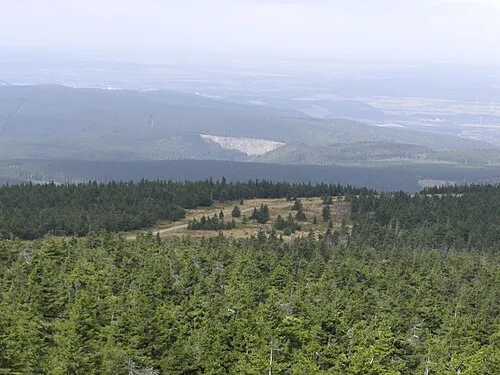 Kleiner Brocken Mountain, Wernigerode2.3 km N
-
Forst Schierke Natural site, Germany1.4 km SE
-
Eckernloch Natural site, Saxony-Anhalt1.4 km SE
-
The Brocken Mountain, Wernigerode1.7 km NE
-
Heinrichshöhe Mountain, Wernigerode2.1 km E
-
Schluftkopf Mountain, Wernigerode2.7 km SE
More nature in Germany
-
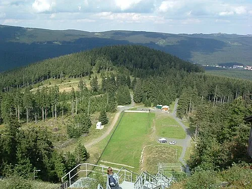 Großer Winterberg Mountain, Wernigerode3.6 km SE
-
Gitterkopf Mountain, Wernigerode3.3 km N
-
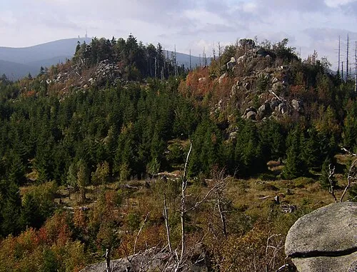 Hohnekamm Mountain, Wernigerode6.6 km E
-
Ohrenklippen Mountain, Wernigerode4.9 km NE
-
Ahrensklint Mountain, Wernigerode5.3 km SE
-
Großer Jägerkopf Mountain, Wernigerode5.5 km NE
Sources & licences
Data last updated: · 2 independent sources