- Elevation
- 714 m
- above sea level
- Local time
- UTC+01:00
- Europe/Berlin · UTC+01:00
- Airports
- KLV Karlovy Vary Airport50 km
- DRS Dresden Airport83 km
About Buchberg
Buchberg is a mountain. Location: Zwönitz, Erzgebirgskreis. Elevation: 714 m. The best months to visit are June–September. The nearest airport is Karlovy Vary Airport (50 km). Nearby sights include Geyerscher Wald and Huthübel.
Climate of Buchberg
Best months for sightseeingBest months for sightseeing: June–September.
This month · November
A cold month
Day 4° · Night -1° · Rain 60 mm
- Hottest month
- July (day 20°)
- Coldest month
- February (night -5°)
- Wettest month
- July (101 mm)
- Driest month
- February (50 mm)
Bars: average monthly low and high temperature. Below: precipitation. Monthly averages for 1970–2000 at about 18 km resolution, adjusted for elevation. Highlighted months are mild and relatively dry. Source: WorldClim 2.1 (CC BY 4.0).
Show values as a table
| Month | Jan | Feb | Mar | Apr | May | Jun | Jul | Aug | Sep | Oct | Nov | Dec |
|---|---|---|---|---|---|---|---|---|---|---|---|---|
| Average high (°C) | 0° | 0° | 5° | 10° | 15° | 18° | 20° | 20° | 16° | 10° | 4° | 1° |
| Average low (°C) | -5° | -5° | -2° | 1° | 5° | 8° | 10° | 10° | 7° | 3° | -1° | -3° |
| Precipitation (mm) | 54 | 50 | 61 | 55 | 71 | 91 | 101 | 91 | 67 | 60 | 60 | 65 |
Other places to visit in this season: June July August September
How to get to Buchberg
The nearest airport is Karlovy Vary Airport (KLV), 50 km to the south as the crow flies. The nearest large city is Chemnitz, 21 km to the north.
Airports
- Karlovy Vary Airport (KLV) Karlovy Vary 50 kmsouth
- Dresden Airport (DRS) Dresden 83 kmnortheast
- Leipzig/Halle Airport (LEJ) Schkeuditz 97 kmnorthwest
Nearby large cities
- Chemnitz Population: 247.2K 21 kmnorth
- Gera Population: 104.7K 61 kmnorthwest
- Dresden Population: 564.9K 76 kmnortheast
- Leipzig Population: 505K 84 kmnorthwest
- Jena Population: 104.7K 95 kmwest
Straight-line distances; road distances are longer. Airport data: OurAirports.
Nearest towns and villages
-
Dorfchemnitz Village, Zwönitz2.7 km NW
-
Hormersdorf Village, Zwönitz3.2 km N
-
Günsdorf Village, Zwönitz2.2 km N
-
Geyer Village, Geyer4.6 km SE
-
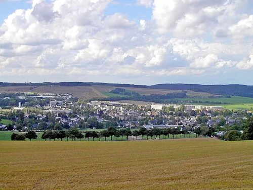 Zwönitz Town, Zwönitz4.3 km SW
-
Geyer Village, Erzgebirgskreis5.1 km E
Nearby attractions & nature
Everything nearby-
Geyerscher Wald Natural site, Saxony1.9 km SE
-
Huthübel Mountain, Zwönitz2.7 km N
-
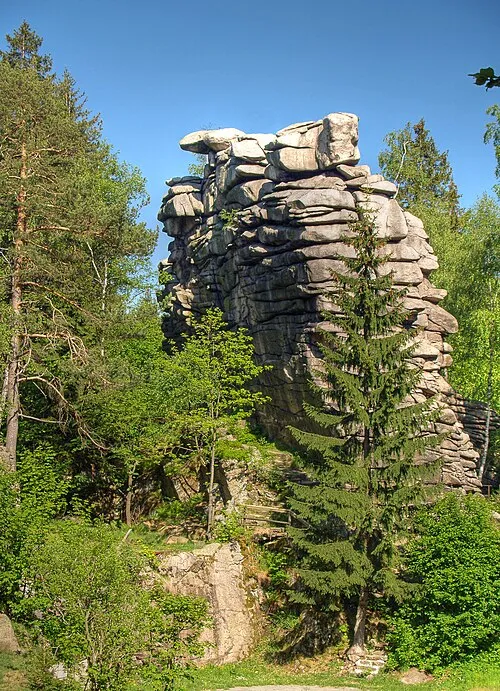 Greifenstein Mountain, Ehrenfriedersdorf4.6 km E
-
Katzenstein Mountain, Zwönitz4.1 km SW
-
Andreasberg Mountain, Zwönitz4.2 km N
-
Richterberg Mountain, Thum4.3 km NE
-
Spitzberg Mountain, Geyer4.4 km SE
-
Henneholz Natural site, Saxony3.7 km E
Sources & licences
Data last updated: · 2 independent sources