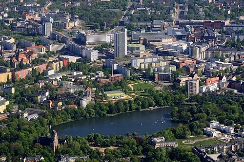
Chemnitz, Kirche St. Matthäus
Located in Chemnitz, Kreisfreie Stadt Chemnitz Coordinates: 50°49′55″ N 12°53′08″ E
- Local time
- UTC+01:00
- Europe/Berlin · UTC+01:00
- Elevation
- 319 m
- above sea level
- Airports
- KLV Karlovy Vary Airport70 km
- DRS Dresden Airport70 km
About Chemnitz, Kirche St. Matthäus
Chemnitz, Kirche St. Matthäus is a tourist attraction. Location: Chemnitz, Kreisfreie Stadt Chemnitz. The best months to visit are June–September. The nearest airport is Karlovy Vary Airport (70 km). Nearby sights include Chemnitz-Altendorf, Friedhofskapelle and Chemnitz-Kassberg, Nikolaikirche.
Climate of Chemnitz, Kirche St. Matthäus
Best months for sightseeingBest months for sightseeing: June–September.
This month · November
A cold month
Day 7° · Night 2° · Rain 56 mm
- Hottest month
- July (day 23°)
- Coldest month
- February (night -3°)
- Wettest month
- July (93 mm)
- Driest month
- February (42 mm)
Bars: average monthly low and high temperature. Below: precipitation. Monthly averages for 1970–2000 at about 18 km resolution, adjusted for elevation. Highlighted months are mild and relatively dry. Source: WorldClim 2.1 (CC BY 4.0).
Show values as a table
| Month | Jan | Feb | Mar | Apr | May | Jun | Jul | Aug | Sep | Oct | Nov | Dec |
|---|---|---|---|---|---|---|---|---|---|---|---|---|
| Average high (°C) | 2° | 3° | 7° | 13° | 18° | 21° | 23° | 22° | 19° | 13° | 7° | 3° |
| Average low (°C) | -3° | -3° | 0° | 4° | 8° | 11° | 13° | 12° | 9° | 5° | 2° | -1° |
| Precipitation (mm) | 47 | 42 | 52 | 50 | 69 | 82 | 93 | 87 | 62 | 54 | 56 | 57 |
Other places to visit in this season: June July August September
How to get to Chemnitz, Kirche St. Matthäus
The nearest airport is Karlovy Vary Airport (KLV), 70 km to the south as the crow flies. The nearest large city is Chemnitz, 3 km to the east.
Airports
- Karlovy Vary Airport (KLV) Karlovy Vary 70 kmsouth
- Dresden Airport (DRS) Dresden 70 kmnortheast
- Leipzig/Halle Airport (LEJ) Schkeuditz 80 kmnorthwest
Nearby large cities
- Chemnitz Population: 247.2K 3 kmeast
- Gera Population: 104.7K 57 kmwest
- Dresden Population: 564.9K 65 kmnortheast
- Leipzig Population: 505K 67 kmnorthwest
- Jena Population: 104.7K 92 kmwest
Straight-line distances; road distances are longer. Airport data: OurAirports.
Day trips from Chemnitz, Kirche St. Matthäus
Within 100 km: 389 historic and cultural sites, 2,111 natural sites, 543 lakes, rivers and coasts.
0–25 km268 places
- Reservoir Neunzehnhain I Lake 22 kmSE
- Reservoir Neunzehnhain II Lake 23 kmSE
- Zschopenberg Mountain 17 kmSE
- Ziegenberg Mountain 16 kmNW
25–60 km1,071 places
- Stoličná Mountain 56 kmS
- Pláň Mountain 56 kmS
- Sprotte River 35 kmW
- Speicherbecken Witznitz Lake 45 kmNW
60–100 km1,704 places
- Erzgebirge Mountain 66 kmE
- Pirna-Sonnenstein Mountain 76 kmE
- Svatý Prokop Landmark 78 kmSE
- Roda River 91 kmW
Straight-line distances.
Nearby attractions & nature
Everything nearby-
Chemnitz-Altendorf, Friedhofskapelle Attraction, Chemnitz0.4 km S
-
Chemnitz-Kassberg, Nikolaikirche Attraction, Chemnitz0.9 km SE
-
Chemnitz-Kaßberg, Kreuzkirche Attraction, Chemnitz1.4 km E
-
Chemnitz, Stadtkirche St. Jakobi Attraction, Chemnitz2.4 km E
-
Bismarckhöhe Mountain, Chemnitz2.4 km NW
-
Chemnitz, Schlosskirche Attraction, Chemnitz2.6 km NE
-
Chemnitz Concentration Camp Historic site, Chemnitz2.8 km SE
-
Siegmar-Schönau Concentration Camp Historic site, Chemnitz3.3 km SW
Nearest towns and villages


Sources & licences
Data last updated: