- Elevation
- 297 m
- above sea level
- Local time
- UTC+01:00
- Europe/Berlin · UTC+01:00
- Airports
- KLV Karlovy Vary Airport57 km
- LEJ Leipzig/Halle Airport87 km
About Silberstraße
Silberstraße is a village. Location: Wilkau-Haßlau, Zwickau. Elevation: 297 m.
Silberstraße is a formerly independent parish in the German state of Saxony. Since 1999 it has been part of the borough of Wilkau-Haßlau, in the district of Zwickau. It has around 2,000 inhabitants and lies at an elevation of 340 m above sea level (NN). As well as the old village houses it also has a newly built residential area with modern housing units, large industrial estates with textile firms and agricultural concerns.
Source: Wikipedia · CC BY-SA 4.0
Photos of Silberstraße
-
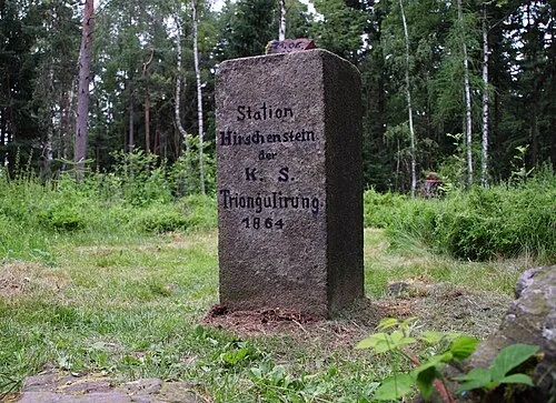
Hirschenstein Geofreund · CC BY-SA 3.0

Climate of Silberstraße
Best months for sightseeingBest months for sightseeing: June–September.
This month · November
A cold month
Day 7° · Night 2° · Rain 64 mm
- Hottest month
- July (day 23°)
- Coldest month
- February (night -3°)
- Wettest month
- July (101 mm)
- Driest month
- February (47 mm)
Bars: average monthly low and high temperature. Below: precipitation. Monthly averages for 1970–2000 at about 18 km resolution, adjusted for elevation. Highlighted months are mild and relatively dry. Source: WorldClim 2.1 (CC BY 4.0).
Show values as a table
| Month | Jan | Feb | Mar | Apr | May | Jun | Jul | Aug | Sep | Oct | Nov | Dec |
|---|---|---|---|---|---|---|---|---|---|---|---|---|
| Average high (°C) | 2° | 3° | 8° | 13° | 18° | 21° | 23° | 23° | 19° | 13° | 7° | 4° |
| Average low (°C) | -2° | -3° | 0° | 4° | 8° | 11° | 13° | 12° | 9° | 5° | 2° | -1° |
| Precipitation (mm) | 48 | 47 | 57 | 49 | 70 | 81 | 101 | 90 | 70 | 60 | 64 | 60 |
Other places to visit in this season: June July August September
How to get to Silberstraße
The nearest airport is Karlovy Vary Airport (KLV), 57 km to the southeast as the crow flies. The nearest large city is Chemnitz, 33 km to the northeast.
Airports
- Karlovy Vary Airport (KLV) Karlovy Vary 57 kmsoutheast
- Leipzig/Halle Airport (LEJ) Schkeuditz 87 kmnorth
- Dresden Airport (DRS) Dresden 100 kmnortheast
Nearby large cities
- Chemnitz Population: 247.2K 33 kmnortheast
- Gera Population: 104.7K 41 kmnorthwest
- Jena Population: 104.7K 74 kmnorthwest
- Leipzig Population: 505K 76 kmnorth
- Dresden Population: 564.9K 94 kmnortheast
Straight-line distances; road distances are longer. Airport data: OurAirports.
Day trips from Silberstraße
Within 100 km: 426 historic and cultural sites, 2,493 natural sites, 552 lakes, rivers and coasts.
0–25 km279 places
- Waldsee Lake 22 kmS
- Talsperre Koberbach Lake 19 kmNW
- Talsperre des Friedens Lake 21 kmS
- Talsperre Falkenstein Lake 25 kmSW
25–60 km926 places
- Stoličná Mountain 52 kmSE
- Pláň Mountain 36 kmS
- Sprotte River 32 kmN
- Zipfelteich Lake 55 kmW
60–100 km2,266 places
- Erzgebirge Mountain 93 kmE
- Svatý Prokop Landmark 77 kmSE
- Roda River 71 kmW
- Roda River 71 kmW
Straight-line distances.
Nearby attractions & nature
Everything nearby-
Schelmberg Mountain, Kirchberg1.8 km SW
-
Aschberg Mountain, Langenweißbach2.9 km E
-
Schützenhöhe Mountain, Kirchberg3.4 km S
-
Culitzsch, Kirche Attraction, Wilkau-Haßlau3.1 km W
-
Plotzbach River, Saxony2.5 km W
-
Aubach River, Saxony2.8 km SW
Sources & licences
Data last updated: · 2 independent sources