Kniphagener Holz
Located in Schönwalde am Bungsberg, Kreis Ostholstein Coordinates: 54°10′04″ N 10°46′45″ E
- Elevation
- 50 m
- above sea level
- Airports
- LBC Lübeck Blankensee Airport41 km
- HAM Hamburg Helmut Schmidt Airport79 km
About Kniphagener Holz
Kniphagener Holz is a natural site. Location: Schönwalde am Bungsberg, Kreis Ostholstein. The best months to visit are June–August. The nearest airport is Lübeck Blankensee Airport (41 km). Nearby sights include Stolper Holz and Knipperbach.
Photos of Kniphagener Holz
-
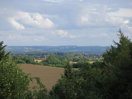
Bungsberg Jörg Braukmann · CC BY-SA 3.0 -
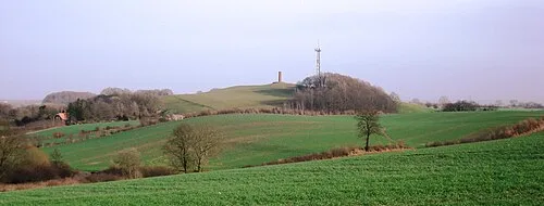
Gömnitzer Berg Genet at German Wikipedia · CC BY-SA 3.0


Climate of Kniphagener Holz
Best months for sightseeingBest months for sightseeing: June–August.
This month · November
A cold month
Day 7° · Night 3° · Rain 67 mm
- Hottest month
- July (day 21°)
- Coldest month
- January (night -1°)
- Wettest month
- July (71 mm)
- Driest month
- February (42 mm)
Bars: average monthly low and high temperature. Below: precipitation. Monthly averages for 1970–2000 at about 18 km resolution, adjusted for elevation. Highlighted months are mild and relatively dry. Source: WorldClim 2.1 (CC BY 4.0).
Show values as a table
| Month | Jan | Feb | Mar | Apr | May | Jun | Jul | Aug | Sep | Oct | Nov | Dec |
|---|---|---|---|---|---|---|---|---|---|---|---|---|
| Average high (°C) | 3° | 3° | 6° | 10° | 16° | 19° | 21° | 21° | 17° | 12° | 7° | 4° |
| Average low (°C) | -1° | -1° | 1° | 3° | 7° | 10° | 12° | 12° | 10° | 6° | 3° | 0° |
| Precipitation (mm) | 61 | 42 | 55 | 46 | 49 | 64 | 71 | 63 | 64 | 62 | 67 | 69 |
How to get to Kniphagener Holz
The nearest airport is Lübeck Blankensee Airport (LBC), 41 km to the south as the crow flies. For international flights: Hamburg Helmut Schmidt Airport (HAM) (79 km). The nearest large city is Lübeck, 34 km to the south.
Airports
- Lübeck Blankensee Airport (LBC) Lübeck 41 kmsouth
- Hamburg Helmut Schmidt Airport (HAM) Hamburg 79 kmsouthwest
- Rostock-Laage Airport (RLG) Laage 102 kmeast
Nearby large cities
- Lübeck Population: 212.2K 34 kmsouth
- Kiel Population: 252.7K 45 kmwest
- Rostock Population: 198.3K 89 kmeast
- Odense Population: 180.9K 139 kmnorth
- Bremerhaven Population: 118.6K 160 kmsouthwest
Straight-line distances; road distances are longer. Airport data: OurAirports.
Day trips from Kniphagener Holz
Within 100 km: 293 historic and cultural sites, 2,204 natural sites, 1,212 lakes, rivers and coasts.
0–25 km434 places
- Hundestrand Beach 14 kmS
- Strand Rosenhagen Beach 25 kmSE
- Hundestrand 1 Beach 24 kmSE
- Strand Kalkhorst Beach 24 kmSE
25–60 km1,069 places
- Fehmarn Island 41 kmNE
- Poel Island Island 47 kmSE
- Spock River 47 kmW
- Köppernitz River 54 kmSE
60–100 km2,206 places
- Tåsinge Island 93 kmN
- Aeroe Island 85 kmN
- Ziegelwerder Island 77 kmSE
- Viertbusch Natural site 78 kmSW
Straight-line distances.
Nearest towns and villages
-
 Altenkrempe Village, Kreis Ostholstein3.1 km S
-
Schönwalde am Bungsberg Village, Schönwalde am Bungsberg3 km NW
-
Kasseedorf Village, Kreis Ostholstein4.1 km W
-
Stolperhufen Village, Schönwalde am Bungsberg1.4 km E
-
Kasseedorf Village, Kasseedorf3.8 km W
-
Hobstin Village, Schönwalde am Bungsberg2 km E
Nearby attractions & nature
Everything nearby-
Stolper Holz Natural site, Altenkrempe1.2 km W
-
Knipperbach River, Altenkrempe1 km S
-
Glinde Natural site, Kasseedorf1.5 km NW
-
Steinklippen Natural site, Kasseedorf2.1 km W
-
Bandorfsgraben River, Altenkrempe1.6 km S
-
Niendieksbrook Natural site, Altenkrempe2.3 km SW
-
Hollenbek Natural site, Altenkrempe2.5 km SE
-
Lassbek Natural site, Altenkrempe2.8 km S
More nature in Germany
-
Bungsberg Mountain, Schönwalde am Bungsberg6 km NW
-
Kukuk Natural site, Schönwalde am Bungsberg2.8 km N
-
Mönchbusch Natural site, Schönwalde am Bungsberg4 km N
-
Buchholz Natural site, Schönwalde am Bungsberg4.7 km NW
-
Schellholz Natural site, Schönwalde am Bungsberg4.8 km NW
-
Thimmhofen Natural site, Schönwalde am Bungsberg5.3 km NW
Sources & licences
Data last updated: