Berlin-Lichterfelde Concentration Camp
Located in Berlin, Berlin, Stadt Coordinates: 52°25′53″ N 13°18′35″ E
- Local time
- UTC+01:00
- Europe/Berlin · UTC+01:00
- Elevation
- 41 m
- above sea level
- Airports
- BER Berlin Brandenburg Airport15 km
- LEJ Leipzig/Halle Airport135 km
About Berlin-Lichterfelde Concentration Camp
Berlin-Lichterfelde Concentration Camp is a historic site. Location: Berlin, Berlin, Stadt. The best months to visit are May–August. The nearest airport is Berlin Brandenburg Airport (15 km). Nearby sights include Bismarck and Lilienthal.
Photos of Berlin-Lichterfelde Concentration Camp
-
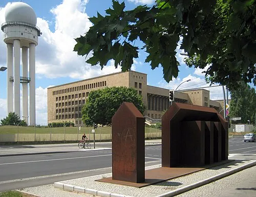
Early Camp Berlin Columbia Haus Beek100 · CC BY-SA 3.0 -
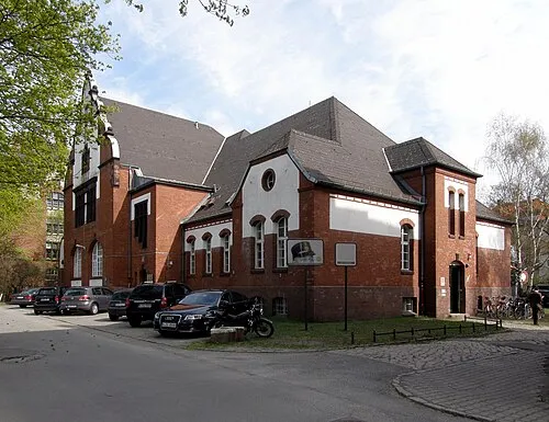
Early Camp Berlin-Tempelhof (General-Pape-Straße) Axel.Mauruszat · CC BY 3.0 de -
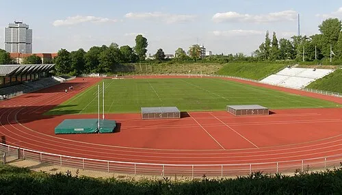
Stadion Wilmersdorf Axel Mauruszat · CC BY 3.0 de -

Museum of Asian Art GodeNehler · CC BY-SA 4.0


Climate of Berlin-Lichterfelde Concentration Camp
Best months for sightseeingBest months for sightseeing: May–August.
This month · November
A cold month
Day 7° · Night 2° · Rain 43 mm
- Hottest month
- July (day 24°)
- Coldest month
- January (night -2°)
- Wettest month
- June (64 mm)
- Driest month
- February (35 mm)
Bars: average monthly low and high temperature. Below: precipitation. Monthly averages for 1970–2000 at about 18 km resolution, adjusted for elevation. Highlighted months are mild and relatively dry. Source: WorldClim 2.1 (CC BY 4.0).
Show values as a table
| Month | Jan | Feb | Mar | Apr | May | Jun | Jul | Aug | Sep | Oct | Nov | Dec |
|---|---|---|---|---|---|---|---|---|---|---|---|---|
| Average high (°C) | 3° | 4° | 8° | 13° | 19° | 22° | 24° | 23° | 18° | 13° | 7° | 4° |
| Average low (°C) | -2° | -2° | 1° | 4° | 9° | 12° | 14° | 13° | 9° | 5° | 2° | -1° |
| Precipitation (mm) | 41 | 35 | 40 | 38 | 51 | 64 | 54 | 58 | 43 | 37 | 43 | 54 |
How to get to Berlin-Lichterfelde Concentration Camp
The nearest airport is Berlin Brandenburg Airport (BER), 15 km to the southeast as the crow flies. The nearest large city is Berlin, 12 km to the northeast.
Airports
- Berlin Brandenburg Airport (BER) Berlin 15 kmsoutheast
- Leipzig/Halle Airport (LEJ) Schkeuditz 135 kmsouthwest
- Dresden Airport (DRS) Dresden 148 kmsouth
Nearby large cities
- Berlin Population: 3.4M 12 kmnortheast
- Potsdam Population: 184.8K 17 kmwest
- Magdeburg Population: 244.3K 119 kmwest
- Leipzig Population: 505K 138 kmsouthwest
- Halle Population: 237.9K 140 kmsouthwest
Straight-line distances; road distances are longer. Airport data: OurAirports.
Day trips from Berlin-Lichterfelde Concentration Camp
Within 100 km: 529 historic and cultural sites, 1,789 natural sites, 1,578 lakes, rivers and coasts.
0–25 km522 places
- Schlachtensee Lake 6 kmW
- Valentinswerder Island 16 kmN
- Scharfenberg Island 16 kmN
- Dahme River River 18 kmE
25–60 km1,203 places
- Mittelbruch Island 50 kmW
- Buhnenwerder Island 57 kmW
- Insel im Bützsee Island 53 kmNW
- Köhninge Island 43 kmW
60–100 km2,171 places
- Strandbad Beach 79 kmNE
- Der Raatz Island 70 kmN
- Großer Horst Island 91 kmN
- Burgwallinsel Island 91 kmNE
Straight-line distances.
Nearby attractions & nature
Everything nearby-
Bismarck Landmark, Berlin0.1 km S
-
Lilienthal Landmark, Berlin0.5 km NE
-
Museum of Asian Art Museum, Berlin3 km N
-
Allied Museum Museum, Berlin3.7 km NW
-
Otto Lilienthal Landmark, Berlin2.3 km SE
-
Berlin-Dahlem Botanical Garden and Botanical Museum Attraction, Berlin2.9 km N
-
Ethnological Museum Museum, Berlin3 km NW
-
Siebzehnten Juni Neunzehnhundertdreiundfünfzig Landmark, Berlin3 km SE
Nearest towns and villages
-
 Lichterfelde Neighbourhood, Berlin0.3 km NW
-
 Lankwitz Neighbourhood, Berlin2.5 km E
-
Steglitz Neighbourhood, Berlin3.1 km NE
-
 Dahlem Neighbourhood, Berlin3.3 km NW
More sights in Berlin
-
Stadion Wilmersdorf Landmark, Berlin5.9 km N
-
Early Camp Berlin-Tempelhof (General-Pape-Straße) Historic site, Berlin6.7 km NE
-
Domäne Dahlem Museum, Berlin3.3 km NW
-
Early Camp Berlin Columbia Haus Historic site, Berlin6.7 km NE
-
Berlin-Zehlendorf Concentration Camp Historic site, Berlin3.4 km W
-
Schiller Landmark, Berlin3.6 km W
Sources & licences
Data last updated: · 2 independent sources