Kleiner Gleichberg
Located in Römhild, Landkreis Hildburghausen Coordinates: 50°24′40″ N 10°35′33″ E
- Elevation
- 641 m
- above sea level
- Local time
- UTC+01:00
- Europe/Berlin · UTC+01:00
- Airports
- ERF Erfurt-Weimar Airport68 km
- NUE Nuremberg Airport107 km
About Kleiner Gleichberg
Kleiner Gleichberg is a mountain. Location: Römhild, Landkreis Hildburghausen. Elevation: 641 m.
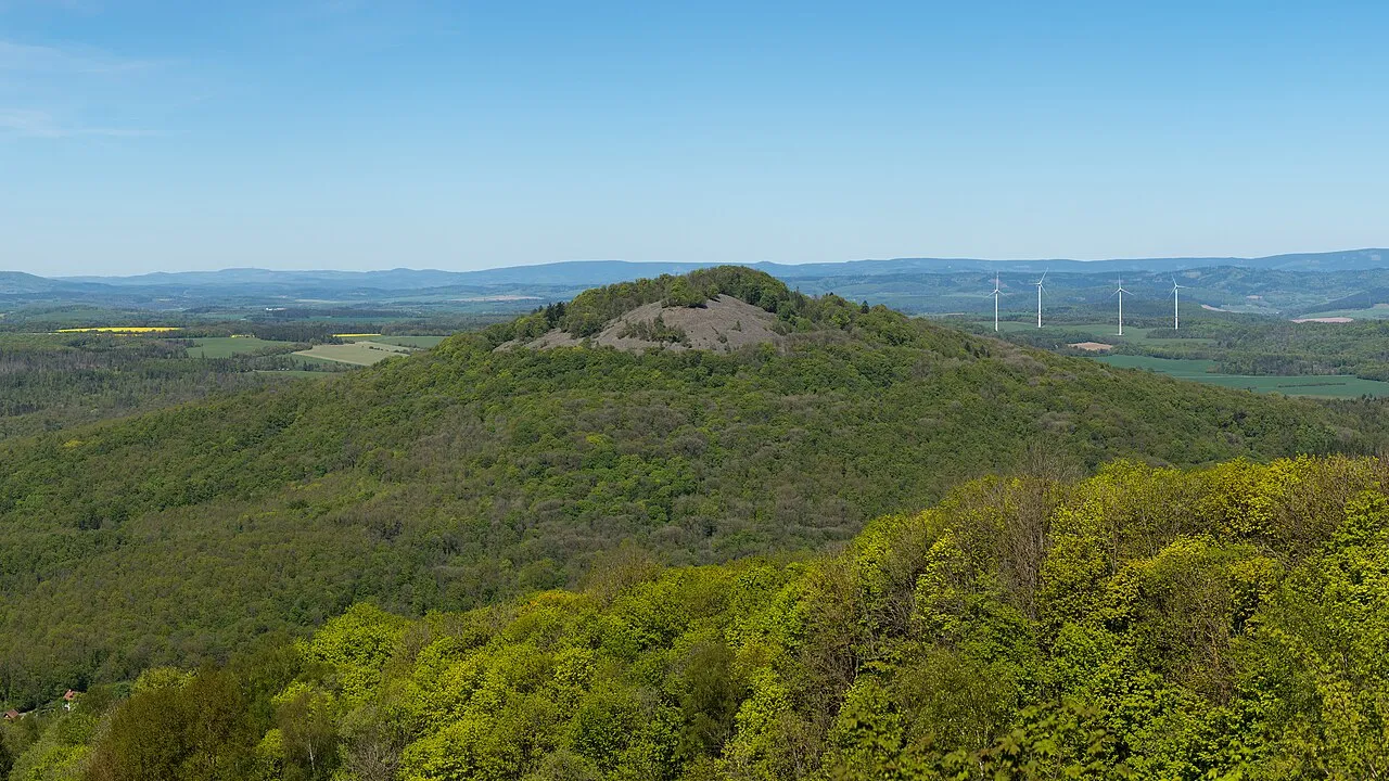
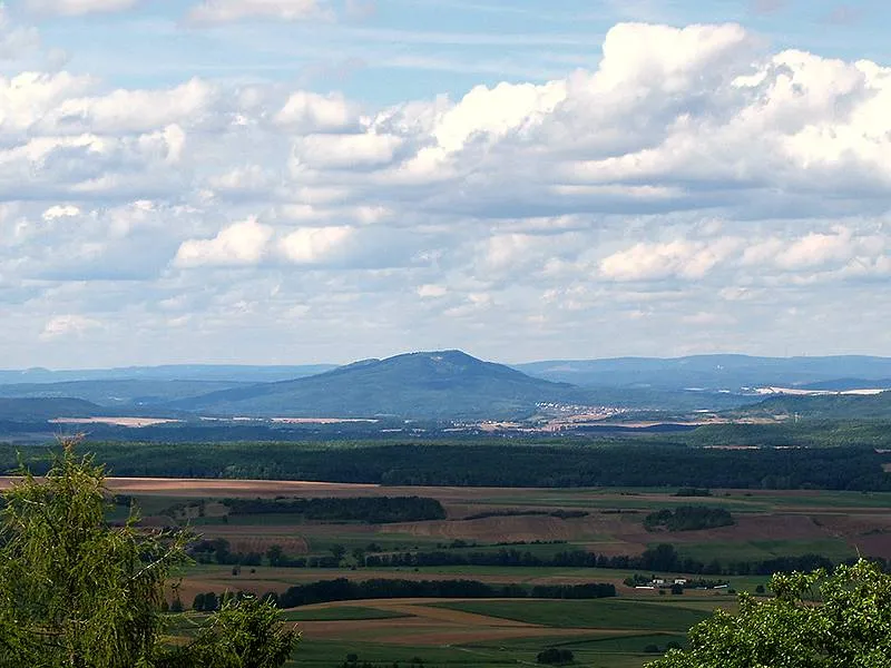
The Kleiner Gleichberg (641.3 m above sea level (NHN)) is the slightly lower of the two Gleichberge mountains, east of the village of Römhild in the country of Grabfeld in the county of Hildburghausen in the German state of Thuringia. The Celtic Oppidum Steinsburg is located on the mountain. Because of the proximity of its larger brother, the Großer Gleichberg, which is less than 3 kilometres away and, at 679.0 m, slightly higher, the Kleiner Gleichberg is not particularly dominant.
Source: Wikipedia · CC BY-SA 4.0
At a glance
- Topographic prominence
- 223 m
Source: Wikidata
Climate of Kleiner Gleichberg
Best months for sightseeingBest months for sightseeing: June–August.
This month · November
A cold month
Day 4° · Night -1° · Rain 64 mm
- Hottest month
- July (day 21°)
- Coldest month
- February (night -5°)
- Wettest month
- July (81 mm)
- Driest month
- February (50 mm)
Bars: average monthly low and high temperature. Below: precipitation. Monthly averages for 1970–2000 at about 18 km resolution, adjusted for elevation. Highlighted months are mild and relatively dry. Source: WorldClim 2.1 (CC BY 4.0).
Show values as a table
| Month | Jan | Feb | Mar | Apr | May | Jun | Jul | Aug | Sep | Oct | Nov | Dec |
|---|---|---|---|---|---|---|---|---|---|---|---|---|
| Average high (°C) | 0° | 1° | 6° | 11° | 16° | 19° | 21° | 21° | 16° | 10° | 4° | 1° |
| Average low (°C) | -5° | -5° | -2° | 1° | 5° | 8° | 10° | 9° | 6° | 2° | -1° | -4° |
| Precipitation (mm) | 61 | 50 | 57 | 50 | 61 | 68 | 81 | 62 | 60 | 59 | 64 | 75 |
How to get to Kleiner Gleichberg
The nearest airport is Erfurt-Weimar Airport (ERF), 68 km to the north as the crow flies. The nearest large city is Erfurt, 70 km to the northeast.
Airports
- Erfurt-Weimar Airport (ERF) Erfurt 68 kmnorth
- Nuremberg Airport (NUE) Nuremberg 107 kmsouth
- Kassel Airport (KSF) Calden 140 kmnorthwest
Nearby large cities
- Erfurt Population: 218.8K 70 kmnortheast
- Würzburg Population: 133.7K 83 kmsouthwest
- Jena Population: 104.7K 91 kmnortheast
- Erlangen Population: 102.7K 96 kmsouth
- Fürth Population: 132K 108 kmsouth
Straight-line distances; road distances are longer. Airport data: OurAirports.
Day trips from Kleiner Gleichberg
Within 100 km: 1,028 historic and cultural sites, 5,302 natural sites, 911 lakes, rivers and coasts.
0–25 km459 places
- Talsperre Schwickershausen Lake 16 kmW
- Talsperre Erletor Lake 22 kmNE
- Zollberg Mountain 17 kmN
- Ziegenrück Mountain 23 kmNE
25–60 km2,391 places
- Waldstadion Weismain Landmark 59 kmSE
- Felda River 60 kmNW
- Badsee Lake 56 kmS
- Unterer Metzenweiher Lake 60 kmW
60–100 km4,391 places
- Buchenwald concentration camp Historic site 82 kmNE
- Roda River 88 kmNE
- Roda River 87 kmNE
- Frieda River 92 kmN
Straight-line distances.
Nearest towns and villages
-
Römhild Village, Römhild4.2 km SW
-
Dingsleben Village, Landkreis Hildburghausen2.5 km N
-
Dingsleben Village, Dingsleben2.5 km N
-
Gleichamberg Village, Römhild4.5 km S
-
Milz Village, Römhild5.4 km SW
-
Zeilfeld Village, Römhild2.8 km E
Nearby attractions & nature
Everything nearby-
Gleichberg Mountain, Dingsleben0.8 km NE
-
Forst Römhild Natural site, Thuringia0.6 km W
-
Kleeberg Mountain, Römhild1.7 km SE
-
Kuppe Mountain, Dingsleben1.9 km N
-
 Großer Gleichberg Mountain, Römhild2.5 km S
-
Röther Kopf Mountain, Römhild2.2 km SE
-
Schwabhäuser Berg Mountain, Römhild2.3 km NW
-
Eichelberg Mountain, Römhild1.9 km W
Sources & licences
Data last updated: · 2 independent sources