Spalathronísia
Local name: Σπαλαθρονήσια
Located in Sithonia, Chalkidikí Coordinates: 40°01′15″ N 23°48′27″ E
- Elevation
- 14 m
- above sea level
- Local time
- UTC+02:00
- Europe/Athens · UTC+02:00
- Population
- 3
- 3
- Airports
- SKG Thessaloniki Macedonia International Airport90 km
- JSI Skiathos Island National Airport97 km
About Spalathronísia
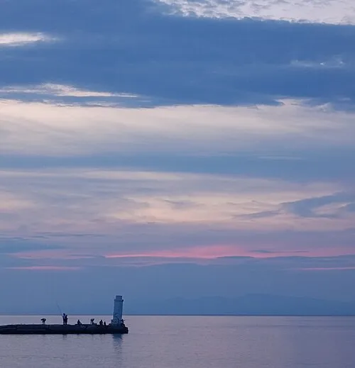
Spalathronísia is an island. Location: Sithonia, Chalkidikí. Population: 3. The best months to visit are May, September–October. The nearest airport is Thessaloniki Macedonia International Airport (90 km). Nearby sights include Alonaki Beach and Glarokampos Beach.
Climate of Spalathronísia
Best months for sightseeingBest months for sightseeing: May, September–October.
This month · November
Outside the best season
Day 15° · Night 9° · Rain 62 mm
- Hottest month
- July (day 30°)
- Coldest month
- January (night 5°)
- Wettest month
- November (62 mm)
- Driest month
- August (15 mm)
Bars: average monthly low and high temperature. Below: precipitation. Monthly averages for 1970–2000 at about 18 km resolution, adjusted for elevation. Highlighted months are mild and relatively dry. Source: WorldClim 2.1 (CC BY 4.0).
Show values as a table
| Month | Jan | Feb | Mar | Apr | May | Jun | Jul | Aug | Sep | Oct | Nov | Dec |
|---|---|---|---|---|---|---|---|---|---|---|---|---|
| Average high (°C) | 10° | 11° | 14° | 18° | 23° | 28° | 30° | 30° | 26° | 21° | 15° | 12° |
| Average low (°C) | 5° | 5° | 7° | 10° | 15° | 19° | 22° | 21° | 18° | 14° | 9° | 6° |
| Precipitation (mm) | 54 | 43 | 44 | 34 | 33 | 27 | 20 | 15 | 21 | 49 | 62 | 62 |
How to get to Spalathronísia
The nearest airport is Thessaloniki Macedonia International Airport (SKG), 90 km to the northwest as the crow flies. The nearest large city is Çanakkale, 223 km to the east.
Airports
- Thessaloniki Macedonia International Airport (SKG) Thessaloniki 90 kmnorthwest
- Skiathos Island National Airport (JSI) Skiathos 97 kmsouth
- Kavala Alexander the Great International Airport (KVA) Kavala 121 kmnortheast
Nearby large cities
- Çanakkale Population: 143.6K 223 kmeast
- Athens Population: 664K 226 kmsouth
- Piraeus Population: 163.7K 231 kmsouth
- Plovdiv Population: 329.5K 250 kmnorth
- Edirne Population: 180K 296 kmnortheast
Straight-line distances; road distances are longer. Airport data: OurAirports.
Day trips from Spalathronísia
Within 100 km: 8 historic and cultural sites, 2 natural sites, 31 lakes, rivers and coasts.
0–25 km8 places
- Glarokampos Beach Beach 13 kmSW
- Polychrono Beach Beach 24 kmW
- Pefkochori Beach Beach 17 kmW
- Agios Isidoros Island 22 kmN
25–60 km10 places
- Monastery of Great Lavra Attraction 52 kmE
- Varkes Beach Beach 47 kmNW
- Solina Beach Beach 30 kmW
- Lefki Peristera Beach Beach 29 kmW
60–100 km23 places
- Amygdalochóri Historic site 91 kmN
- Panagia Island Island 92 kmNE
- Pelagos Island 92 kmNE
- Nei Pori Beach Beach 100 kmW
Straight-line distances.
Nearest towns and villages
-
Galini Neou Marmara Village, Sithonia0.8 km NE
-
Agia Kyriaki Village, Sithonia2.6 km N
-
Styladario Village, Sithonia3.3 km E
-
Azapiko Village, Sithonia4.4 km E
-
Porto Carras Village, Sithonia6.1 km N
-
Neos Marmaras Village, Sithonia8.6 km N
Nearby attractions & nature
Everything nearby-
Alonaki Beach Beach, Kassandra13 km SW
-
Glarokampos Beach Beach, Kassandra13 km SW
-
Paliouri Beach Beach, Kassandra13 km SW
-
 Pefkochori Beach Beach, Kassandra17 km W
-
Chanioti Beach Beach, Kassandra20 km W
-
Loutra Beach Beach, Kassandra22 km SW
-
Polychrono Beach Beach, Kassandra24 km W
-
Agios Isidoros Island, Sithonia22 km N
Sources & licences
Data last updated: · 2 independent sources