- Population
- 424
- 424
- Elevation
- 306 m
- above sea level
- Local time
- UTC+02:00
- Europe/Athens · UTC+02:00
- Airports
- KVA Kavala Alexander the Great International Airport37 km
- SKG Thessaloniki Macedonia International Airport109 km
About Myrtofyto
Myrtofyto is a village. Location: Pangaio, Kavala. Population: 424. Elevation: 306 m. The best months to visit are May–June, September. The nearest airport is Kavala Alexander the Great International Airport (37 km). Nearby sights include Philippi and Moni Analhpseos.
Climate of Myrtofyto
Best months for sightseeingBest months for sightseeing: May–June, September.
This month · November
Outside the best season
Day 13° · Night 6° · Rain 73 mm
- Hottest month
- July (day 29°)
- Coldest month
- January (night 1°)
- Wettest month
- November (73 mm)
- Driest month
- August (13 mm)
Bars: average monthly low and high temperature. Below: precipitation. Monthly averages for 1970–2000 at about 18 km resolution, adjusted for elevation. Highlighted months are mild and relatively dry. Source: WorldClim 2.1 (CC BY 4.0).
Show values as a table
| Month | Jan | Feb | Mar | Apr | May | Jun | Jul | Aug | Sep | Oct | Nov | Dec |
|---|---|---|---|---|---|---|---|---|---|---|---|---|
| Average high (°C) | 8° | 9° | 12° | 16° | 22° | 26° | 29° | 29° | 24° | 18° | 13° | 9° |
| Average low (°C) | 1° | 1° | 4° | 8° | 12° | 17° | 19° | 19° | 15° | 10° | 6° | 2° |
| Precipitation (mm) | 66 | 41 | 48 | 37 | 39 | 39 | 27 | 13 | 24 | 59 | 73 | 71 |
How to get to Myrtofyto
The nearest airport is Kavala Alexander the Great International Airport (KVA), 37 km to the east as the crow flies. The nearest large city is Plovdiv, 155 km to the north.
Airports
- Kavala Alexander the Great International Airport (KVA) Kavala 37 kmeast
- Thessaloniki Macedonia International Airport (SKG) Thessaloniki 109 kmwest
- Alexandroupoli Democritus Airport (AXD) Alexandroupolis 148 kmeast
Nearby large cities
- Plovdiv Population: 329.5K 155 kmnorth
- Çanakkale Population: 143.6K 202 kmeast
- Stara Zagora Population: 121.6K 215 kmnortheast
- Edirne Population: 180K 219 kmnortheast
- Sofia Population: 1.2M 220 kmnorth
Straight-line distances; road distances are longer. Airport data: OurAirports.
Day trips from Myrtofyto
Within 100 km: 12 historic and cultural sites, 4 natural sites, 5 lakes, rivers and coasts.
0–25 km2 places
- Moni Analhpseos Attraction 17 kmNW
- Philippi Historic site 22 kmN
25–60 km8 places
- Amygdalochóri Historic site 44 kmW
- Moní Agíou Panteleímonos Attraction 36 kmE
- Ekklisia Zoodochos Pigi Attraction 41 kmN
- Panagia Island Island 46 kmSE
60–100 km11 places
- Kapnótopos Historic site 92 kmNW
- Makryótissa Historic site 81 kmW
- Monastery of Great Lavra Attraction 74 kmS
- Spalathronísia Island 95 kmS
Straight-line distances.
Nearby attractions & nature
Everything nearby-
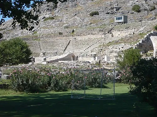 Philippi Historic site, Kavala22 km N
-
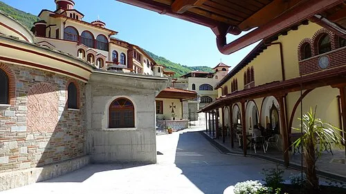 Moni Analhpseos Attraction, Amfipoli17 km NW
Other cities and towns in Pangaio
-
 Nea Peramos Village, Pangaio9 km E
-
 Eleftheroupoli Village, Pangaio11 km NE
-
 Mesoropi Village, Pangaio11 km NW
-
 Nikisiani Village, Pangaio14 km N
-
Sidirochori Village, Pangaio4.9 km NW
-
Mesia Village, Pangaio5.4 km N
Sources & licences
Data last updated: