Kefalonia
Local name: Κεφαλονιά
Located in Kefallonia Regional Unit, Ionian Islands Coordinates: 38°15′00″ N 20°35′00″ E
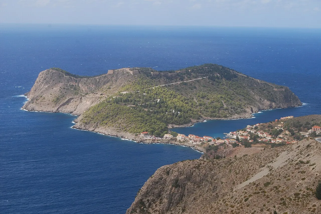
- Elevation
- 408 m
- above sea level
- Local time
- UTC+02:00
- Europe/Athens · UTC+02:00
- Population
- 36,064
- 36.1K
- Airports
- EFL Kefalonia International Airport "Anna Pollatou"16 km
- ZTH Zakynthos International Airport "Dionysios Solomos"61 km
About Kefalonia
Kefalonia is an island. Location: Kefallonia Regional Unit, Ionian Islands. Population: 36,064.
Kefalonia or Cephalonia (Greek: Κεφαλονιά [kefaloˈɲa]), formerly also known as Kefallinia or Kephallenia (Κεφαλληνία), is the largest of the Ionian Islands in western Greece and the sixth-largest island in Greece after Crete, Euboea, Lesbos, Rhodes and Chios. It is also a separate regional unit of the Ionian Islands region. It was a former Latin Catholic diocese Kefalonia–Zakynthos (Cefalonia–Zante) and short-lived titular see as just Kefalonia. The largest cities of Cephalonia are Argostoli and Lixouri.
Source: Wikipedia · CC BY-SA 4.0
Photos of Kefalonia
-

Nicolas Hadjidimitriou · CC BY-SA 4.0 -

Nicolas Hadjidimitriou · CC BY-SA 4.0 -

Nicolas Hadjidimitriou · CC BY-SA 4.0


Travel notes for Kefalonia
From Wikivoyage
Kefalonia (Greek: Κεφαλονιά) is believed to have derived its name from the mythological figure Cephalus, the son of Hermes and a hero in ancient Greek legends. This picturesque island, with its captivating landscapes and historical significance, reflects a deep connection to the rich tapestry of Greek mythology and history. It is the largest of the Ionian Islands in Greece.
Understand+
Kefallinia, Kefalonia, Cephallonia—so good they named it thrice. You may also hear islanders pronounce it as "sefalonia". The region, incorporating the neighbouring island of Ithaki (Ithaca) is known as Kefallinia, hence the name of the airport. The island is best known as the setting for the 2001 film Captain Corelli's Mandolin, though the level of movie-related merchandising is not as great as you might expect, even in Sami, the old-fashioned port in the East of the island, the portside of which was turned into a kind of set for the film.
Get in+
By plane:
The main airport is located near Argostoli and Lassi, and is a typical small island airport. In other words, if there are two or more planes on the ramp, it can get very crowded! The main travel days are Tuesday and Sunday, and it's bedlam on both days. Remember that chaos is a Greek word and just go with the flow—the staff are surprisingly cheerful and relaxed. There is a small cafe bar and gift shop both before and after security.
By boat:
You can also arrive by frequent ferry from Italy, Patras & Killini on the Greek mainland & Pessada to connect with Zakynthos.
Source: Wikivoyage · CC BY-SA 4.0 · abridged
Climate of Kefalonia
Best months for sightseeingBest months for sightseeing: May–June, September.
This month · November
A wet month
Day 16° · Night 9° · Rain 160 mm
- Hottest month
- August (day 29°)
- Coldest month
- January (night 5°)
- Wettest month
- November (160 mm)
- Driest month
- July (11 mm)
Bars: average monthly low and high temperature. Below: precipitation. Monthly averages for 1970–2000 at about 18 km resolution, adjusted for elevation. Highlighted months are mild and relatively dry. Source: WorldClim 2.1 (CC BY 4.0).
Show values as a table
| Month | Jan | Feb | Mar | Apr | May | Jun | Jul | Aug | Sep | Oct | Nov | Dec |
|---|---|---|---|---|---|---|---|---|---|---|---|---|
| Average high (°C) | 11° | 12° | 14° | 17° | 22° | 26° | 29° | 29° | 25° | 21° | 16° | 13° |
| Average low (°C) | 5° | 5° | 6° | 9° | 12° | 16° | 18° | 18° | 16° | 13° | 9° | 7° |
| Precipitation (mm) | 123 | 119 | 89 | 66 | 31 | 15 | 11 | 16 | 44 | 113 | 160 | 154 |
How to get to Kefalonia
The nearest airport is Kefalonia International Airport "Anna Pollatou" (EFL), 16 km to the southwest as the crow flies. The nearest large city is Piraeus, 271 km to the east.
Airports
- Kefalonia International Airport "Anna Pollatou" (EFL) Kefallinia Island 16 kmsouthwest
- Zakynthos International Airport "Dionysios Solomos" (ZTH) Zakynthos 61 kmsoutheast
- Patras Araxos Agamemnon Airport (GPA) Patras 75 kmeast
Nearby large cities
- Piraeus Population: 163.7K 271 kmeast
- Athens Population: 664K 277 kmeast
Straight-line distances; road distances are longer. Airport data: OurAirports.
Day trips from Kefalonia
Within 100 km: 9 historic and cultural sites, 25 lakes, rivers and coasts.
0–25 km9 places
- Moni Agiou Andrea Attraction 13 kmS
- Monastery of Kipoureon Attraction 21 kmW
- Monastery of the Virgin Mary of Atros Attraction 18 kmSE
- Saraki Island 21 kmSE
25–60 km10 places
- Kablafka Beach 50 kmNE
- Nisídes Falarídes Island 47 kmE
- Asprogiali Beach 49 kmNE
- Mikri Kamplafka Beach 50 kmNE
60–100 km15 places
- Nisída Sáranta Island 76 kmE
- Lakopetra Beach Beach 80 kmE
- Nisída Vasilikó Island 77 kmE
- Nisída Tigáni Island 91 kmSE
Straight-line distances.
Nearest towns and villages
-
Kefalonia Municipality, Kefallonia Regional Unit2.9 km S
-
Karavomylos Village, Kefalonia3.8 km E
-
 Pouláta Village, Kefalonia2.3 km SE
-
 Sami Village, Kefalonia5.6 km E
-
Agía Effimía Village, Kefalonia5.9 km N
-
Dilináta Village, Kefalonia6.5 km SW
Nearby attractions & nature
Everything nearby-
Dionisi Island, Ionian Islands19 km S
-
Skartsoubonisi Island, Ithaca17 km NE
-
Saraki Island, Kefallonia Regional Unit21 km SE
-
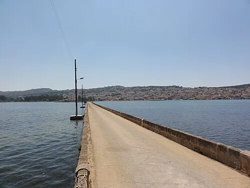 De-Bosset Bridge Landmark, Kefalonia11 km SW
-
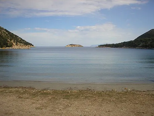 Atheronisi Island, Kefallonia Regional Unit18 km NW
-
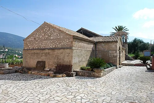 Moni Agiou Andrea Attraction, Kefalonia13 km S
-
Monastery of the Virgin Mary of Atros Attraction, Kefalonia18 km SE
-
Estavromenos Attraction, Kefalonia15 km S
Sources & licences
Data last updated: · 2 independent sources