Kefalonia
Located in Kefallonia Regional Unit, Ionian Islands Coordinates: 38°13′28″ N 20°34′41″ E
- Population
- 34,544
- 34.5K
- Elevation
- 689 m
- above sea level
- Local time
- UTC+02:00
- Europe/Athens · UTC+02:00
- Places inside
- 114
- listed under Kefalonia
- Airports
- EFL Kefalonia International Airport "Anna Pollatou"13 km
- ZTH Zakynthos International Airport "Dionysios Solomos"59 km
About Kefalonia
Kefalonia is a municipality. Location: Kefallonia Regional Unit, Ionian Islands. Population: 34,544. Elevation: 689 m. The best months to visit are May–September. The nearest airport is Kefalonia International Airport "Anna Pollatou" (13 km). Nearby sights include Kefalonia and Dionisi.
Climate of Kefalonia
Best months for sightseeingBest months for sightseeing: May–September.
This month · November
A wet month
Day 14° · Night 7° · Rain 160 mm
- Hottest month
- August (day 27°)
- Coldest month
- January (night 3°)
- Wettest month
- November (160 mm)
- Driest month
- July (11 mm)
Bars: average monthly low and high temperature. Below: precipitation. Monthly averages for 1970–2000 at about 18 km resolution, adjusted for elevation. Highlighted months are mild and relatively dry. Source: WorldClim 2.1 (CC BY 4.0).
Show values as a table
| Month | Jan | Feb | Mar | Apr | May | Jun | Jul | Aug | Sep | Oct | Nov | Dec |
|---|---|---|---|---|---|---|---|---|---|---|---|---|
| Average high (°C) | 10° | 10° | 12° | 15° | 20° | 24° | 27° | 27° | 24° | 19° | 14° | 11° |
| Average low (°C) | 3° | 3° | 4° | 7° | 10° | 14° | 16° | 16° | 14° | 11° | 7° | 5° |
| Precipitation (mm) | 123 | 119 | 89 | 66 | 31 | 15 | 11 | 16 | 44 | 113 | 160 | 154 |
Other places to visit in this season: May June July August September
How to get to Kefalonia
The nearest airport is Kefalonia International Airport "Anna Pollatou" (EFL), 13 km to the southwest as the crow flies. The nearest large city is Piraeus, 271 km to the east.
Airports
- Kefalonia International Airport "Anna Pollatou" (EFL) Kefallinia Island 13 kmsouthwest
- Zakynthos International Airport "Dionysios Solomos" (ZTH) Zakynthos 59 kmsoutheast
- Patras Araxos Agamemnon Airport (GPA) Patras 75 kmeast
Nearby large cities
- Piraeus Population: 163.7K 271 kmeast
- Athens Population: 664K 278 kmeast
Straight-line distances; road distances are longer. Airport data: OurAirports.
Day trips from Kefalonia
Within 100 km: 9 historic and cultural sites, 26 lakes, rivers and coasts.
0–25 km10 places
- Kefalonia Island 3 kmN
- Moni Agiou Andrea Attraction 10 kmS
- Monastery of Kipoureon Attraction 20 kmW
- Monastery of the Virgin Mary of Atros Attraction 17 kmSE
25–60 km10 places
- Kablafka Beach 53 kmNE
- Nisídes Falarídes Island 48 kmE
- Asprogiali Beach 52 kmNE
- Mikri Kamplafka Beach 52 kmNE
60–100 km15 places
- Nisída Sáranta Island 77 kmE
- Lakopetra Beach Beach 80 kmE
- Nisída Vasilikó Island 78 kmE
- Nisída Tigáni Island 89 kmSE
Straight-line distances.
Places in Kefalonia
114 places- 1 Lixouri 7K
- 2 Sami 1.3K
- 3 Poros 1.1K
- 4 Farakláta 1.1K
- 5 Peratáta 845
- 6 Dilináta 719
- 7 Svoronáta 694
- 8 Valsamáta 676
- 9 Agía Effimía 638
- 10 Razáta 548
- 11 Vlacháta 520
- 12 Kompothekrata 449
- 13 Makriótika 449
- 14 Skála 448
- 15 Metaxáta 439
- 16 Chavdáta 427
- 17 Karavomylos 391
- 18 Divaráta 382
- 19 Kerameiés 380
- 20 Sarláta 380
- 21 Digaléto 348
- 22 Lakíthra 341
- 23 Mousáta 335
- 24 Fiskardo 322
- 25 Kardakáta 310
- 26 Agía Eiríni 294
- 27 Valeriános 284
- 28 Minia 260
- 29 Kateleiós 254
- 30 Markópoulo 254
- 31 Mitakáta 248
- 32 Troïanáta 248
- 33 Pesáda 246
- 34 Kaminaráta 239
- 35 Chavriáta 223
- 36 Fársa 222
- 37 Mantzavináta 217
- 38 Ágios Vasíleios 198
- 39 Fiskardo 198
- 40 Livádi 193
- 41 Tzanáta 193
- 42 Agkónas 186
- 43 Favatáta 178
- 44 Kokolata Argostoliou 176
- 45 Pouláta 174
- 46 Athéras 172
- 47 Ágios Nikólaos 170
- 48 Ferentináta 169
- 49 Monopoláta 162
- 50 Simotáta 162
- 51 Pástra 160
- 52 Káto Kateleiós 156
- 53 Chionáta 151
- 54 Lourdata 147
- 55 Skinéas 146
- 56 Zóla 139
- 57 Agios Dimitrios 138
- 58 Drepano 135
- 59 Mesovoúnia 135
- 60 Chaliotata 132
Bar: population relative to the most populous place in this list.
Nearby attractions & nature
Everything nearby-
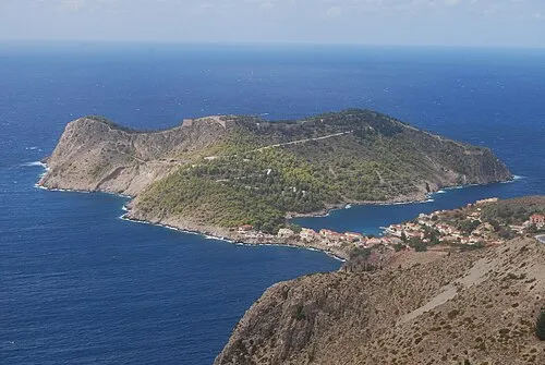 Kefalonia Island, Kefallonia Regional Unit2.9 km N
-
Dionisi Island, Ionian Islands16 km S
-
Saraki Island, Kefallonia Regional Unit20 km SE
-
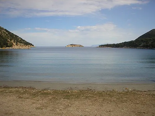 Atheronisi Island, Kefallonia Regional Unit20 km NW
-
Skartsoubonisi Island, Ithaca20 km NE
Sources & licences
Data last updated: