Kefalonia
Located in Kefallonia Regional Unit, Ionian Islands Coordinates: 38°13′28″ N 20°34′41″ E
- Population
- 34,544
- 34.5K
- Elevation
- 689 m
- above sea level
- Local time
- UTC+02:00
- Europe/Athens · UTC+02:00
- Places inside
- 114
- listed under Kefalonia
- Airports
- EFL Kefalonia International Airport "Anna Pollatou"13 km
- ZTH Zakynthos International Airport "Dionysios Solomos"59 km
About Kefalonia
Kefalonia is a municipality. Location: Kefallonia Regional Unit, Ionian Islands. Population: 34,544. Elevation: 689 m. The best months to visit are May–September. The nearest airport is Kefalonia International Airport "Anna Pollatou" (13 km). Nearby sights include Kefalonia and Dionisi.
Photos of Kefalonia
-
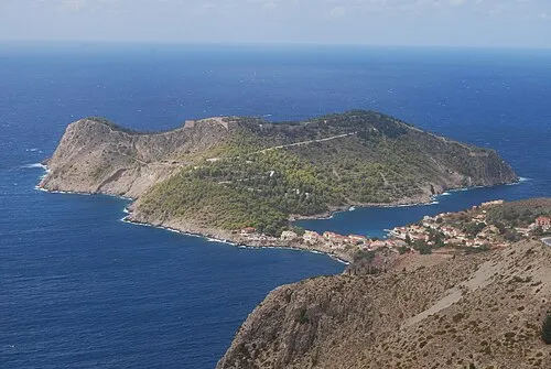
Kefalonia Matt Sims · CC BY 2.0 -
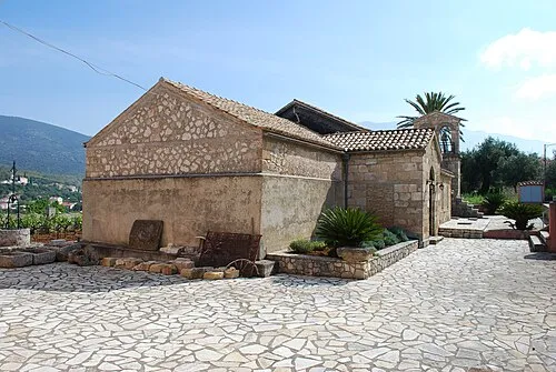
Moni Agiou Andrea Jean Housen · CC BY-SA 3.0 -
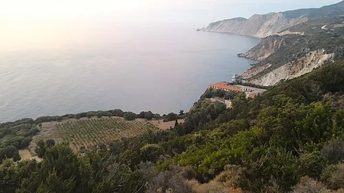
Monastery of Kipoureon Kostas94 · CC BY-SA 4.0 -
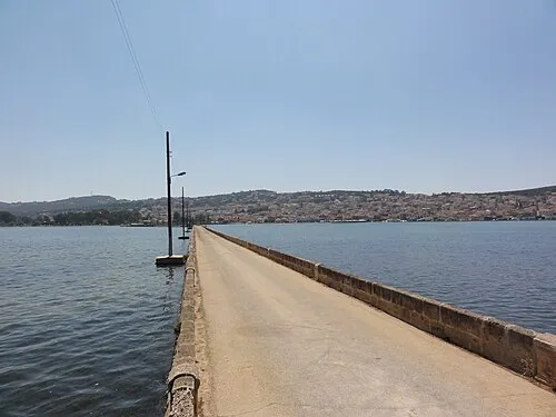
De-Bosset Bridge Fæ · CC BY-SA 3.0


Climate of Kefalonia
Best months for sightseeingBest months for sightseeing: May–September.
This month · November
A wet month
Day 14° · Night 7° · Rain 160 mm
- Hottest month
- August (day 27°)
- Coldest month
- January (night 3°)
- Wettest month
- November (160 mm)
- Driest month
- July (11 mm)
Bars: average monthly low and high temperature. Below: precipitation. Monthly averages for 1970–2000 at about 18 km resolution, adjusted for elevation. Highlighted months are mild and relatively dry. Source: WorldClim 2.1 (CC BY 4.0).
Show values as a table
| Month | Jan | Feb | Mar | Apr | May | Jun | Jul | Aug | Sep | Oct | Nov | Dec |
|---|---|---|---|---|---|---|---|---|---|---|---|---|
| Average high (°C) | 10° | 10° | 12° | 15° | 20° | 24° | 27° | 27° | 24° | 19° | 14° | 11° |
| Average low (°C) | 3° | 3° | 4° | 7° | 10° | 14° | 16° | 16° | 14° | 11° | 7° | 5° |
| Precipitation (mm) | 123 | 119 | 89 | 66 | 31 | 15 | 11 | 16 | 44 | 113 | 160 | 154 |
Other places to visit in this season: May June July August September
How to get to Kefalonia
The nearest airport is Kefalonia International Airport "Anna Pollatou" (EFL), 13 km to the southwest as the crow flies. The nearest large city is Piraeus, 271 km to the east.
Airports
- Kefalonia International Airport "Anna Pollatou" (EFL) Kefallinia Island 13 kmsouthwest
- Zakynthos International Airport "Dionysios Solomos" (ZTH) Zakynthos 59 kmsoutheast
- Patras Araxos Agamemnon Airport (GPA) Patras 75 kmeast
Nearby large cities
- Piraeus Population: 163.7K 271 kmeast
- Athens Population: 664K 278 kmeast
Straight-line distances; road distances are longer. Airport data: OurAirports.
Day trips from Kefalonia
Within 100 km: 9 historic and cultural sites, 26 lakes, rivers and coasts.
0–25 km10 places
- Kefalonia Island 3 kmN
- Moni Agiou Andrea Attraction 10 kmS
- Monastery of Kipoureon Attraction 20 kmW
- Monastery of the Virgin Mary of Atros Attraction 17 kmSE
25–60 km10 places
- Kablafka Beach 53 kmNE
- Nisídes Falarídes Island 48 kmE
- Asprogiali Beach 52 kmNE
- Mikri Kamplafka Beach 52 kmNE
60–100 km15 places
- Nisída Sáranta Island 77 kmE
- Lakopetra Beach Beach 80 kmE
- Nisída Vasilikó Island 78 kmE
- Nisída Tigáni Island 89 kmSE
Straight-line distances.
Places in Kefalonia
114 places- 61 Komitáta 131
- 62 Loukáta 128
- 63 Mavráta 120
- 64 Atsoupádes 111
- 65 Dhemoutsandáta 109
- 66 Plagiá 108
- 67 Xenópoulo 94
- 68 Longos 87
- 69 Ásos 82
- 70 Kapandríti 80
- 71 Patrikáta 79
- 72 Thirámonas 79
- 73 Vlycháta 79
- 74 Michalitsáta 67
- 75 Koriána 63
- 76 Davgáta 62
- 77 Rífi 62
- 78 Kothréas 60
- 79 Kouvaláta 56
- 80 Menegáta 55
- 81 Kástro 54
- 82 Tselentáta 53
- 83 Chalikerí 50
- 84 Tzamarelláta 50
- 85 Katsaráta 49
- 86 Matsoukáta 47
- 87 Agriliás 46
- 88 Kampitsáta 46
- 89 Kolaḯtis 44
- 90 Karyá 43
- 91 Neochóri 43
- 92 Ríza 42
- 93 Koulouráta 37
- 94 Lépedha 36
- 95 Ventouráta 35
- 96 Epanochóri 33
- 97 Faniés 31
- 98 Viglí 31
- 99 Defaranáta 30
- 100 Micháta 25
- 101 Parisáta 25
- 102 Evretí 24
- 103 Argínia 21
- 104 Alimatas 20
- 105 Psilithriás 9
- 106 Andrioláta 8
- 107 Ágioi Apóstoloi 8
- 108 Moni Agiou Andrea 8
- 109 Drapanítika 7
- 110 Monastery of Kipoureon 3
- 111 Monastery of the Virgin Mary of Atros 2
Bar: population relative to the most populous place in this list.
Cities & villages1
- Ágios Eleftherios · Village
Heritage & sights2
- De-Bosset Bridge · Landmark
- Estavromenos · Attraction
Nearby attractions & nature
Everything nearby-
Kefalonia Island, Kefallonia Regional Unit2.9 km N
-
Dionisi Island, Ionian Islands16 km S
-
Saraki Island, Kefallonia Regional Unit20 km SE
-
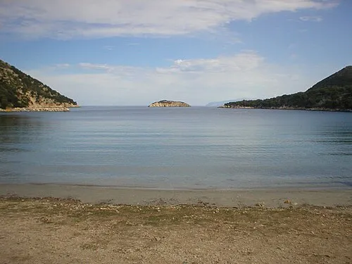 Atheronisi Island, Kefallonia Regional Unit20 km NW
-
Skartsoubonisi Island, Ithaca20 km NE
Sources & licences
Data last updated: