- Population
- 527
- 527
- Elevation
- 22 m
- above sea level
- Local time
- UTC+02:00
- Europe/Athens · UTC+02:00
- Airports
- CKZ Çanakkale Airport108 km
- KVA Kavala Alexander the Great International Airport124 km
About Néa Koútali
Néa Koútali is a village. Location: Lemnos, Lesbos. Population: 527. Elevation: 22 m.
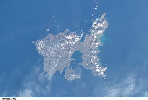
Nea Koutali (Greek: Νέα Κούταλη) is a village and a municipal unit on the island of Lemnos, North Aegean, Greece. Located in the south central portion of the island with a land area of 75.735 square kilometres (29.241 sq mi), it accounts for about 15.9% of the island's area, making it the smallest of the four municipal units on Lemnos. The village is the largest settlement in the municipal unit, though the seat of government is the village of Kontias.
Source: Wikipedia · CC BY-SA 4.0
Population of Néa Koútali over time
| 1991 | 424 | |
|---|---|---|
| 2001 | 454 | |
| 2011 | 442 | |
| 2021 | 527 |
Censuses and official estimates; source: Wikidata.
Climate of Néa Koútali
Best months for sightseeingBest months for sightseeing: May, September–October.
This month · November
Outside the best season
Day 16° · Night 9° · Rain 68 mm
- Hottest month
- July (day 30°)
- Coldest month
- January (night 5°)
- Wettest month
- December (87 mm)
- Driest month
- August (8 mm)
Bars: average monthly low and high temperature. Below: precipitation. Monthly averages for 1970–2000 at about 18 km resolution, adjusted for elevation. Highlighted months are mild and relatively dry. Source: WorldClim 2.1 (CC BY 4.0).
Show values as a table
| Month | Jan | Feb | Mar | Apr | May | Jun | Jul | Aug | Sep | Oct | Nov | Dec |
|---|---|---|---|---|---|---|---|---|---|---|---|---|
| Average high (°C) | 11° | 11° | 13° | 18° | 23° | 28° | 30° | 29° | 26° | 21° | 16° | 13° |
| Average low (°C) | 5° | 5° | 7° | 10° | 14° | 18° | 21° | 21° | 17° | 13° | 9° | 7° |
| Precipitation (mm) | 78 | 56 | 53 | 31 | 25 | 19 | 12 | 8 | 23 | 40 | 68 | 87 |
How to get to Néa Koútali
The nearest airport is Çanakkale Airport (CKZ), 108 km to the east as the crow flies. For international flights: Kavala Alexander the Great International Airport (KVA) (124 km). The nearest large city is Çanakkale, 107 km to the east.
Airports
- Çanakkale Airport (CKZ) Çanakkale 108 kmeast
- Kavala Alexander the Great International Airport (KVA) Kavala 124 kmnorthwest
- Alexandroupoli Democritus Airport (AXD) Alexandroupolis 124 kmnortheast
Nearby large cities
- Çanakkale Population: 143.6K 107 kmeast
- Çiğli Population: 214.1K 224 kmsoutheast
- Edirne Population: 180K 229 kmnortheast
- Cordaleo Population: 339.6K 230 kmsoutheast
- Tekirdağ Population: 122.3K 230 kmnortheast
Straight-line distances; road distances are longer. Airport data: OurAirports.
Nearby attractions & nature
Everything nearby-
Ispatho Island Island, Lesbos5.5 km E
-
Panagia Kakaviotissa Attraction, Lemnos8.9 km W
-
Agios Georgios Attraction, Lemnos8.9 km E
-
 Nisída Siderítis Island, Lesbos15 km N
Sources & licences
Data last updated: · 2 independent sources